Date: Middle of June – End of September
Trekking tour along the western alpine range passing Mont Blanc and traversing trough the beautiful Beaufortain region. Further south we hike trough the oldest French national Park, the Vanoise Park before entering the Ecrins park. Final destination is the beautiful historical old town of Briancon.
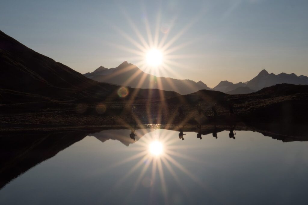
Traverse of the Alps hiking – Chamonix to Briancon, France
This Traverse of the Alps hiking tour leads from Chamonix, the foot of Mont Blanc to Briancon in the Southern French Alps? Cross with us on this journey the French Alps on the most beautiful alpine trails from north to south. This trip starts in Chamonix and crosses the alpine pastures of the Beaufortain and the Vanoise National Park in high alpine ambience. With the ascent of Mt. Thabor 3178m we face our long distance destination, the Massif des Écrins.
During this traverse of the Alps hiking tour we spend the night in beautiful mountain huts and reach Briançon on narrow paths. Located at an altitude of 1,326 metres, at the confluence of five valleys, Briançon is the highest town in France. This City of Art of History, fortified by French military architect Vauban in the 18th century, is today a UNESCO World Heritage Site precisely because of its remarkable group of fortifications built between the 18th and 20th centuries in order to improve the town’s defence system.
We cover short stretches by cab and have access to our extra luggage every few days.
Detailed hiking Itinerary: Traverse of the Alps hiking Chamonix to Briancon
Day 1
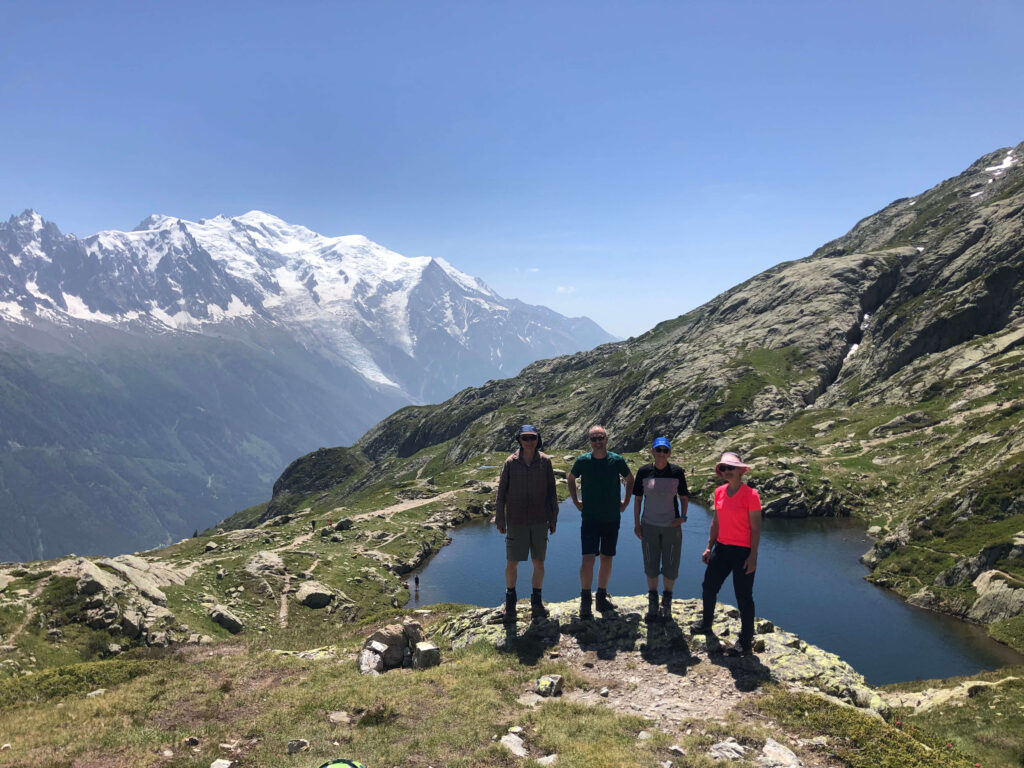
From our meeting point in Chamonix we start our journey with a half-hour train ride to the Col des Montets 1461m. At the watershed between Switzerland and France we start our first stage with a light daypack (the cab will already bring further luggage to the hotel). First we climb 400 meters in altitude in steep serpentines into the nature reserve of the Aiguilles Rouges. Now we follow the flat terraces southward and visit numerous small mountain lakes along the way. The highlight of today’s high-altitude hike is the magnificent view of the high peaks of the Mt. Blanc massif. Our gaze sweeps across to the steep flanks of the Aiguille Verte, the jagged ridges of the Aiguilles du Chamonix, and to the jagged glaciers of Mont Blanc. From La Flégère 1877m we descend with pleasure by cable car to Chamonix 1087m. In a short cab ride we reach our hotel in Les Contamines-Montjoie 1167m. Luggage is at your disposal.
Ascent 1000m, descent 550m, walking time without breaks about 4.5 hours.
Day 2
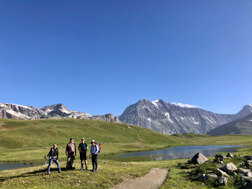
By cable car we reach our high starting point Le Signal 1850m at the edge of the nature reserve les Contamines-Montjoie. In easy ups and downs we go around the Aiguille de Roselette. We climb up to Col du Bonhomme 2329m and traverse high above the valley to the Refuge du Col de la Croix-du-Bonhomme 2433m. We are now entering the Beaufortain massif. A quiet and relaxing area, away from the busy tourist trails. Well fortified, we now continue our way along an evenly shaped, grassy ridge “Crête des Gittes”. From Col de la Sauce 2307m we descend to our hut. It is surrounded by flowery alpine pastures in the plain Plan de la Lai 1818m. If we are lucky, we can taste a spicy piece of Beaufort. This alpine cheese is a specialty of Haute-Savoie.
Ascent 900m, descent 950m, walking time without breaks about 6 hours.
Day 3
The meadows above the Lac de Roselend are paradise for marmots. Here they can burrow and dig and yet they always have to be on their guard. Maybe we will be lucky and see a bearded vulture. We now leave the lake behind us and climb to the foot of Pierra Menta 2714m. The famous rock monolith with its steep walls stands like a watchtower on the ridge and shows us the way ahead. Passing the Col du Bresson 2469m, we descend the sunny slopes of the Tarantaise to the Chapelle St Guérin 1589m. From here we cross the main valley by cab and arrive at Chalet-Refuge de Rosuel 1556m. The modern chalet is located in the forest edge at the back of the Peisey-Nancroix valley.
Ascent 1000m, descent 1200m, walking time without breaks about 6 hours.
Day 4
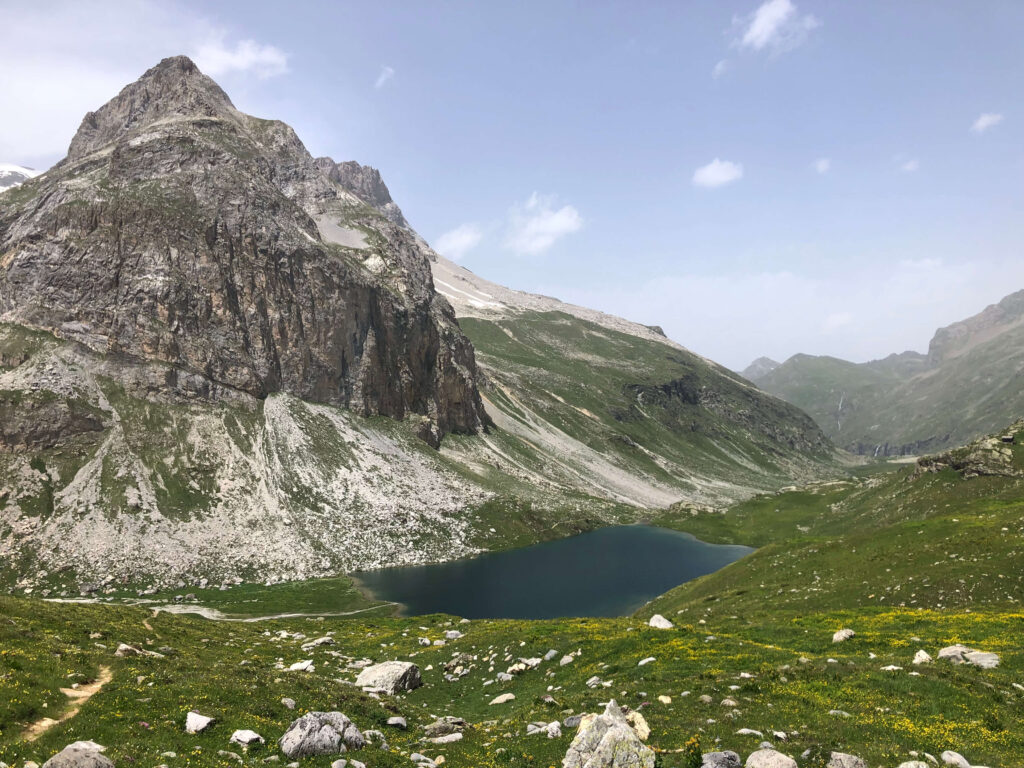
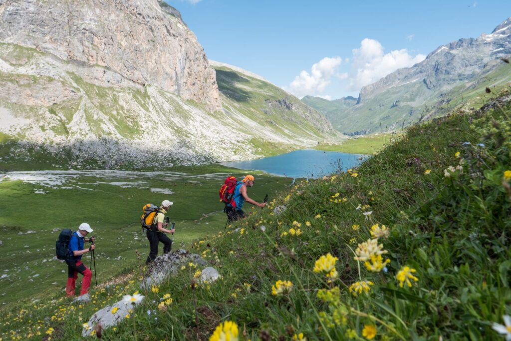
Today we enter the oldest French national park The Parc national de la Vanoise was founded in 1963 to protect the endangered Alpine ibex. We follow the beautiful valley into the untouched high mountain world. Right at the beginning there are three big waterfalls to admire. They are fed by Lac du Cevril through an 8 km long tunnel. A pair of bearded vultures often nests in these rocks. On the way we look out for other wild animals, enjoy the bubbling streams and reach the Refuge du Col du Palet 2587m in the heart of the park in a steady climb. After a break and refreshment, an afternoon tour to the Pointe du Chardonnet 2870m is possible. We can climb this viewpoint not far from the hut via pathless terrain and a slight boulder ridge.
Ascent 1100m, walking time without breaks about 4.5 hours.
Day 5
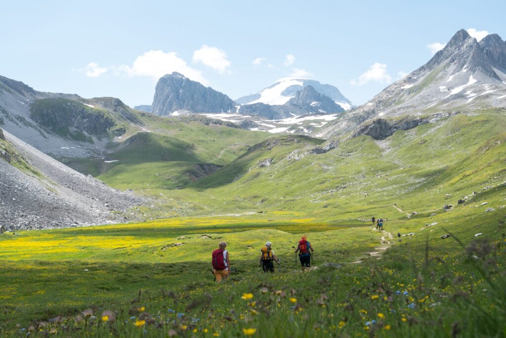
With the crossing of the national park, a long and grandiose stage is in store for us today. We start at an early hour with the descent to the mountain village Tignes-le Lac 2093m. From here we reach the Col de la Leisse 2767m. Different rocks on the right and left side of the valley form a great play of colors. The path now descends at a leisurely pace and meanders along the wild and original stream at the foot of the steep south face of La Grande Casse and La Grande Motte.
For the last counter ascent of our high alpine stage to the Refuge du Plan du Lac 2364m we take all the time we need. From the refuge we have once again a particularly good view of the glacier-covered peaks of the Vanoise, which reach up to almost 4000m. Luggage is available.
Ascent 1050m, descent 1250m, walking time without breaks about 8 hours.
Day 6
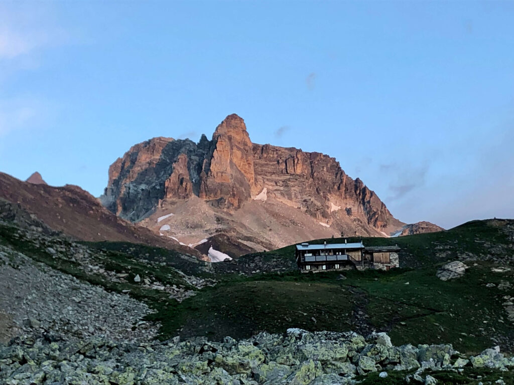
In a short hike we reach the parking lot. Here a cab waits for us and helps us to cross the valley of Maurienne. From Modane we reach Valfréjus. The trip takes about an hour. Now we dive into the Massif du Thabor. For this we follow the valley upwards. Halfway up, it becomes more and more spacious and we approach the Réfuge du Mont Thabor 2472m. This lies above the Col de la Vallée Etroite. In former times the French-Italian border passed through here.
Ascent 700m, descent 150m, walking time without breaks about 6.5 hours.
Day 7
Today is a special highlight on the program with the ascent of Mont Thabor 3178m. Early in the morning we start from the hut and warm up in the flat terrain for the first hour. From Lac du Peyron the path climbs steadily and steeply in narrow hairpin bends to the highest point. A small pilgrimage chapel stands up here at the summit. We are on the line that separates the northern and southern Alps. The view is free in all directions and reaches back to the peaks of the Vanoise and up to the Écrins massif. We cross the Roche du Chardonnet 2950m and rejoin wider paths at the Col des Mundes 2828m. From here we descend into the Vallée de la Clarée and resort to a local cab for a short transfer. From Pont de la Souchère 1813m we tackle the last counter ascent. On narrow paths through sparse mountain forest we reach Refuge Buffère 2076m.
Ascent 1150m, descent 1400m, walking time without breaks about 8 hours.
Day 8
We start our final stage with the ascent to Col de Buffère 2427m. From here we follow the high trail above the Vallée de la Guisane. On the way to Col de Granon 2404m the view becomes increasingly clear to the glaciated peaks of the Massif des Écrins – La Meije, Barre des Écrins and Mont Pelvoux. The narrow ridge trail over the Crête de Peyrolle and to the summit la Grande Peyrolle 2645m is not to be missed. The view down to Briançon is ingenious. A very nice descent leads downhill through larch forests and we land directly in the heart of Briançon. The historic old town, surrounded by moats and walls, with its narrow streets and the church Notre-Dame-et-Saint-Nicolas invites us to explore. Luggage is available.
Ascent 950 Hm, descent 1650 Hm, walking time without breaks approx. 8.5 hrs.
Day 9
In the morning of the last day there will be time for an extended city walk or a visit to the fortifications of Vauban. At noon we will travel by cab from Briançon to Grenoble and from there return to Switzerland by train via Geneva.
Price:
- With 8 hikers: 1817.00€ per hiker
- With 6 hikers: 2153.00€ per hiker
- With 4 hikers: 2691.00€ per hiker
Included in the price:
- Guided by a mountain guide in training or a qualified hiking guide
- 8 overnight stays in huts, inns in multi-bed rooms, hotel in Les Contamines-Montjoie and Briançon in double room with shower/WC
- 8x half board, tour tea day 2-8
- All cab, bus and train rides from Chamonix to Briançon according to the program
- Luggage transport
Not included in the price:
- Journey to Chamonix
- Journey home from Briançon
- Snacks (can be bought on the way)
- Drinks on the way and in the accommodations
- Tips
Personal Requirements for Traverse of the Alps hiking tour
In preparation for this trekking tour, you ideally do regular endurance training such as hiking, biking or jogging. The average daily walking time is 6.5 hours. Individual stages are significantly longer with up to 9 hours. The indicated walking times refer to the pure walking time without breaks.
The technical requirements mostly correspond to the difficulty level T1-T3 of the Swiss difficulty scale for hiking trails (red-white marked trails). According to our level assessment, this corresponds to the technique level Starter in summer. Individual short passages may be slightly above this.
Accommodation for Traverse of the Alps hiking tour
We stay mainly in huts and gîtes d’étapes, sometimes in guesthouses and hotels, according to the described daily stages. The accommodation in the French huts is simple, but we will be spoiled there with very good food and drink. If possible double rooms are booked, otherwise shared rooms. Most of the huts have showers.
Packing tip for Traverse of the Alps hiking tour
On days 1, 2-5 and 6-8 you carry your own personal luggage. Besides the usual equipment for day hikes in the mountains, you only need spare underwear and a small toilet bag. Light goes a long way! The backpack should not weigh more than 8-9 kg.
Packing list
Waterproof Gore Tex jacket and pants
Trekking pants
Soft shell or fleece jacket
Thin, windproof finger gloves
Hat, possibly headband or buff
Functional socks (1 spare pair)
Functional underwear short/long
Backpack with hip belt (30-40l)
Separate piece of luggage (for luggage transport)
Sunglasses
Sun and lip lotion, sun hat
Drinking bottle, possibly thermos flask
Pocket knife
LED headlamp with new battery
Sticking plaster and Compeed
Rain cover for backpack
Adjustable trekking poles
Sturdy trekking or mountain boots
Earplugs
Small size toiletries and refreshing towel for personal hygiene
Inner sleeping bag made of silk or cotton (for hygiene reasons)
Most huts have showers and shower towels.
Light slippers/cottage fins
Identity card
Cash in Euro
Some cash for drinks
Earplugs
Small size toiletries and refreshing towel for personal hygiene
Inner sleeping bag made of silk or cotton (for hygiene reasons)
Most huts have showers and shower towels.
light slippers/cottage fins
Meals
Half board: Half board (dinner/breakfast) is included in this tour.
Snack: This is eaten between breakfast and dinner. Dried fruit, chocolate, nuts, cheese, wholemeal bread and energy bars are good. So that the backpack is not too heavy, not too much food should be taken. Additional snacks can be purchased at most huts.
Tour tea: The tour tea is provided by the accommodation in the morning and is included in the price.
Meeting point:
- 9.00am, Chamonix Train station
Send us an e-mail to with your booking request and questions.

 Previous Post
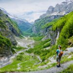 Next Post