Trekking the Cordillera Blanca, Peru

Dates: May /June / August

Date 2025: 20st – 31st of May

Private dates: please send us a message to check for other dates

Peru’s Cordillera Blanca is a renowned destination for trekking, boasting majestic ice peaks and tranquil turquoise lakes. With over 70 summits exceeding 18,000 feet, including Huascarán and Alpamayo, trekkers are treated to unparalleled views and challenging terrain. A 10-day trek starting from Laguna Jancarurish offers an exploration day below Alpamayo Base Camp, with optional hikes to scenic overlooks of the region. While the high altitude poses a challenge, the exhilarating days on the trail and the opportunity to camp by stunning lakesides make this trek a truly rewarding adventure.

“Trekking the Cordillera Blanca. Peru means exploring the highest tropical mountain range in the world. Incredible mountain scenery including snow-capped peaks, turquoise lakes and beautiful meadows.”

  • A fine trek in glorious landscape in this high, glaciated range around the most beautiful mountains in the world
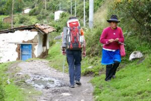
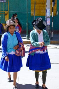
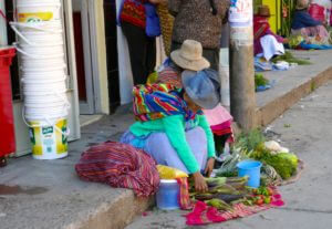
  • Cross high passes between deep valleys with their remote Quechua farming communities.
  • Revel in snowy peaks, bright lakes and areas of grassland.
trekking in Peru alpamayo loop

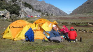
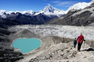
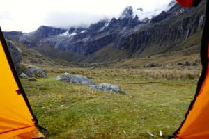
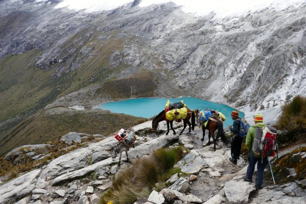
Trekking the Cordillera Blanca,Peru boasts an unspoiled landscape that is literally dotted with 5,700 to 6,000 metre peaks including Huascarán, the highest mountain in Peru at 6,768 metres (22,205 feet). Every day we trek past head-turning glacial lakes sporting an otherworldly colour of blue – always with a backdrop of rugged mountains. During this trek in the Cordillera Blanca we cross high passes and can be awestruck by the sheer number of glaciers. We’ll keep an eye out for the remains of pre-Incan ruins along the trail and will be treated to spectacular wildflower filled meadows. We sleep in tents in beautiful camp sites and enjoy the luxury of walking only with a daypack. Donkeys and local “arrieros”and cooks assist us to make the loop around the prettiest mountains in the world an unforgettable trek of a lifetime.

“The incredible landscape on this trip will stir your soul.”


DAY BY DAY HIKING ITINERARY TREKKING THE CORDILLERA BLANCA, PERU
DAY 1: MEET IN HUARAZ

Individual arrival at the small and lively city of Huaráz, Peru’s center for mountaineering, at 10,200 feet. This climbing and trekking center is located in the valley of the Río Santa, nestled between the Cordillera Negra and the Cordillera Blanca. Our hotel, the Andino, has outstanding views of the peaks of the Cordillera Blanca, including massive Huascarán (22,204′), Peru’s highest mountain, and several other beautiful snow-capped peaks over 19,000 feet. We gather for a Welcome Dinner tonight.

  • Night and dinner at Hotel in Huaraz
DAY 2: ACCLIMATIZATION HIKE TO LAKE CHURUP (14,700′)

For today’s acclimatization hike, we drive north of Huaráz for about 1 hour to a trailhead below Lake Churup. We begin our hike at about 12,800 feet, following along glacial moraine for about 1.5 hours, then continue steeply up for about 1.5 hours. We arrive at the stunning setting of Lake Churup, set at 14,700 feet at the base of the Churup Glacier. After a picnic lunch, we hike back down and return to Huaráz in the late afternoon.

  • Hiking Details: 6 hours, 5 miles, 1,900 feet ascent/descent
  • Night and dinner at Hotel in Huaraz
DAY 3: YUNGAY MEMORIAL PARK / HUALCAYÁN

We depart Huaráz and drive north along the main valley, the Callejón de Huaylas. En route, we visit Yungay Memorial Park, which commemorates the 1970 earthquake and avalanche/mudslide that tragically decimated this Andean community. After the lovely town of Caráz, we turn off the main road and descend on a dirt road to cross the Rio Santa, where the landscape becomes increasingly rugged and remote. We then ascend to the farming community of Hualcayán. Our camp is near the school, set below the Wari ruins of Hualcayán (10,500′), which we can explore on an optional afternoon hike. Here we’ll have good views of the Callejón de Huaylas and the Cordillera Negra.

  • BLD, Approximate Driving Time: 4 hours
DAY 4: BEGIN TREK / WISHCASH (14,100’)

In the morning, we meet our arrieros (horse wranglers) and the pack animals that will carry our gear. We start hiking on a steep switchback trail and pass through a landslip area, a legacy of the 1970 earthquake. Lunch is in an open green meadow on a ridge at Huaca Corral (13,070′), which overlooks our last night’s camp of Hualcayán and across the Callejón de Huaylas. From Huaca Corral, we continue steadily uphill for two hours to Wishcash. A five-minute walk from camp brings us an absolutely stunning view down to Yanacocha.

  • BLD, Hiking Details: 6 hours, 5.5 miles, 3,700 feet ascent
DAY 5: LLAMPASHILLÓN PASS (15,929’) QUEBRADA DE LOS CEDROS

We continue uphill, walking on a rocky trail to arrive on the edge of impossibly blue Laguna Cullicocha (15,184′), nestled below the towering Santa Cruz peaks. We walk over rocky slabs around the lake with dramatic views of the cliffs above the lake and the three peaks of Santa Cruz, the highest of which reaches 20,536 feet. We cross Llampashillón Pass (15,929′), descend to a grassy area called Osoruri at 14,900 feet, and ascend again to a second pass at 15,650 feet (a 750-foot ascent). Our day ends with a steep and long zig-zag descent of 2,480 feet into the wide, green Quebrada (canyon) de los Cedros, where we can see Inca terraces on the far side of the valley. Our camp is at Ruina Pampa (13,170′).

  • BLD, Hiking Details: 9 hours, 9 miles, 1,829 feet ascent to first pass, 750 feet to second pass, 3,509 feet descent (cumulative)
DAYS 6-7: ALPAMAYO BASE CAMP / REST DAY OR OPTIONAL HIKES

The hike on Day 8 will be is shorter and less difficult as we continue up the valley. After an hour of hiking gently uphill, we have our first glimpse of
the perfect pyramid of Alpamayo (19,506′), a favorite climbing objective of mountaineers. Our campsite (13,600′) is just short of Laguna Jancarurish (out of view), with stunning views of Alpamayo. Day 9 is an opportunity to rest and take it easy in camp, or choose one of three optional hikes. The first brings us to emerald-green Lake Jancarurish (14,380′). The second option continues from the lake up a steep switchback trail to Alpamayo Base Camp at 14,800 feet. For the very fit only, a third option continues steeply to the “Mirador” (16,165’), a lookout point with stunning overviews of the whole region.

  • BLD, Overnights at camp near Laguna Jancarurish
  • Hiking Details, Day 8: 3.5 hours, 4.6 miles, 430 feet ascent
  • Hiking Details, Day 9: Option 1, 880 feet ascent from camp; Option 2, 1,350 feet ascent from camp; Option 3, 2,665 feet ascent from camp
DAY 8: CARACARA PASS (15,770′) / MOYOBAMBA PASS (14,670′) / HUILLCA

This morning we cross the challenging and often very windy Caracara Pass at the head of Quebrada Alpamayo. We descend on a steep, rocky trail and then cross a lush grassy valley that leads to a second, yet not as challenging pass of Moyobamba Pass, with great views of the multiple peaks of Pucajirca, the other side of Alpamayo, and one of the two Safuna lakes. We continue down the valley and arrive at the community of Huillca, composed of a few farms, with sheep, goats and alpaca. Our camp is at 13,160 feet.

  • BLD, Hiking Details: 8 hours, 9.5 miles, 2,840 feet ascent, 3,080 feet descent
DAY 9: PUCAJIRCA PASS (15,200’) / JANCAPAMPA

This morning we have a long ascent through a delightful hanging valley that appears to be a dead-end canyon. At the far end, though, we ascend a steep trail through lupines and red-rock scree to Pucajirca Pass then descend on a long and steep path into a valley dotted with waterfalls, lakes, and native polylepis forest. We enter the lush valley of the meandering Jancapampa River, where we begin to see rural Peruvian life, with people at work in their fields and herding animals. We’ll have stunning views of the Pucajirca and Taulliraju glaciers at our camp (11,670′).

  • BLD, Hiking Details: 8 hours, 7 miles, 2,040 feet ascent, 3,530 feet descent
DAY 10: QUEBRADA JANCAPAMPA / LAGUNA HUECROCOCHA

Continuing down the valley, we pass village houses and cultivated areas and leave the valley with a long and steady climb up past homes and herders
to Tupatupa Pass (14,320′), with lovely views down the eastern side of the Cordillera Blanca. After a descent into the beautiful valley of Quebrada Tingopampa, a final uphill push brings us to our camp next to Laguna Huecrococha (13,000′).

  • BLD, Hiking Details: 8 hours, 9.3 miles, 2,870 feet ascent, 1,720 feet descent
DAY 11: PUCARAJU PASS (15,210′) / CACHINA

We follow a trail around Laguna Huecrococha and eventually make our zig-zag ascent to Pucaraju Pass, where the knife-edged peak of Taulliraju (19,127′) seems to tower over the pass. After enjoying a stunning view of
the surrounding mountains, a steep, rocky descent leads to the upper part of Quebrada Huaripampa, and we continue to the lovely meadow of Tuctubamba (12,666′), where we have splendid views of Taulliraju and Pucajirca peaks. A descent on a rocky trail brings us through the lovely, green valley of Paria and to our destination of a small herder community of Cachina.

  • BLD, Hiking Details: 8-9 hours, 11 miles, 2,210 feet ascent, 3,200 feet descent
DAY 12: CACHINA / VAQUERÍA / HUARAZ

We continue along the river amid indigenous polylepis trees and past homes. After crossing a bridge, we have our final long steep ascent to Vaquería (12,206′), where we meet our vehicles for the return drive to Huaraz,
which takes us over the stunning Llanganuco Pass for breathtaking views

of Huascarán, Huandoy, Pisco, and Chacraraju. We drive past the blue Llanganuco lakes and continue into the Callejón de Huaylas, arriving in Huaraz late afternoon. Tonight we’ll celebrate with a festive Farewell Dinner in town.

  • Overnight at Hotel in Huraz
  • BLD, Hiking Details: 4 hours, 4 miles, 1,426 feet descent, 966 feet ascent Approximate Driving Time: 5-6 hours

Fees for trekking the Cordillera Blanca, Peru:
  • 6-10 hikers: 4’995.00€ each

Included in the fee:

Organisation, 2 certified English speaking mountain guides, 3 nights at Hotel in Huaraz (double rooms with ensuite bathroom), 9 camp nights, full board with snacks and non alcoholic drinks, camp service & cook (tents, kitchen), dunkies for your luggage during the trekking, park entrance fees, all ground transportation from Huaraz back to Huaraz as defined in the program, Satellite phone, 

Not included in the fee:

Flights, bus/taxi to Huaraz, personal insurances, personal equipment, alcoholic drinks


Average Hiking Day

• 6-8 hours
• 2,000-2,500 feet gain/loss
• Altitudes range from 10,000 to 15,000 feet


How Tough is Trekking the Cordillera Blanca, Peru?

You need to be able to hike on uneven surfaces on mountain trails at high elevations. You must feel comfortable and confident on your feet for up to 8 hours a day, with recent experience hiking at least 8 miles in a day (preferably at high altitude).


Terrain

Trails can be rough, not the well-maintained switchbacks you may be accustomed to. An average day’s walk is seven or eight hours. With rest stops and photo stops, few people walk faster than one mile an hour in a mountainous region. Some hiking days are shorter than others, and some days are more difficult than others due to altitude gain and loss. The optional climb of Nevado Pisco is non-technical but requires basic knowledge of the use of ice axe and crampons (we’ll have some training on one of our acclimatization hikes) and a lot of stamina.


Getting in shape

For maximum enjoyment of the trip, you must be in good shape and ready to hike at high altitudes. We strongly urge you to train for the trip with regular hiking, especially over hills and uneven terrain. Running, swimming, bicycling, and stair-climbing are all great options as well. As you progress, practice these hikes with your loaded daypack (full water bottle, camera gear, jacket). The object is to improve your overall level of fitness and aerobic capacity and get your legs and lungs in shape for the Andes. As the time for departure approaches, try to climb a high peak near you or go on strenuous weekend hikes that involve 6-7 hours of uphill and downhill walking. Your feet should be fully prepared and accustomed to long days in sturdy, well broken-in hiking boots.


Weather

Being so close to the equator, Peru has only two seasons: a dry season from April to October, and a wet season from December to March. Altitude is the main factor controlling the climate. In the mountains, you’ll encounter sunny days with daytime temperatures ranging between 65°F and 70°F, dropping to the 40s and lower at night. The sun is very strong at high altitude and it can often be warm enough to hike in shorts and a t-shirt. However, it can also get extremely cold; if you’re familiar with mountain weather, you know how suddenly it can get cold even in the daytime if the sun slips behind a cloud. Nighttime is always cold and temperatures can drop to below freezing. Be prepared with warm layers for cold nights. Rain should not be a problem on our trek, but always keep in mind that mountain weather is unpredictable and sudden storms can occur, especially on high mountain passes. The best preparation for the changeable climate of the high Andes is to dress in layers. Lima lies in a coastal desert where rainfall is rare and temperatures are usually warm (70s and 80s).


A typical day on the trek

Once we leave the town of Huaraz we’ll be camping in the mountains.  We have a daily routine that goes like this:
Every morning starting at around 7.00 we bring you hot tea or coffee to the tent. Then as you pack your day pack and the duffel for the donkeys back we prepare your breakfast. By 8:30/9:00 we’ll start walking on the trails. After a picnic lunch we hike several more hours to reach the camp for the next night. Now you’ll have some time to get cleaned up and for relaxation. After a delicious dinner, chances are you’ll be scurrying to the warmth of your sleeping bag shortly after dinner. Nights come early close to the equator and the temperature drops quickly once the sun goes down.


How to get to the Cordillera Blanca / Huaraz

Take a flight to Lima, the capitol of Peru and a taxi to the bus terminal.
The easiest way to reach the Cordillera Blanca from Lima is by bus from the new bus terminal, it’s a seven- to ten-hour ride from Lima (420km).


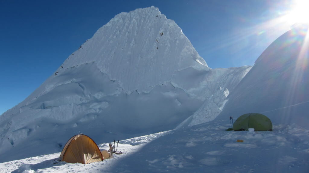
Alpamayo mountain 5947 m

Voted as the most beautiful mountain in the world. The picture was taken at the high camp for climbers that climb up to the peak.

trekking in Peru around this beautiful mountain alpamayo

Maps for trekking in Peru:

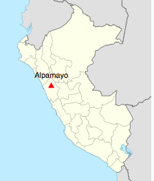
Location of alpamayo mountain in Peru


Packing list for trekking in Peru

It can get pretty cold at night  (-10°C) and than pleasant and warm during the day. Usually the mornings are still cold and as soon as the sun sets it’s cool again. I’ts important to bring layers.

  • Backpack: 30L (you only carry your day pack)
  • Shufflebag: This bag goes on the dunkies bag and has your items that you need for the trekking
  • Boots: Good trekking boots with ankle support, Teva’s or running shoes for the camps and town 
  • 2 Trekking poles
  • Down sleeping bag (800g down)
  •  Sleeping mat (Thermarest or similar)
  • Down Jacket with hood
  • Gore-tex Jacket and Pants
  • Long underwear to sleep in the tent and for cold days
  • Trekking pants, 1 pair of Shorts if you prefer to walk in Shorts
  • 2-3 Merino T-shirts or similar
  • 1 warm Pullover
  • Thin gloves 
  • Socks Merino preferred
  • Warm hat 
  • Buff, neck warmer
  • Sunglasses, hat, sun protection face and lips
  • Head lamps with extra batteries
  • Thermos bottle 1L
  • Drink bottle or camel bag 1L
  • Personal toiletteries
  • pocket knife
  • personal Travel documents, passport
  • Camera
  • 1 lightweight camping plate/bowl
  • personal medicaments
Which Vaccines Do I Need for trekking in Peru?
  • Yellow Fever
  • Typhoid
  • Hepatitis A
  • Hepatitis B
  • Rabies
  • Routine Vaccines

Make a booking with Patagoniatiptop


Pages: