Chamonix hiking: Hut to Hut short trips, French Alps


Lac Blanc mountain Lake in Chamonix

Patagoniatiptop video

Dates Chamonix hiking: June – September
  • Find our two 3-Day trip options below

“Rustic hut charm with incredible views!” 

This two short trips are perfect for hikers that like to enjoy stunning views over the Mont Blanc mountain chain, sleep in two mountain huts and spot some ibex and wildflowers along the way. Your local guide makes sure that you will get to the huts just in time to enjoy a delicious mountain dish and that you don’t have to worry about anything but taking the nicest pictures of the famous mountain scenery.

On the first option you will sleep in dormitories, and on the second option you’ll enjoy the comfort of a double room if available.


1. Aiguille Rouge mountain range
 
Arrival day : Meet in Chamonix

18.00: Information and meeting with the guide in Chamonix.

Day 1: Refuge Bellachat, 2152m

We hike from Chamonix up to the Refuge Bellachat (2152m). The Refuge offers one of the nicest views over the Mont Blanc mountain chain. You might want to enjoy a drink on the terrace that overlooks the whole Mont Blanc valley and wait until the sunset puts the mountains in a pink coat. The family style dinners will soon be served in the cosy mountain hut.

  • 5-6 hrs, 7km,  +1100m, (can be less altitude gain with a transfer to a higher start in the morning, overnight at the Refuge Bellachat
Day 2: Lac Blanc – Refuge Lac Blanc, 2352m

An early breakfast at the mountain hut with the fantastic views towards Mont Blanc. Our trail brings us up to Brevent summit for an even more breathtaking view. We reach Col du Cornu via the Col du Brévent where we walk down to Planpraz. After a picknick lunch we continue along the northern Balcony trail to Flégere. A chair takes us high above tree line. From here, our Refuge for the night is only 1hr away.  Lac Blanc mountain lake is the perfect location to take some stunning pictures of a perfect mountain scenery with the Mont Blanc in the back.

Day 3: Aiguilles Rouges

We eat a good breakfast overlooking the Aguilles Rouges mountain before leaving this beautiful spot. Our way down to Argentière will take us to the Lac Cheserys and either Argentière or the Col du Montets. Those that want to hike a bit longer can join the guide on the Petit Balcon Sud all the way back to Chamonix. Lunch will be served at local restaurant in a typical mountain restaurant. 

  • 3-5 hrs, 10km, – 100m
Map with the Chamonix hiking route in red:

chamonix hut to hut hiking route

Costs per Hiker 
  • 1254.00€ with 2 hikers
  •  795.00€ with 4 hikers 
  •  642.00€ with 6 hikers

Included in the price: Organisation, privat UIMLA-mountainleader for 3 days, 2 nights in dorms at mountain refuges with half board, 2 pack lunches, one lunch at Restaurant, hiking map copy
Not included: personal insurance, drinks


2. Miage Mountain range
 
Day 1: Refuge de Miage, 1559m
 
Meet your guide at 9.00 in the morning in Chamonix and take the local bus to Les Houches. Prarion cable car brings you to a starting location with an exceptional view, right across the Mont-Blanc mountain range. You will walk down to Col de Voza (1653m), cross an impressive suspension bridge over a glacial stream and hike up to your next pass, Col de Tricot (2120m). You will eat picknick along the way and have time to enjoy the wild flowers and views over glaciers and peaks.
A steep trail down brings you to your beautiful final location of the day, the Refuge de Miage.
Overnight at one of the wonderful Chalets at Miage Alpage.
 
  • (8km, -700m, +500m), overnight at Refuge Miage
 
Day 2: Refuge de Miage – Refuge Tré – la Tête (1970m)
 
You will walk up to Chalet du Truc (1800m), a lookout where local farmers produce their cheese and sausages and start walking down trough a lush forest to the Valley of Les Contamines. Now your way starts climbing up little by little to finally arrive at the Tré – la – Tête Refuge at the foot of the Domes du Miage on the West side of Mont Blanc. You might want to enjoy the homemade Blueberry pie on the sunny terrace overlooking the mountains and valleys.
Night and dinner at Refuge Tré-la-Tête
  • (9km, – 300m, + 850m)
 
 
Day 3: Refuge Tré – la – Tête – Les Contamines
 
You stroll down to the Gorge Bon-Nant and can decide if you want to take a longer hike to Jovet Lake or just a loop in the Gorge and back down to Les Conatmines.
Take the local bus back down to St.Gervais les Bains and continue back to Chamonix by train. 
You will be back in Chamonix around 5-6pm.
  • (14km, -1400m, + 800m included Lac Jovet, can be much less up and down)
 
Map with the Chamonix hiking route and the huts in red:
chamonix-hut-to-hut-hiking
Costs per Person
  • 2 hikers: 1290.- € / hiker
  • 4 hikers:  828.- € / hiker
  • 8 hikers:  597.- € / hiker
 
Included in the price: Organisation, privat UIMLA mountain leader guide for 3 days, guides expenses, 2 huts in privat rooms with half board, 3 picknick lunches, Prarion cable car, Bus Chamonix – Les Houches, Bus Les Contamines – St.Gervais les Bains, Train St.Gervais les Bains – Chamonix, hiking map copy

Guide for your Chamonix hiking tour :

Local, certified UIMLA – mountain leader


Pages:

Trekking tour around Mont Blanc with Hotel nights , TMB

Dates: Middle of June to late September

  • 10 – day program, 9 hiking days
  • (We offer this tour also as a 6 days Best of Tour du Mont Blanc, please ask us for the itinerary)

The Tour du Mont Blanc, a complete circuit of the Mont Blanc, is the ultimate long distance mountain walk in the Alps, and has some of the most stunning scenery.

The TMB is a 120km route that passes through France, Italy and Switzerland. The track offers cultural delights, picture book Alpine villages, the vibrant towns of Chamonix and Courmayeur, and mountain huts with majestic views.  Almost each night we stay in a different location. Accommodation varies from small family run village hotels and hand picked mountain guest houses.

Our Video:

Detailed Program:

Arriving day:
We pick you up at Geneva airport or you travel independent to Chamonix in the Chamonix Valley. Check-in at the Hotel and get to know your hiking guide that tells you all about the tour.

Dinner and night at the Hotel in Chamonix

Day 2: Les Houches (1007m) to Les Contamines (1167m)
Cable car ride up to Bellevue and ascent to Col de Tricot. A great lunch waits for us after a steep descent to the alpine village Chalets du Miage. We pass the Refuge de Truc where we buy some fresh cheese and sausages and finish the day in Les Contamines.

Night and dinner at Hotel in Les Contamines
• ascent 639m, descent 1200m
• distance 14km

Day 3: Les Contamines (1167m) to Les Chapieux (1554m).
We reach Col de Bonhomme (2329m) 0ver an old Roman bridge and trough alpine cow pastures.  After a picknick lunch we traverse the hillside to the slightly higher Col de Croix de Bonhomme before a descent to the hamlet of Les Chapieux.

Night and dinner at les Chapieux or village du Glacier
• ascent 1270 m, descent 906m
• distance 15 km

Getting into Italy

Day 4: Village du Glacier (1554m) to Courmayeur
We follow the well marked route up to Col de la Seigne (2516m) where we cross the border into Italy. We enjoy views to the impressive Mont Blanc from it south side while stepping over the border line. From the Col we descend slightly down to Val Veny and take a bus to the alpine city of Courmayeur.

Night at Hotel Courmayeur, no organized dinner
• ascent 734 m, descent 741m
• distance 15 km

hiking in Courmayeur val veny

Day 5: Courmayeur (1226m) – Rest day
Today you have a rest day in Courmayeur. There are great shops, cafes and bars. We also suggest a trip up the new cable car to punta Helbronner. Fantastic views of Mont Blanc and the glaciers of the Valle Blanche.

Night in Hotel in Courmayeur, no organized dinner

Day 6: Courmayeur (1226m) to Refugio Ferret
We head up to Bertone Refuge for a coffee. Then along the ridge with some of the finest views of the Mont Blanc range, to the guesthouse Chalet Ferret(2025m). A peaceful mountain guest house next to a mountain stream.

Night and dinner at Chalet Ferret
• ascent 1080m, descent 522m
• distance 18km

Getting into Switzerland

Day 7: Chalet Ferret (2025m) to La Fouly (1610m)
A gentle traverse of the mountainside to the Rifugio Elena for a morning coffee followed by a climb up to the Grand Col Ferret (2537m) where we cross the border into Switzerland. Down through the flower meadows to the small village of La Fouly.

Night and dinner in a Hotel in La Fouly.
• ascent 760m, descent 746m
• distance 14km

Day 8: Champex Lac (1466m) to Trient (1279m)
We take a bus up to Champex Lac and  walk along the Bovine trail up to the Bovinette alpage where you can enjoy a delicious apple pie or a home made soup. Enjoy stunning views down to the Roman town of Martigny and the Rhone valley as you walk to Trient for the night. After the dinner we’ll have a short transfer into France for the night in the Mont Blanc valley at Argentière.

Night and dinner in a Hotel in Argentière

  • • ascent 750m, descent 705m
  • • distance 14 km
Back to France

Day 9: Col de Balme to Argentière (1252m)
The last Col of the tour… The hike over the Col de Balme offers some of the finest views over Mont Bland and all the pointy needles around it. We stop for a delicious homemade Quiche at a mountain guest house before heading back down to Argentière.

Night at Hotel in Argentière, no organized dinner
• ascent 1100m, descent 500m
• distance 13km

Day 10: Argentière (1252m) to Chamonix (1000m)
From the Col des Montets  you walk through the Aiguilles Rouges Nature Reserve  to the famous Lac Blanc which provides a magnificent view of the Mont Blanc Massif. Your last walk down of the tour to La Flegère (1875m) and then a  cable car down back to Chamonix.

Last night in a Hotel in Chamonix and farewell dinner
• ascent 1100m, decent 500m
• distance 12km


Map:

map of the tour du Mont Blanc


Difficulty

This is a challenging route with an accumulated height gain and loss of over 9,000meters. The route crosses from valley to valley via  mountain passes, with long and some steep ascents and descents. This tour is ideal for regular walkers that are physically fit. The terrain on this trail is diverse with country lanes, forest trails, rocky mountain paths, and high mountain meadows. In early season you might have to walk over a few snow patches.

 We can arrange a luggage transfer between accommodations to make the tour easier for you.


Rates for a tour with luxury accommodations, please ask for the price for the tour with nights in huts and local guest houses
  • Luxury tour from 3915.00€ per hiker / single room supplement 410.00€
  • Tour with huts and guesthouses: Please ask for the price

Included in the price:
Organization, certified UIMLA-hiking guide for the whole tour, 10 nights in privat rooms with ensuite bathroom in typical village hotels and mountain guest houses, breakfasts, 7 dinners, cable cars, pick up and drop off at Geneva airport, transport to hiking starts 

Not included in the price: lunches, 3 dinners,luggage transfer (we are happy to organize that for you, the cost is  35.00€ per day per luggage of 15kg), meals that are not listed above, personal insurance (accident, travel, annulation etc.), drinks


a picknick along our tour du Mont Blanc Trekking
Lunches

We didn’t include lunches because often hikers have different kind of appetite and food wishes along the trail. There are a view mountain guesthouses where we can stop for delicious lunches and the guides are more than happy to organize a buffet style picknick during the hike. Once in Les Houches the guide will ask you what your food preferences are.


Book Pataagoniatiptop


9 Reasons why you should hike the Tour du Mont Blanc

There is a never-ending battle over which city or region is truly the best “mountain town,” “trail city” or “outdoor heaven.” East versus West, mountain access versus desert singletrack, dense forest versus world-class crags, even the local craft-brew scene comes into the debate. Europe doesn’t have this problem—there’s a clear winner.
Chamonix, France is nestled at around 3,000 feet at the base of the picturesque Mont Blanc Massif and is about as close to a true outdoor heaven as a town can possibly be.
Chamonix’s crowning attraction for adventure-seekers, though, is its location along the Tour du Mont Blanc, a 170 kilometer (105-mile) circuit that observes the massif from all sides through three countries. More of a shrine to the Alps than a simple walk in the mountains, the TMB is the definition of a Bucket List Hike.

So, why should you stick the TMB on top of your list? Here are a few good reasons.
1. The Difficulty

The trail acts as a rite of passage for those addicted to serene alpine environments, climbing to 2,500 meters five times and totaling somewhere around 30,000 feet of total elevation gain. Each section of trail is comprised of a major uphill slog, usually followed by an almost equally brutal descent. It’s certainly no walk in the park, but the rewards are well worth the effort.

2. The Scenery

This one is a no-brainer. With hardly any forest cover, the mountain views are panoramic and never-ending. From almost any point along the trail there are million-dollar views of the massif’s glaciers and of Mont Blanc itself. You’ll want to keep your camera handy!

3. The Food

The TMB gives hikers the option to forego the “just add water” meals and incessant food daydreams that usually characterize a lengthy backpacking trip. Villages with stores and bakeries can be found almost daily, and more than 50 trail refuges offer semi-reasonable prices for hot food. Don’t worry, the physical demands of the hike will erase any guilt you might have about culinary indulgences. When in Europe, right?

4. The Accessibility

Many people shy away from backcountry trips that take longer than 2-3 days, the standard time/distance threshold where the risk goes up and the ability to bail goes way down. One of the most appealing characteristics of the Tour du Mont Blanc is how accessible and well marked the trail is. The path winds around some of the most sought-after terrain in Europe, so people are always nearby and help is readily available if needed. There are plenty of points to get on or off the trail, giving hikers the flexibility to create their own itineraries.

5. The Prestige

The trail is famous for its beauty, but this fame extends far beyond some pretty pictures in a magazine. For over a decade now, Chamonix and the TMB have hosted thousands of trail runners each August for the Ultra-Trail du Mont Blanc (UTMB), which has developed into one of the most prestigious and influential ultra races in the world. Hundreds of the fastest mountain athletes flock to Chamonix weeks before the event to train for what may be their biggest race of the year. The UTMB follows the TMB counterclockwise starting and ending in Chamonix, and the fastest runners finish in under 24 hours.

6. The People

One of the best aspects of any popular hiking destination is the people that you meet on the trail. The fact that the Tour du Mont Blanc is such a global attraction elevates this to a whole new level. On any thru-hike it would not be unusual to hear ten different languages being spoken and to see an incredible age range of people using the trail. The trail is also open to mountain bikes, so it’s common to see cyclists resting on the trail’s high-elevation cols before an exhilarating descent. Swapping trail stories is even more fun when your campfire pals are from all over the world.

7. The History

Most high mountain areas have a history of adventure, and the Mont Blanc Massif is no different. The first ascent of Mont Blanc was in the late 1700’s, not too long after the first circumnavigation of the massif itself roughly along the Tour du Mont Blanc’s path. Some of the trails that comprise today’s TMB route are even older than this, though, because they follow old trade and transportation routes used for many centuries between mountain villages—some dating as far back to the days of the Roman Empire.

8. The Culture

In international travel, getting from Point A to B efficiently can sometimes restrict cultural immersion. Hiking is the perfect way to reverse that. As the trail wanders through quaint and historic hamlets in France, Italy, and Switzerland, hikers are able to gain an intimate look into local life and culture at their own pace without the distractions of modern transportation.

9. The Distance

Hiking over mountainous terrain is tough, especially for the first few days. When a hiker is able to continue working through the soreness and discomfort on a longer trek, a new world of empowered enjoyment can be found. A thru-hike of the TMB takes 9-12 days for most hikers, giving anyone plenty of time to adapt to the terrain and to thrive in the mountains. This is the perfect distance for an international trip that calls for a full-scale adventure in a compact timeline.


Book Pataagoniatiptop


bottom-banner-logo


Pages:

Dolomites hiking traverse, Italy


Patagoniatiptop video

Private Dates: June – September

The Dolomites might just be the world’s most beautiful construction, on this both architect Le Corbusier and alpinist Reinhold Messner can agree. See and experience true South Tyrolean beauty whilst pondering the towers of Three Peaks (Drei Zinnen) or basking in the last rays of evening light that redden the mountains around Pederü mountain guest house. Hike along the Dolomites High Mountain trail and enjoy the very tasty, local food in this UNESCO World Heritage site. Our hiking traverse brings us from Cortina d’Ampezzo to Val Gardena and the impressive Sella mountain range and ends at the foot of the impressive Rosengarten towers at Karer pass.

There are great differences between the Himalayas, the Rocky Mountains and the Alps. It is yet not easy to tell them apart, by just giving a quick glance at a picture of the ranges. Generally speaking, mountains have common features, such as rocky summits, trees growing on hillsides, snow remaining in shady couloirs… 

The Dolomites however show very specific characteristics and are impossible to mistake for other massifs. Not only were they made from coral, but their history, flora and fauna make them truly unique. Mountain lovers find the views offered by these spectacular landscapes striking. 

We will discover the pretty mountain villages, 3 different natural parks and 5 mountain Dolomite mountain ranges. We will stay in beautiful Hotels with one night in a traditional mountain Guesthouse.

Picture credit: Keith Wagner, Canada

The Dolomites:

“Born as coral reefs 250 million years ago, today they soar skywards proud and confident as white towers of rock.”


Dolomites hiking Itinerary
Day 1: Cortina d’Ampezzo

We all meet at the Hotel in Cortina at 7pm to get to know your hiking guide, and talk about the itinerary for the week. We enjoy a delicious dinner together.
Night and dinner at Hotel in Cortina 

Day 2: Tre Cime di Lavaredo

10.5km, 4 – 5hrs, + 378m – 378m // 6.5 miles, 1240ft elevation gain, 1240ft loss 
After a short drive past beautiful Misurina lake we start with a gentle hike at the foot of the famous vertical rock needles Tre Cime di Lavaredo. 
Night at Hotel in Cortina, no organized dinner (many options in Cortina)

Day 3: Around Croda di Lago

13,4km, 6hrs,  + 864m – 327m // 8.3 miles, 2834ft gain, 1073ft loss
A short drive brings us to the south side of the Cortina valley from where we hike to the beautiful mountain lake Mondeva located at the foot of the imposing Croda da Lago. Here we stop for a drink at the mountain hut and can later admire the Mondeval alpine pastures from the Forcella Ambrizola Pass. We continue to Forcella Giau and meet our minivan at Passo Giau.
Night at Hotel in Cortina, organized dinner

Into the mountains we go…
Day 4: Malga Ra Stua – Rifugio Seekofel – Pederü 

15 km, 5hrs, + 730m, – 840m // 9.3 miles, 2395ft gain, 2756ft loss
We hike through the Fannes-Sennes nature park today on the Alta Via, a high trail that crosses the Dolomites, and visit the Seekofel hut, one of the oldest mountain huts in the Dolomites. Over green pastures we reach Fodara Vedla to test the best Apfelstrudel in the area. Down a steep military road and we are in Pederü.
Night and dinner at Mountain Guesthouse Pederü

Day 5: Pederü, Lavarella hut, Fanes Alm, Capana Alpina

14,3km, 5hrs, + 635m, – 575m // 8.8 miles, 2083ft gain, 1886 loss
A trail through beautiful alpine pastures in the heart of the Fannes – Sennes Nature park and a sea of rocky limestone formations decorate our way up to Fanes Alm. A short way down a steep valley and we’re in the Alta Badia valley.
Night and dinner at our Mountain Explorers Hotel in the beautiful small town of San Cassiano, Spa

Day 6: San Cassiano – Kolfschung – Crespeina alta via – Wolkenstein (Val Gardena) 

7.4km, 5hrs, + 545m, – 339m // 4.6 miles, 1788ft gain, 1112ft loss
From Kolfschung we take a small cable car up to our hiking start. We hike a panoramic high trail today and finish the hike in the beautiful small town of Wolkenstein in the famous Val Gardena.
Night and dinner at Hotel in Wolkenstein, Spa

Day 7: Wolkenstein – Sassolungo loop (Langkofel / Plattkofel) – Sellajoch 

13km, 5hrs, + / – 540m // 8.1 miles, 1300 gain, 1772ft loss         
This hike leads us around one of the mightiest of the Dolomite mountains. Thanks to this loop path, you can circumnavigate the whole Langkofel / Sassolungo mountain range and enjoy continuously different sceneries and panoramas, always spectacular, while you proceed. We start and finish our hike with cable cars.
Night and dinner at Chalet Hotel in Fassa valley, Spa

Day 8: Rosengarten explorer – Refugio Vajolon  

11km, 6hrs, + 538m, – 290m // 6.8 miles, 1765ft gain, 951ft loss
The Rosengarten towers are very unique and our loop brings us to the Vajolon mountain cabin which is situated right underneath the steep rocky faces of the Rosengarten towers. We might spot some rock climbers on our way back towards the cable car.
Night at Hotel in Fassa valley, organized dinner

Day 9: Panoramic high trail Campiedi – Paolina hut – Fronza hut

10km, 4hrs, + 615m, – 200m // 6.2 miles 2018ft gain, 656ft loss
This relaxing walk is perfect to enjoy the views over the Fassa valley and up to the beautiful Rosengarten towers. A great hike up to a relaxed meal at Paolina hut with lots of time to enjoy the beauty that surrounds us. A chair lift brings us back down to our beautiful Hotel at Karer pass.
Night and farewell dinner at our beautiful Hotel at Karer pass, Spa

Day 10: Departure day 

Bye – Bye hikers Breakfast at the Hotel before your onward journey or your travel back home.
From Karer pass it’s only about a 1.5hr drive to Bolzano.


Map for the Dolomites hiking traverse:

Dolomites hiking tour


Fees  Dolomites hiking traverse:
  • 4982.00 USD per person with 6 guests, single supplement $270.00
    Minimum of 4 persons needed to conduct the tour (ask for prices); tour will be cancelled if less than 4
    Ask for discounts for bigger groups.

Included in the price: 
Accommodation and meal reservations and organization of the trip, UIMLA hiking guide, 9 nights in nice Hotels in private double rooms, 1 night in a cozy mountain guesthouse in private double rooms, private transportation to the hikes and back to the hotels, luggage transfer to all hotels, 8 dinners (as noted), park entries, cable car fees.

Not included in the price: 
1 dinner, lunches and snacks, beverages, personal insurances (accident, travel, cancelation etc.), transport to Cortina and back from Karer pass.


Changes to the itinerary: 

Note: All itineraries are subject to change due to circumstances beyond our control including, weather, road or trail conditions and flight schedules.


Hiking Level for Dolomites hiking traverse:

This is a moderate trek 
8 hiking days with 4 to 7 hours of hiking daily, with 1900ft of average vertical gain each day. Hiking will generally be on well-maintained mountain trails, sometimes including easy off-trail sections. This trip is for active people who don’t mind training to prepare for the hike, or a great multi- day hike for people with trekking experience. 


Accommodation: 

3 nights at Hotel in Cortina d’Ampezzo
1 night at the mountain guest house in Fanes Natural Park 
1 night at Hotel in San Cassiano
1 night at Hotel in Wolkenstein
2 nights in Fassa valley
1 Nights at Karer pass


Lunches: 

We didn’t include the lunches because we have had big differences in eating preferences in the past. Some people only want to eat an energy bar, others like more a buffet style picnic or to stop at one of the many great mountain restaurants. Once in Cortina you can let me know your preferences and I can organize a picnic style buffet each day or box lunches for you. Also often there are many great mountain restaurants along the way where we can stop for lunch.


Dinners: 

1 dinner in Cortina d’Ampezzo is not included. The guide will help you find the perfect dinner place for you.


Insurances: 

Travel insurance is not included in your tour.
We strongly recommend that you purchase insurance to cover cancellation, medical expenses, personal accident, personal baggage, money and public liability. 


Climate: 

Alpine weather can change suddenly, involving wide temperature variations. Temperatures also drop with altitude, and snow falls in summer are not rare. You should be prepared for cold and  hot weather, while minimising items you need to pack. 


How to get to Cortina d’Ampezzo:

Venice has the closest airport and is a great location to start the tour. We recommend spending a day or two in this beautiful town prior or after the trip.

Private transportation from Venice airport:
If you like I can organize a private shuttle from the Venice airport to Cortina and back for those who would like to go back to Venice on the last day.  

By train:

If you prefer traveling by train, the main railway line is Venezia S.Lucia – Calalzo di Cadore, then transfer to Cortina by a connected bus service. The next railway station is at Calalzo di Cadore, 21.7 miles away.

By bus:

There is a 2-hours direct bus service from Venice to Cortina called the Cortina Express. It operates daily: http://www.cortinaexpress.it/en/index.htm 

How far is Cortina from … / miles:

100 from Venice
268 from Milan
430 from Rome 
102 from Innsbruck 
820 from Calais
  27 from the Austrian border  
  45 from A27-Belluno motorway   

How to get back from Karer Pass at the end of the tour

I’m happy to arrange a Taxi for you or you can take the public bus to Bozen/Bolzano and than a train to Venice or where ever you like. From Bozen there are trains in all different directions.


Packing list for this Dolomites hiking tour:
Recommended clothing:
(We’re fans of Merino wool clothing for hiking, they dry fast and don’t smell)
  • 1 pair of hiking boots or shoes (high or low is up to you, I always recommend higher ones but the trails are in very good shape)
  • functional underwear
  • hiking socks
  • 1 long sleeve shirt
  • 2-3 T-shirts
  • 1 fleece or soft-shell jacket
  • 1-2 pair synthetic hiking pants or shorts
  • 1 pair long pants
  • 2 – 3 pair hiking socks – wool or wool blend
  • 1 pair shoes for wearing after the hiking in the towns
  • 1 sun hat, 1 warm hat
  • thin Gloves
  • 1 set Gore-tex rain gear
  • 1 thin down jacket
  • Casual outfit for dinners
  • Gaters (for tours in early spring) 
Optional clothing:
  • Swimsuit (many Hotels have a Spa)
Gear:
  • 1 day backpack
  • 1-2 water bottles, thermos bottle
  • Sunglasses
  • Personal toiletries
  • Wollte or similar for hand washing clothes at Hotels
  • 1 pair trekking poles
  • Camera
  • Blister tape
  • Pocket knife
  • Personal medicaments

Read more about our last Dolomites hiking traverse from our friend and travel writer Laura Gosset

Please press on the “make a booking” button to send us an e-mail with your questions!

Book Haute Route Chamonix to Zermatt


Pages:

Hiking in Cornwall & Lake District, England


Patagoniatiptop video


Private Dates: May – October

What to expect

Cornwall

In Cornwall we will discover  landscapes where the sea turns turquoise in the sun, the sand is white and the natural light is sometimes blindingly bright, the land is adorned with a legacy of Bronze age standing stones. Huge granite burial chambers, Celtic crosses and holy wells. We will walk trough beautiful flower fields along the South Western Coast Path and might spot some seals on the way.

Lake District

Walking on the Fells in the Lake District National Park is something every walker should experience. 500 million years of geological processes have produced a tightly packed landscape of sparkling waters and superb rugged peaks of dramatic beauty. Within an area only 30 miles across, England’s highest mountains tower over its deepest and longest lakes, with picturesque stone-built villages, farms and country inns crowding into the valleys.

Highlights
  • Discover the Cornish coast walks
  • Reach the highest fells in the North
  • Sleep in an old castle and luxury Hotels
  • Cruise on an old steamboatLuggage transport – Hike only with a daypack
Hiking Itinerary

Day 1: Mullion Cove
Transfer from Newquay Airport to Mullion Cove Hotel
You will stay at the magnificently sited Mullion Cove Hotel for the next two nights. The hotel is situated on the Lizard Peninsula in South Cornwall. The hotel stands on the cliff top overlooking the harbour and fishing cove with uninterrupted sea views.
There will be time for a short walk before dinner.
Dinner  be at hotel.

Day 2: Kynance Cove and Lizard Point
Today we’ll take our first long hike along the Cornish coast, directly from the hotel on the South West Coast Path. We’ll visit the dramatic Kynance Cove and Lizard Point, before proceeding to the pretty village of Cadgwith for a welcome pint!
10 miles, 2000 feet of ascent and descent.
Dinner at hotel.

The very westerly point of England

Day 3:  St Michael’s Mount and Land’s End
Today we’ll start very early to fit in a visit to iconic St Michael’s Mount and its 17th Century Castle, with access by its cobbled tidal causeway. If the tide is high, transfer is by small boat.
After that we can transfer to the little village of Porthcurno and hike along the South West Coast Path to Land’s End admiring the views from the most westerly point of the English mainland.
6 miles, 2000 feet of ascent and descent.
Dinner at Hotel

Day 4: St.Ives
Today you will hike from Lelant to Zennor. Again we follow the South West Coast Path through wonderful coastal scenery through areas of wild orchids, with views down to rocky inlets where the seals will be resting. An option today is to finish the walk in St.Ives to allow more time to shop and sightsee there. Otherwise the hike finishes in Zennor.
Using the train, allows the choice of length of stay in St.Ives and the journey takes just 10 minutes.
Leland to Zennor, 11 miles, 2700 feet in ascent and descent
Lelant to St.Ives, 3,5 miles

Lake District discovery

Day 5:  Transfer to the Lake District & The Swan Hotel
Today you will transfer by private minibus to Newquay airport and again transfer to the Lake District by private minibus from Manchester airport.
Depending on flight times, we should have time for a little hike up Hampsfell and a visit to the picture postcard village of Cartmel, famous for its races, sticky toffee pudding and its priory, before reaching our hotel, The Swan at Newby Bridge.
Dinner will be at the Hotel

Day 6: Scafell Pike, the highest point in England
Today, we’ll attempt an iconic British hike, to the top of England’s highest fell, Sca Fell Pike. The hike starts in Brotherilked, we go up past the waterfalls of Scale Gill and the River Esk, to magnificent Great Moss. From there we make a final ascent of Sca Fell Pike via Micklesore, and then descend steeply down the path by Lingmell Gill enjoying views over Wastwater. A short hop by minibus brings us to the Wastwater Hotel with its famous hikers bar. A long, but very rewarding day.
8 miles, 3100 feet in ascent and descent on rocky and uneven Lakeland paths with some steep sections.
Dinner will be at the hotel.

To the northern Lake District area

Day 7: Rydal Water and Grasmere
Today’s we’ll enjoy a shorter hike as we transfer to the North Lake District. Starting in Rydal Water on the coffin route, we’ll ascend little Loughrigg Fell high above pretty Rydal Water. We’ll then descend to Loughrigg Terrace where the bluebells will greet us before crossing over to White Moss and Wordsworth’s house. It is possible to have a guided tour of Wordsworth’s house, a fascinating insight into 18th century domestic life, as well as the great poet.
Grasmere village itself is a picture postcard of pretty slate houses, shops and pubs.
4 miles, 1300 feet in ascent and descent
Your hotel tonight is Armathwaite Hall and Spa, where you will have dinner.

Day 8: The Newlands Round, Keswick and Derwentwater
Today we will drive into the heart of the Newlands Valley to Little Town, the starting poing of one of the Lake District’s most famous hikes, The Newlands Round. First we will ascend the spectacular wide ridge of Hindscarth to reach Dale Head and one of the best views in the Lake District over Buttermere and Crummock Water. From here we will descend over Maiden Moor down to beautiful Derwentwater and the jetty at Brandlehow. You will then catch the Victorian steam launch across the lake to the market town of Keswick, where there are plenty of shops and cafes, before catching your private minibus home, via the ancient stone circle of Castle Rigg.
9 miles, 2900 feet in ascent, 2400 feet in ascent, on rocky and uneven Lakeland paths. Some steep sections.
Your dinner tonight will be at Armathwaite Hall.

A cruise and a train ride back to London

Day 9: Ullswater and transfer to London
Today you will transfer to Pooley Bridge to catch another Victorian steamer and enjoy a trip down the deepest lake in England, Ullswater. You will enjoy a gentle walk along the shores to the pub in Patterdale. There a private minbus will transfer you to Penrith station for your First Class train journey back to London.
5.7 miles, 1100 feet in ascent and descent.


Prices
  • 3857.00€ / hiker, with a group of 5 hikers
  • 3450.00€ / hiker with a group of 8 hikers

Excluded: Flights, London hotels, Meals other than those stated, lunches, drinks


Book mountaineering Switzerland


Pages:

Private Ski Lessons Chamonix & Megève

December – April

chamonix-private-ski-lessons

Professional private Ski lessons in  Chamonix & Megève ski areas from December until end of April. Learn from the Swiss Ex-world cup ski racer Ella Alpiger and her team.


Chamonix ski lessons

chamonix-private-ski-lessons

Everything about Chamonix ski resort is big. In the shadow of Mont Blanc, the deep valley has more skiable slopes than seems reasonable. With several ski areas distributed across the huge mountain ranges to north and south, a thriving town in the centre and smaller, charming mountain villages in the valley, there’s something for everyone.


Megève ski lessons

chamonix-private-ski-lessons-megeve

With the Mont Blanc as its backdrop, Megève ski area is in a lovely sunny setting and the village has a beautifully preserved, partly medieval centre. It’s the capital of the mountain way of life, an authentic village in the Savoy Alps that is covered by a carpet of snow every winter.


Teaching for beginners and experts

Many different slopes in all different colors and challenging Offpiste runs are waiting for you to be discovered.
Beginners and Experts are welcome to join the lessons!

We will analyze your skiing on video cameras. Fast technical progress and more enjoyable ski days are the result of that.

Ella Alpiger Snowsports instructor Chamonix Valley


Prices for private ski lessons in Chamonix valley:

Daily Ski and Telemark lessons, Off – piste days and Ski touring intro courses:

Half day (3hrs): 250.00€

  • 09:00-12:00 / 13:00 – 16:00

All day (6hrs): 500.00€ 

  • 09:00 – 16:00 (with 1 hour lunch break)

Included in the price: Teaching, Video of your progress, pick up at your Hotel

Make a booking with Patagoniatiptop


Ski areas within the Chamonix Valley

chamonix-ski-areas-map

The Chamonix Valley offers 4 different, big ski areas. There is a multitude of slopes for all levels, each ski area having its own merit. Sometimes it’s not easy to choose where to go. Let us help you with this decision.

Brévent – Flégère the ski area out of Chamonix town

chamonix-brévent-flégère-ski-area-map

A south-facing ski area for skiers of every level, with superb gullies, on the edge of the nature reserve Aiguilles Rouges. An unrivalled panorama of the ‘roof’ of Europe and its surrounding summits. Access Brévent from the center of Chamonix or Flégère from Chamonix Les Praz (3km from Chamonix). At the bottom of the Brévent ski area there is a beginners area: the Savoy which can be accessed on foot from the resort center.


Grand Montets out of Argentière

grand-montets-ski-map-chamonix

The north facing ski area for expert skiers. Grand Montets ski area offers long, steep runs and a great off piste ski bowl. It’s the spot after a snow storm and for skiers that like moguls.


Balme – Vallorcine out of Le Tour or Vallorcine

balme-vallorcine-ski-map

The perfect family ski where to enjoy wide open gentle slopes overlooking the entire Chamonix Valley. There is some fantastic tree-skiing and tree-lined pistes on the Vallorcine ski bordering with Switzerland. In Le Tour at the bottom of the ski area there is La Vormaine, a very good beginner area.


Les Houches

les-houches-ski-map

Great for families and intermediate skiers. The ski area of Les Houches / Saint Gervais extends from an altitude of 950m to 1900m. From the summit one has a spectacular 360° view of the Mont-Blanc massive. And with 55 km of slopes meandering through the forests, you will discover the real pleasures of skiing. With the Kandahar slope Les Houches also offers a black slope where Men’s World Cup races are hold.


Unlimited skiing in and around Chamonix

With the Chamonix Unlimited Skipass (more than 3 days) we can also enjoy skiing in Courmayeur (ITA) 15 Min., Verbier (CH) 40 Min. and Evasion Mont Blanc (Megève, St.Gervais, Les Contamines) (FR) 20 Min. by car from Chamonix.


Why not try Ski touring?

chamonix-private-ski-lessons-ski-touring

Chamonix also offers great ski touring options not only for Experts.

Let us introduce you to our favourite sport with a Ski touring Intro. Learn all about safety, snow and technique. Bring your skiing and skinning to the next level!


Sign in for our Off piste, powder courses

chamonix-private-ski-lessons-powder-day

Explore the snow on the other side of the groomed run! If you have mastered the pistes and want to learn how to ski all trains off piste, come and sign up for our Off piste courses. We will teach you on all different slopes and terrains. Let’s train to get you fit to take a ski trip down the Valle Blanche!


Equipment

chamonix-private-ski-lessons-old-skis

We proudly ski with K2 Skis, they offer a great range of skis and boots for all different kind of availabilities and snow conditions. Not sure which material to buy or rent? We are happy to recommend the perfect ski for you.

There are plenty of shops in Chamonix that rent high quality skiing equipment. 


Accommodation for ski lessons in Chamonix

Do you want to sleep in down town Chamonix or rather a bit outside in the quite or maybe ski in and ski out? Chamonix has it all, let us find the perfect place for you!


Chamonix skiing, what it’s all about

A must by all ski enthusiasts! The Chamonix Valley is consistently rated as one of the top ten ski areas in the world. The legendary skiing caters for every taste and ability. 90% of the ski area is above 2000m with an excellent snow record and a long season from December to May. It is the home of the legendary 23 kilometre Vallee Blanche and the Kandahar World Cup downhill runs. The lift pass which, covers 750km of groomed skiing includes the elegant resort of Courmayeur in Italy, Verbier in Switzerland, and Evasion Mont Blanc ski area. The Chamonix Valley is approximately 20 kilometres long with the Aiguilles Rouges mountain range on the north side, and the Mont-Blanc mountain range on the south side. 

The town

chamonix-town-with-mont-blanc

Chamonix is an ancient mountain town with a stylish atmosphere and a blend of French charm, varied skiing and modern facilities that few other alpine resorts can match. Our guests return time after time and always discover something new.

The town of Chamonix with its pedestrianised cobbled streets and squares, beautiful buildings has an excellent choice of quality shops, cafes, bars, restaurants, and a Saturday market that should not be missed. Chamonix has an attractive, bustling old town centre. The smaller, quieter ski villages of Argentiere, Les Houches and Vallorcine offer a different style of resort life.


Aiguille du Midi, 3842m

chamonix-private-ski-lessons-aiguille-du-midi

The top station of the Aiguille du Midi cablecar has a spectacular panorama of Chamonix, the Mont Blanc and the Mer De Glace glacier. It’s the access point to high elevation glacier skiing the world famous Vallée Blanche. Majestic Mont-Blanc, one of the world’s natural wonders dominates the area.


How skiing came to France; did you know?

first female skier in the French alps

Skiing had come to Italy via Switzerland since about 1895. The natural thing for France would have been to copy the neighboring Italians. They went to the source instead, they wanted a missionary from Norway and in November 1902 one such providentially dropped in. A junior Norwegian army lieutenant called Herman Schultz that wanted to visit France as a ski instructor in order to get out into the wider world an learn French. Later two more officers where sent to France and they started a ski school to teach the French soldiers. Those soldiers showed a legendary marching ability and could accomplish to march up to 50 or 60 km a day on skis without really being worn out. They sometimes started at 4a.m. and didn’t return until 8p.m.

The ski school was so exhausting, both for teachers and the taught, that it only ran from Monday to Thursday, with the rest of the week free; for the French soldiery at any rate. On Friday and Saturday, the Norwegians were expected to teach the officers and on Sundays, their wives. The Colonel’s lady was particularly keen. The two instructors would support her on each side and she was wearing a hat and veil! …”Suddenly her skis broke trough the crust, and we ran on, but in confusion. It was not a dignified regimental commander’s wife who got her feet, covered in blood, with hat awry and tattered veil. Afternoon tea with her was cancelled. We didn’t see her for 14 days.”

Pages:

Ski touring Camp La Fouly, Switzerland

  • Date for private camps: December – April
Skiing in Liddes, Pays du St. Bernard
Highlights 
  • 3 days ski teaching and ski touring 
  • 3 nights at a wonderful small Chalet in Val Ferret
  • Learn all about ski touring and back country skiing
  • Ski touring basics, including gear usage, uphill techniques, pacing, layering, and route selection
  • Avalanche awareness including terrain management and basic companion rescue strategies

Learn Off piste skiing and ski touring with us!

Three days of world-class skiing with top instructions from Ex-World Cup ski racer and certified ski instructor Ella Alpiger.
This ski touring camp features the latest ski and ski-touring teaching techniques, avalanche safety informations and some hidden Off-piste runs.

  • “It’s all about learning off piste skiing technique, backcountry skills, mountain safety, and most importantly, having fun in the outdoors!”

We will base out of the beautiful Swiss Val Ferret for 3 days of adventure skiing. Our goal is to ski the best hidden places for the given conditions, and provide you with coaching and instruction in skiing off piste.

  • “It’s a unique ski program that makes it easier, faster and more fun to learn.”

Ski touring camp La Fouly Itinerary 

Arrival day

We pick you up at Martigny train station at 6pm and drive into the Swiss Val Ferret (20′). We welcome you at the Chalet for a first get together.

Come enjoy a dinner in the kitchen and a glas of wine infront of the fire place.

  • Night and dinner at Chalet in Val Ferret

Day 1: Off piste skiing work shop and avalanche rescuing

From piste to Off piste work shop in the ski area of Liddes near Grand Saint Bernard Pass. We ski where we find the nicest snow. Get tips on your skiing skills and technique to help you improve in a variety of ski conditions and terrain. Work on technique and mental preparation that will improve your skiing in the backcountry, in steeps, trees, narrow chutes and crud.
Learn how to search with your avalanche transceiver in the afternoon on a short ski tour. An important skill you have to know!

Before heading back to the Chalet we stop at the local cheese factory to get our Raclette cheese for dinner.

  • Night and dinner at the Chalet in Val Ferret.

Day 2:  Ski touring intro La Fouly, Switzerland

A short drive brings us to our Offpiste work shop in the morning in the small ski area of  La Fouly. It’s a secret spot for powder lovers and offers also some great tree skiing. Practice the tips you have learned yesterday.
Now we are ready to bring our back country skiing to the next level. We start with a short ski tour in the afternoon where you learn all about ascending with skins on your skis, ski touring itineraries and snow safety information.

  • Night and dinner at the Chalet, enjoy a glas of wine at the fire place and check out today’s skiing videos.

Day 3: Ski tour 

With a picknick and all necessary things in our backpack we skin up into the mountains. We use and try all our new learned skills and enjoy a day in the peaceful mountains.
The course finishes at 4pm at the train station in Martigny.

Changes to the itinerary:

The programme is given as an indication only. Changes and adaptation may be made to suit current technical criteria, safety requirements and weather conditions.


What you will learn in this Women’s ski touring camp:

This course makes it possible for intermediate and advanced skiers to move to the next level of expertise in the shortest time possible. Get confident with the avalanche safety skills and make your first ski touring experiences. All in a group session designed to foster camaraderie. A truly elevated experience. Do you already have some ski touring experience? This course will still help you to improve and make sure, you feel confident while skiing off piste. 


Personal Requirements:

If you feel confident on red and black slopes and have some off-piste experience, you’re ready to join this camp. Please contact us if you’re not sure about your level.


Location, Pays du St. Bernard:

In a privileged natural Alpine setting that is almost perfectly preserved, the St-Bernard region offers a wide range of sports and cultural activities.

In winter, the charming resorts offer ski runs and freeride for all levels with spectacular panoramic views in breathtaking natural surroundings .


How to get to Martigny, Switzerland:

Martigny in the Swiss Valais region can be reached by train in an hour from Geneva and in 2hrs from Zürich. From Chamonix you can reach Martigny by train as well. 


Our Accommodation:  (Depending on availability, sometimes we might stay in a small Hotel in La Fouly)

We’ll stay in a special Chalet from the 18th century, carefully renovated by Sylviane, our host. The chalet is located in a very quiet, traditional village with only 30 people living there.

We share the two big bedrooms with places for 8 people and can enjoy the whole chalet to ourselves. You can relax in front of the  fireplace with a glass of wine or enjoy the tastefully decorated wooden living room and a big common space underneath the roof where we can do some yoga and stretching after skiing. 

Chalet features:
  • Champagne and canapés upon arrival at the chalet
  • Home made vegetarian dinners  – including special menus for those with dietary needs, prepared by Sylviane our host
  • Full breakfast every morning: hot and cold option including eggs, fresh bread, fruit platter and cereals
  • Afternoon tea – home baked cakes, fresh bread and jams with tea and coffee

Fees:
  • 3 Skiers:            910.00CHF /skier
    5 skiers:             772.00CHF /skier
    Skiing only*:     500.00CHF /skier 

(*Min. 3 skiers: accommodation/half board, ski pass and transport not included in the skiing only program)

Included: Professional teaching and organisation, 2 ski passes, 3 nights in a traditional Chalet with half board in shared rooms, lots of information about ski touring and avalanche rescuing, mental training tips, pick up and drop off at Martigny train station

Not included: Transportation to and back from Martigny, lunches, drinks, personal insurance, personal equipment (let us know if you need ski touring and avalanche safety equipment, it can be rented).


What material should you choose for our women’s ski touring camp? 

Let us help with your decision. Please ask us before the course. 


Book Haute Route Chamonix to Zermatt


Pages:

Ski touring Patagonia, Expedition Cerro San Lorenzo

Dates:  
  • September – November

Cerro San Lorenzo seen from Refugio

Cerro San Lorenzo is the second highest peak in the Patagonian Andes (47° 36′ S, 72° 19’W). It’s a huge mountain range that rises about 3300meters out of its surroundings.

Not only its elevation is very special, also its location. This mountain stands between the southern and the northern continental icefields and exactly between the Argentinian and the Chilenian boarder.
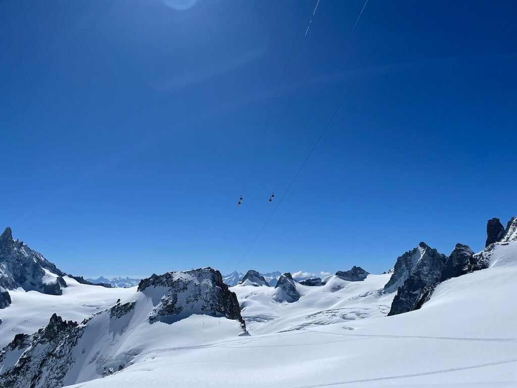
It is surrounded by four huge glaciers.

We choose the so called “routa de Agostini”, named after the first climber Padre de Agostini in 1943.
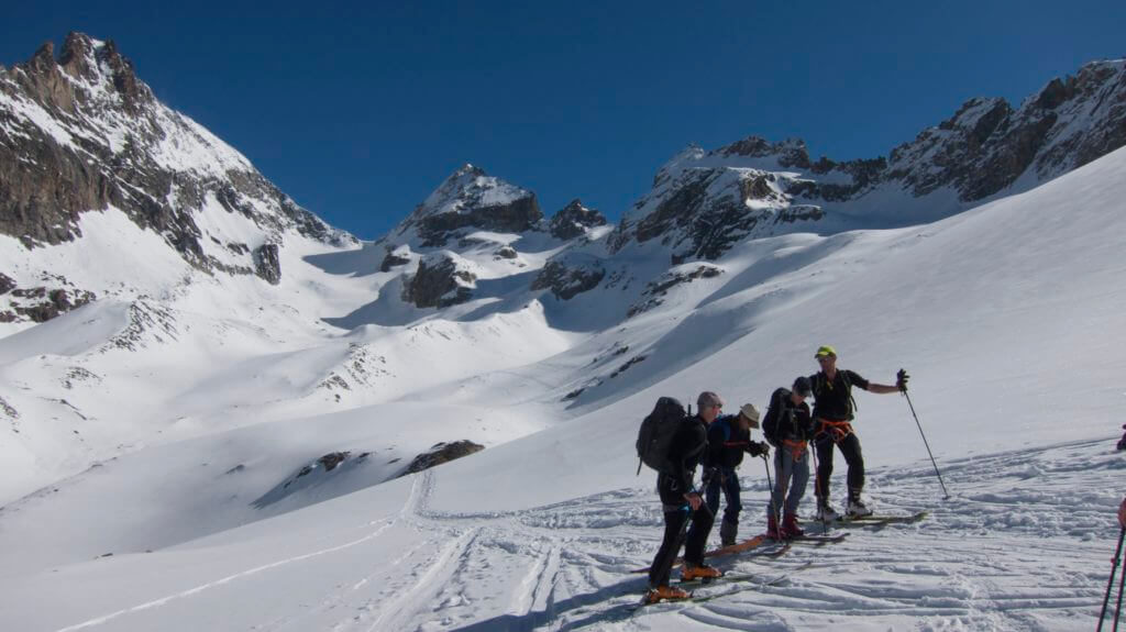
We offer this route as a wonderful ski touring expedition.

Cerro San Lorenzo mountaineering tour

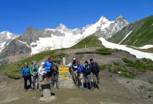
Itinerary ski touring Patagonia, Cerro San Lorenzo:

Day 1
Transport from Balmaceda airport to the hotel in Coyhaique.
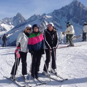
Meet and greet with the guides and the other guests.
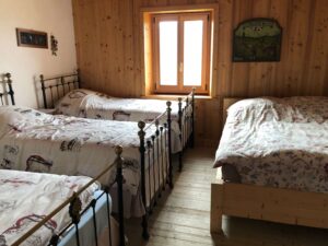
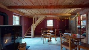
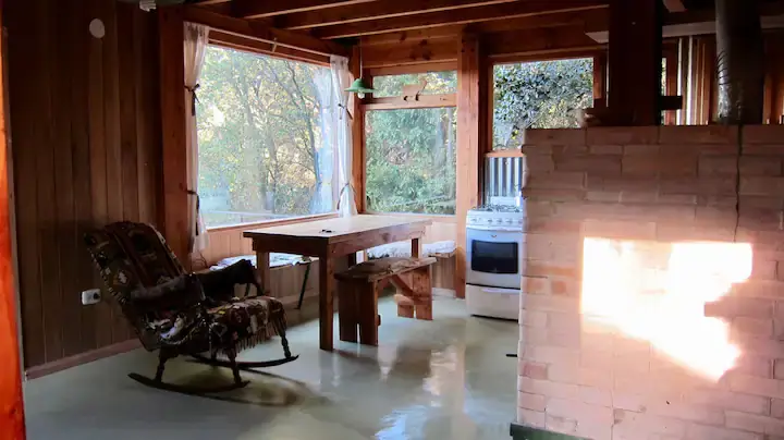
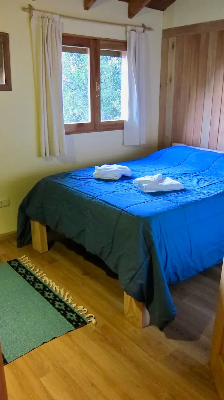
Night in a hotel in Coyhaique

Day 2
Transfer by car to Cochrane, one of the last small villages at the famous routa 40. (6 hours)
Overnight stay in a hotel in Cochrane

Day 3
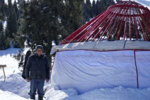
Transport with a fourwheel drive car to Fundo San Lorenzo, our starting point
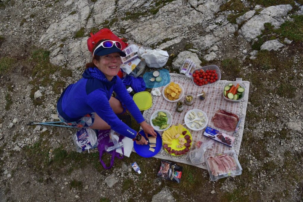
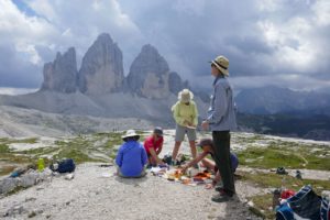
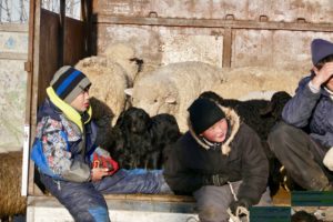
Here we enjoy a typical, delicious patagonian grilled sheep, a “Cordero Patagonico”
Night at the Fundo, a local farmers mountain home

Day 4
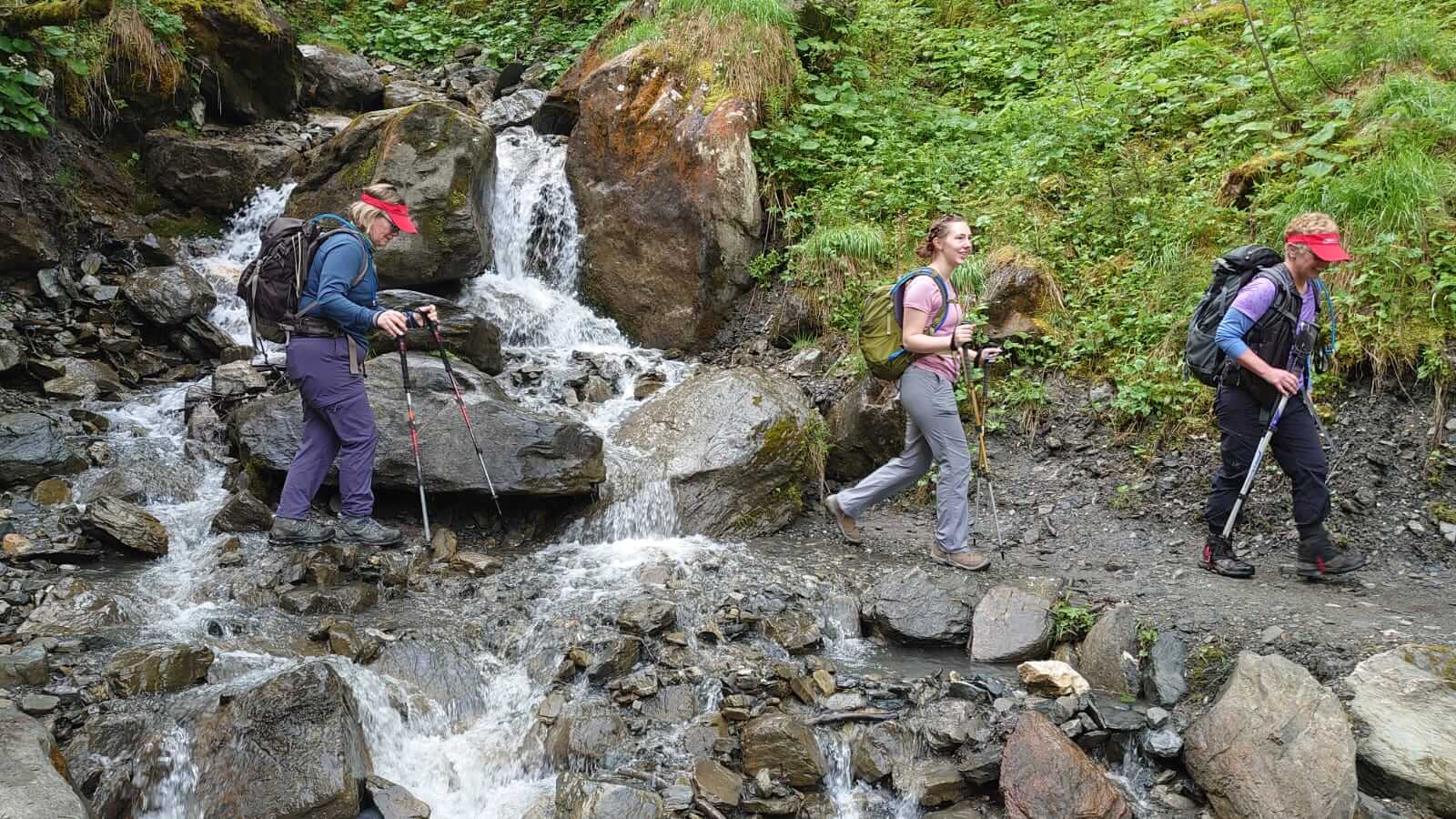
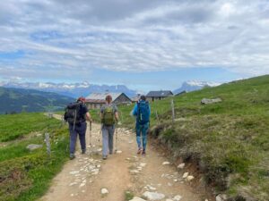
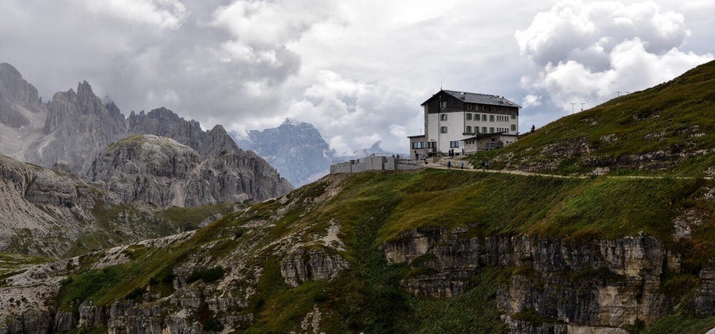
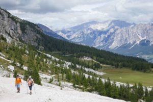
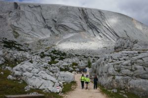
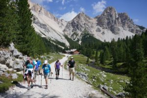
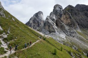
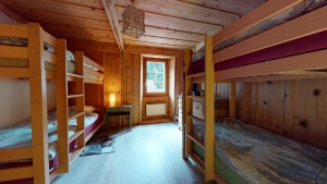
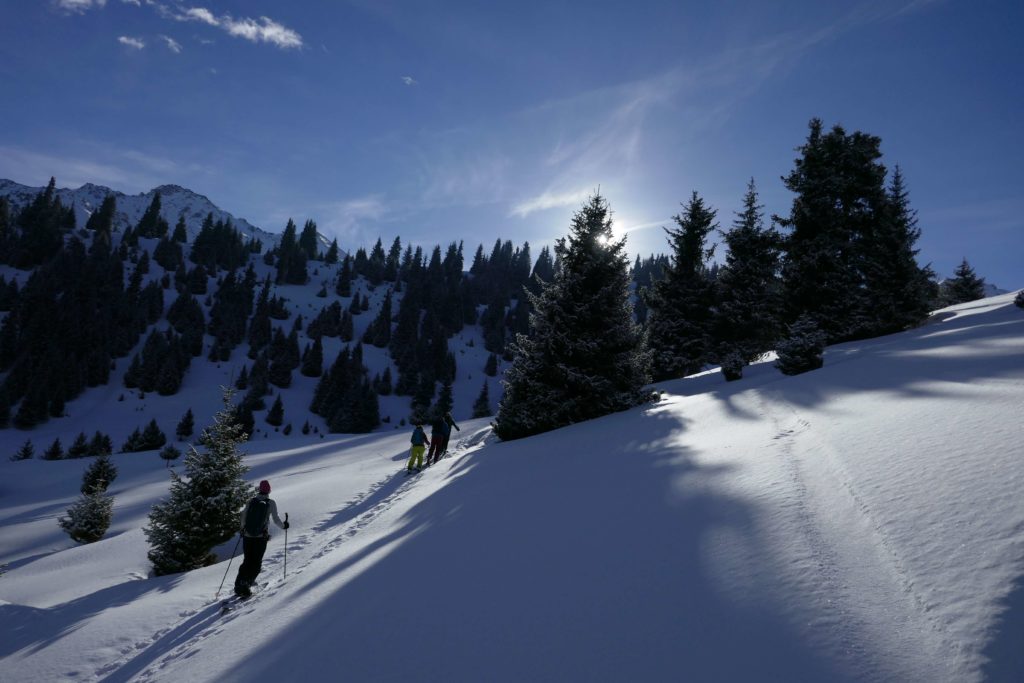
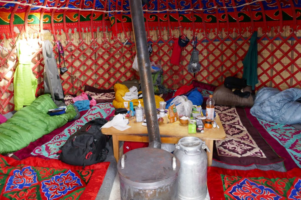
Trekking to Refugio Toni Rohrer, a small pretty shelter in the woods. Night at the Refugio

Day 5
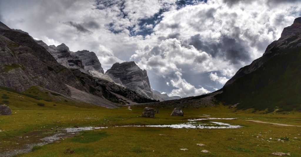
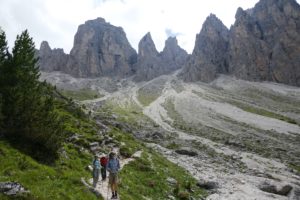
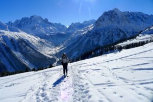
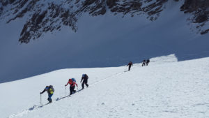
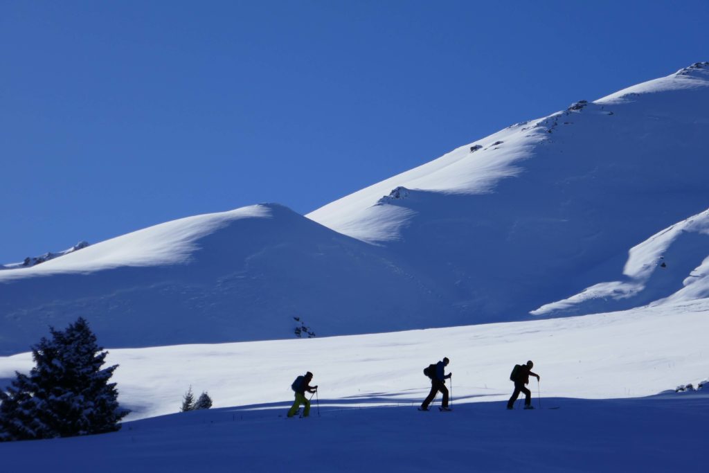
We reach Paso del comedor and Brecha del comedor (aprox. 6hrs)
Overnight in the tent

Day 6
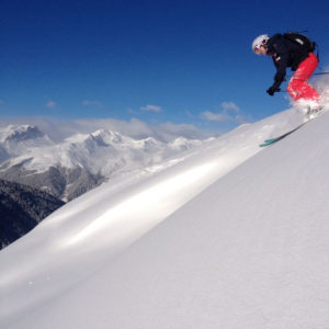
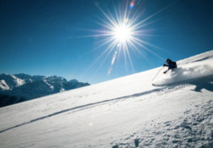
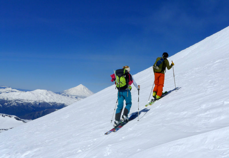
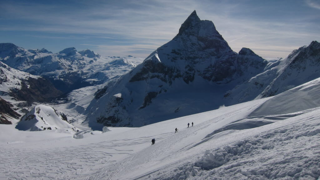
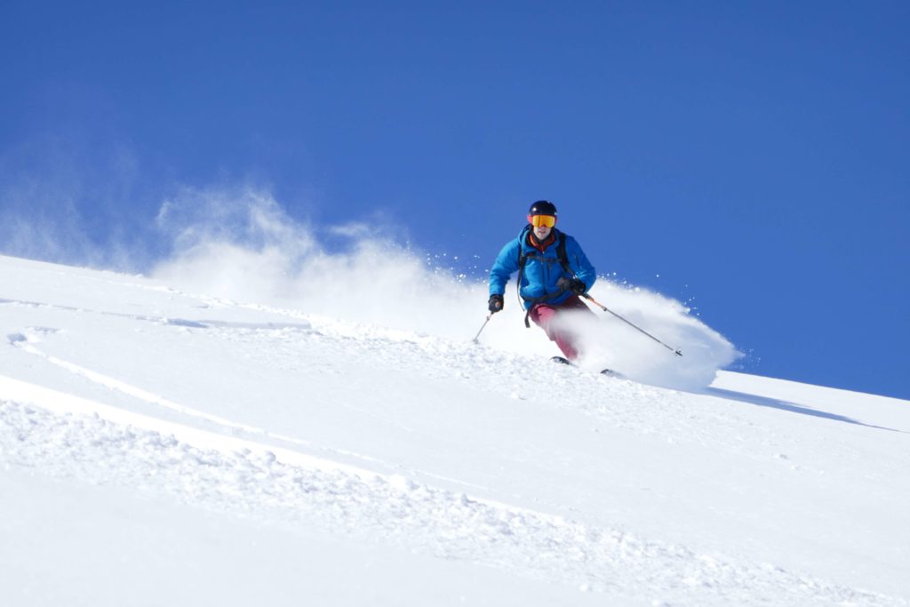
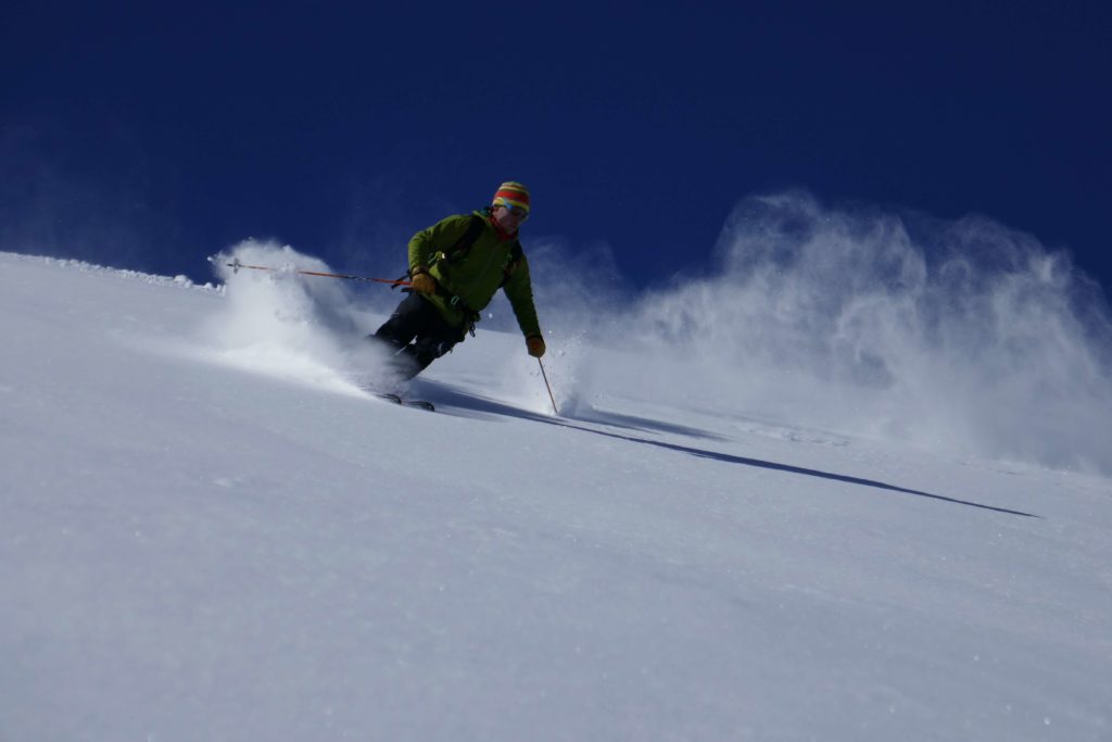
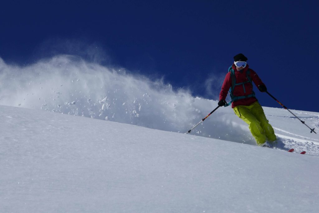
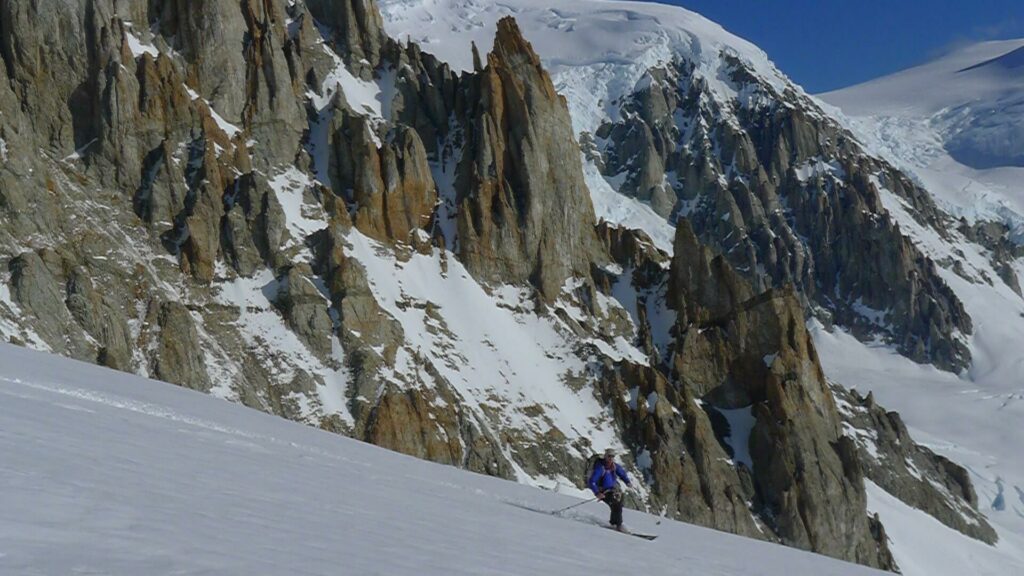
Cumbre!!! All the way up to Cerro san Lorenzo today and a great ski down back to the camp (aprox. 8-9hrs)
Overnight in the tent

Day 7
Back to Refugio Rohrer

Day 8
Back to Fundo San Lorenzo
Overnight stay at the Fundo

Day 9
Transport back to the hotel in Coyhaique
(This program is base on nice weather. As the weather can change very quick in this area, it’s important to plan a couple back up days)

Day 10-12
back up days


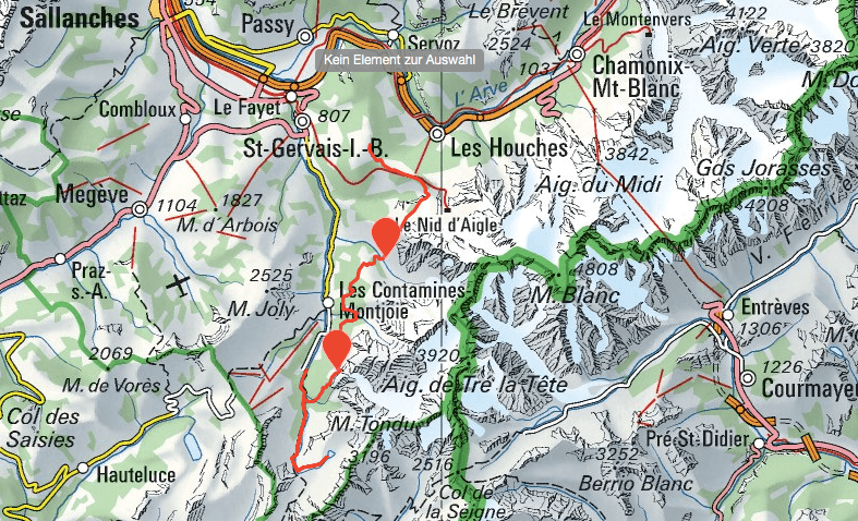
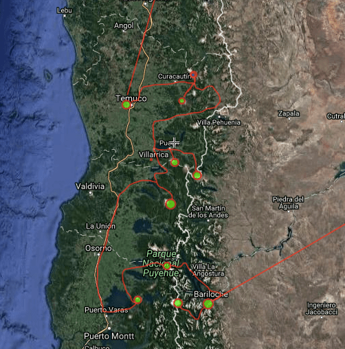
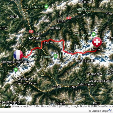
Map San Lorenzo, Skitouring Patagonia:

map of cerro San Lorenzo Patagonia


Personal requirements:

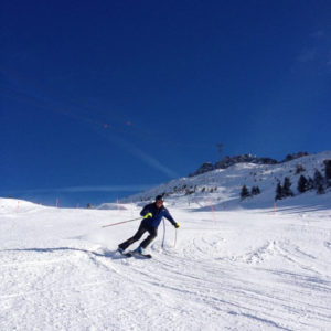
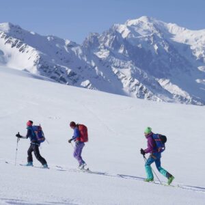
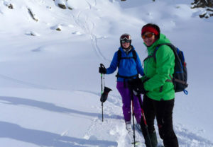
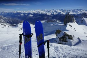
Proper parallel turn in all snow conditions
Walking with crampons
Enough personal fitness to climb 1000m a day (total 3100m), with a backpack (15-18kg)


How to get there:

Flight to Santiago de Chile and from there to Balmaceda (BBA) airport. It’s served by Latam airlines. That’s where we pick you up.

driving to the basecamp of cerro San Lorenzo

Price Skitouring Patagonia trip:

Please contact us for the actual price and your group size

Included in the price:

Organisation, 2 local IVBV-IFMGA mountain guides, transport from Balmaceda airport, Coyhaique to Fundo San Lorenzo and back, all meals, 1 night at a Hotel, luggage transport to the mountain hut by horse, tents and cooking equipment

Not included in the price:

Personal equipment, personal insurances (accident, annulation, travel etc.)

View from the top of Cerro San Lorenzo

Experience Report from a Skitouring Patagonia trip:

Cerro San Lorenzo – A ski expedition on the second highest mountain of Patagonia

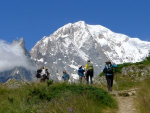
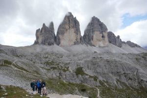
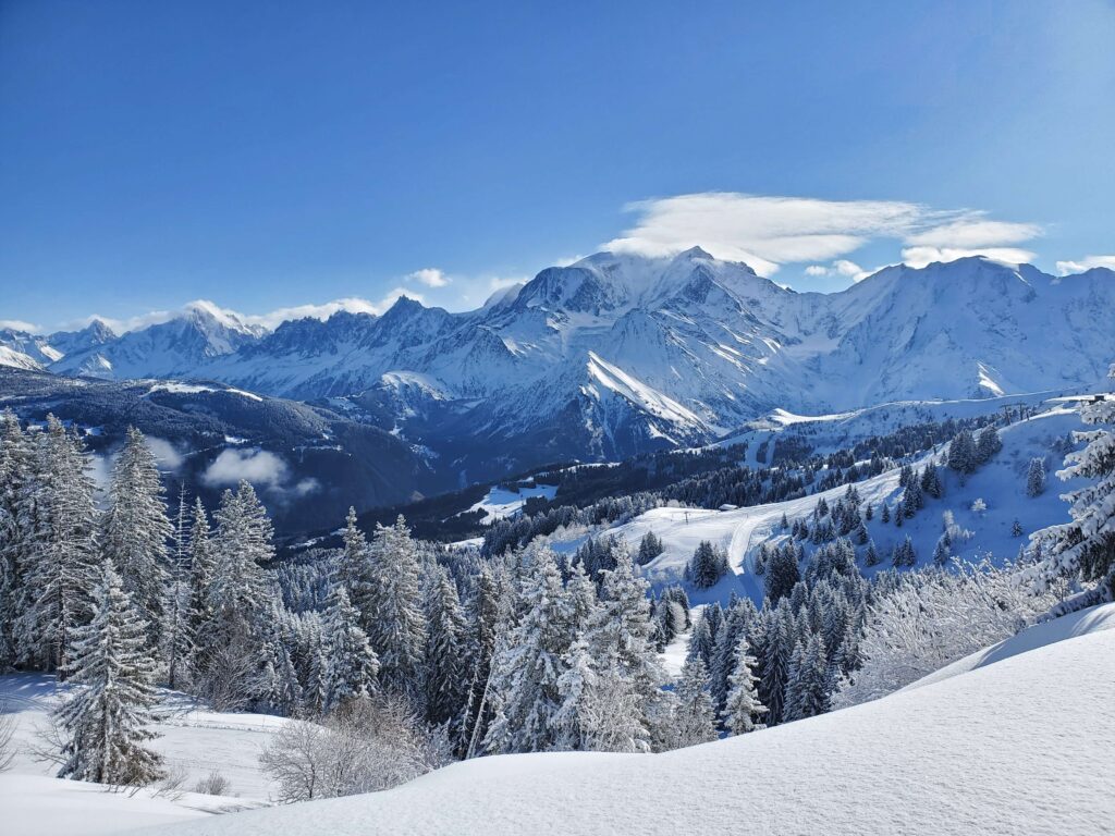
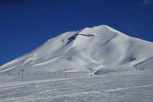
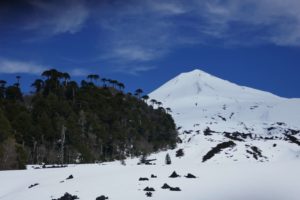
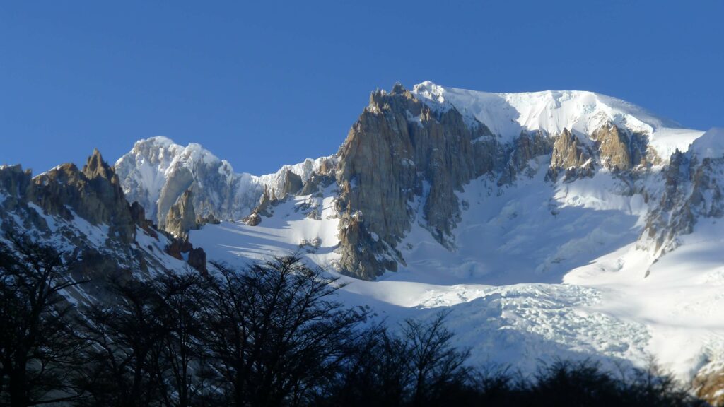
Cerro San Lorenzo is with 3706m the second highest mountain of Patagonia. It is one of the greatest mountain massifs Chile and Argentina have to offer. Like a gigantic castle, the mountain’s shape rises far to the east over the Argentine pampas. Parque Nacional Perito Moreno lies in the south of it.

Skitouring at Cerro San Lorenzo Patagonia

De Agostini Route

For our expedition we decided for the “normal route”, the Route de Agostini. A Salesian priest who is able to climb the mountains was the first to dare to climb the impressive mountain via de Agostini Route.
Patagonia alone is a world in itself. But the region of the Cordillera, which houses the high peaks of San Lorenzo, is even more special. These mountains occupied a different position alds the other groups of the Cordillera Patagonia Austral.
They are the only ones that have moved to the east with comparison of the axis of the Andes. More than at any other place in Patagonia, the history of the Andinists who have circumnavigated this mountain has been shaped by researchers, geographers, miners, farmers with estancias and military.
Thus exciting stories of the whole world were created. 

Great mountain ambience 

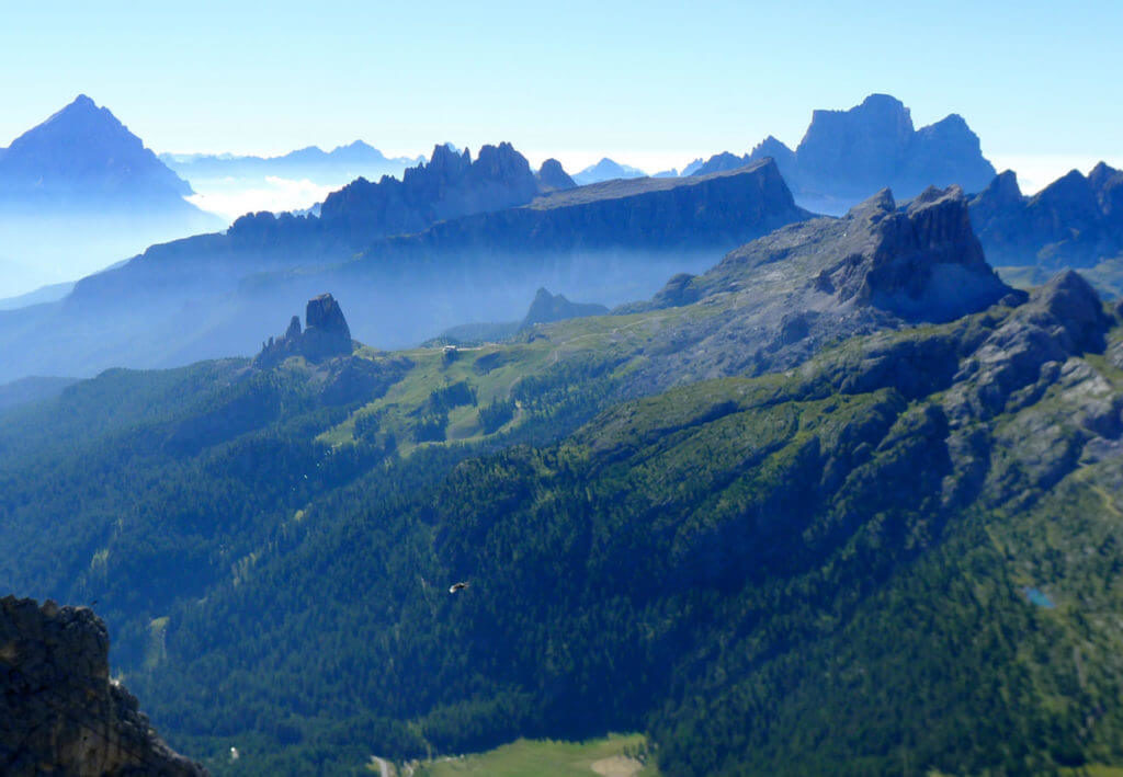
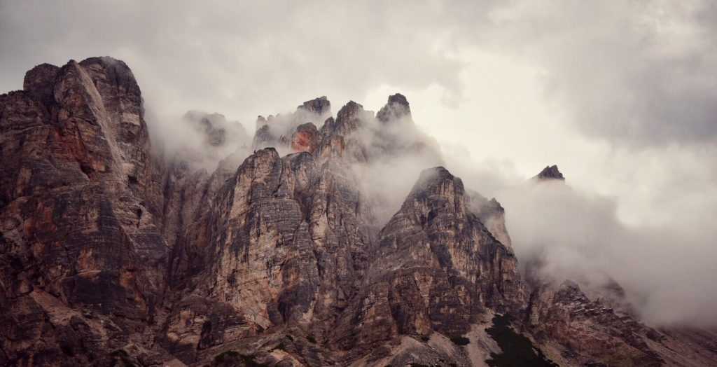
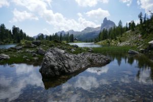
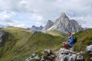
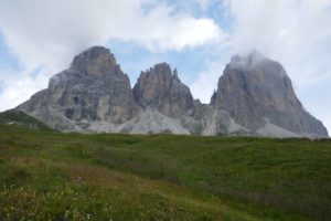
This massif does not offer spectacular yellow, grey or pink granite walls as its famous neighbor the Fitz Roy massif. Here there is a spectacle of various coloured volcanic stones which are not very suitable for climbers. What is extraordinary, however, is the ambience. The impressive solitude of the main summit which resembles from its proportions a Himalayan summit, the colorful swamp meadows and high plateaus of Argentina and the green valleys of Chile on the other side.

Hidden Paradise

If you want to explore real, wild Patagonia, you will find a hidden paradise here. This massif lies roughly between Lago Pueyredon – Cochrane in the north and Paso de la Balsa in the south. In the east of the Argentine side the valleys are more and more dry and sandy with contrast to the Chilean west where dense, almost impenetrable Lenga forest lies. The summit of San Lorenzo with its 3706m is the second highest of the Patagonian Cordillera Austral. Only the Cerro San Valentin and the adjacent Cuerno de Plata which dominate the northern continental ice field are higher.

Cerro San Lorenzo Mountain views

Discovering San Lorenzo

The first one who was really interested in this mountain was the naturalist Clemente Onelli (164-1924). After his studies in Rome he left for Argentina to work out the borders of Argentina with Perito Moreno. Together with geographers and border committees. Onelli followed the transit path of the Indios, which is today the Ruta Nacional No. 40, through the Valle de l Pintura. He said about this region: “It is the biggest forgotten landscape the creator made in the world. After days of riding through the dry Argentine steppe he finally passed the deep green Lago Pueyredon, which had been discovered by the geographers shortly before. From there he followed the Rio Oro. At the end of this path, where he found many obsidian peaks, he finally came across the impressive San Lorenzo Massif.

He described it as follows:

From here I saw a gigantic, grandiose crown of a bluish mass of ice that dominated the whole landscape, it was an huge mountain towering over the sky tent, its shape and dimension reminded me of Mont Blanc.
There he found other goegraves exploring its deep blue lagoons, rivers and glaciers.

First Ascent 

This magical place attracts mountaineers as well as nature lovers who want to hike around or simply enjoy this natural spectacle. Shortly thereafter, gold seekers and sheep barons came to this area, who appropriated huge estancias. Today after the wool and gold boom the sheep farmers live here in simple conditions and it is again the epoch of isolated nature freaks arrived. Many farmers have moved to places like Comodoro Rivadavia to work in the Petrol.

skitouring in October in patagonia
De Agostini

The first one who turned his eyes to the San Lorenzo out of mountaineering interest, was probably Father Alberto Maria de Agostini (1883-1937).
The formidable walls that surround the San Lorenzo from all sides cut apart in thousand meter height, look like a gigantic castle that has its white summit of ice mushrooms against all mountaineers.
This mountain which has a beautiful, polished ridge from this side, which is encrusted by ice and snow, appeared like a sphinx. In 1940, after often dreaming of climbing this mountain, he began to explore the various valleys for a possible ascent route.

1941

In 1941 he returned with two young climbers, Zampieri and Alfredo Lopez. They climbed various peaks and traversed glaciers to better explore the area. Because of the war in Europe in 1943 no Italian mountain guides could accompany him as in earlier expeditions. He was accompanied by two members of the Club Andino Bariloche. The Swiss mountain guide Alejandro Hemmi and the Austrian Heiberto shmoll, a gifted climber. Thanks to some Italian engineers, who worked on the road to the south, they quickly reached the Valle Rio Oro by ox and cart. The ascent to the foot of San Lorenzo through a narrow gorge was precarious. Steep rock walls with condor nests bordered the falling mountain stream. At the forest border they set up a base camp of para boards.

Summit

On 17.12.1943 he was the first to reach the summit at the age of 60, which they reached after almost two weeks via the so-called de Agostini Route. Over glaciers passes and a steep 500m long wall with Seracs they reached the pre summit and in the late evening and after hitting countless stairs in the ice they reached the main summit. Almost 3000 meters of altitude and 15km.

When dreams come true

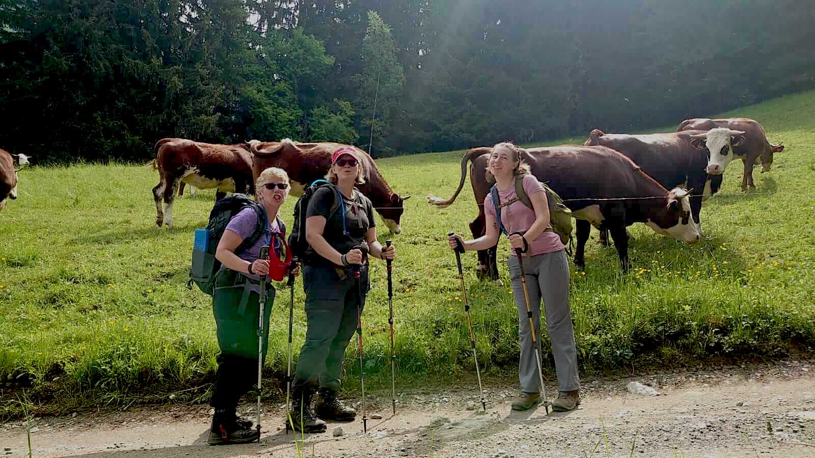
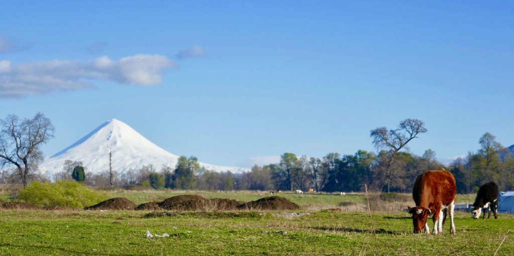
Our dream was to be able to explore this secret area. There is not much to read from this massif. Nevertheless we felt well prepared and started our way from Bariloche through Argentina to the border pass Roballos by car. Home of the Guanacos and Avestruses, high plateaus whipped by the winter, colorful lagoons down into the valley of the Rio Baker. Almost unnaturally, this turquoise-green spray descends to Cochrane. A small town at Lago Cochrane, last bigger inhabited place of the Caretera Austral. Everything what is missing can be bought here in a typical supermarket. Typically you can find everything in the same four walls. From the cheese to the chainsaw, rifle, cleaning rag, pants, whatever you need to survive a longer time in the wilderness of Patagonia.
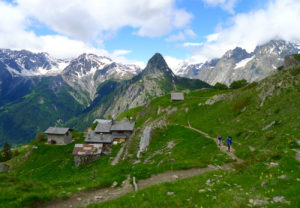
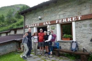
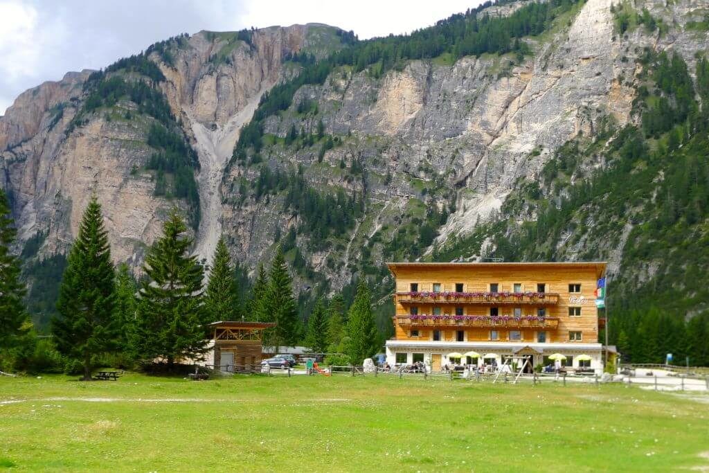
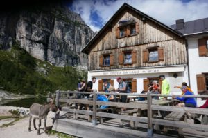
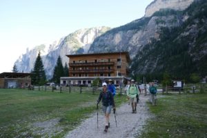
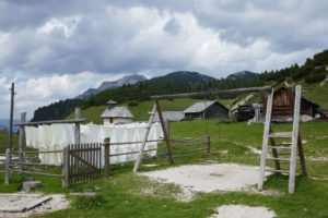
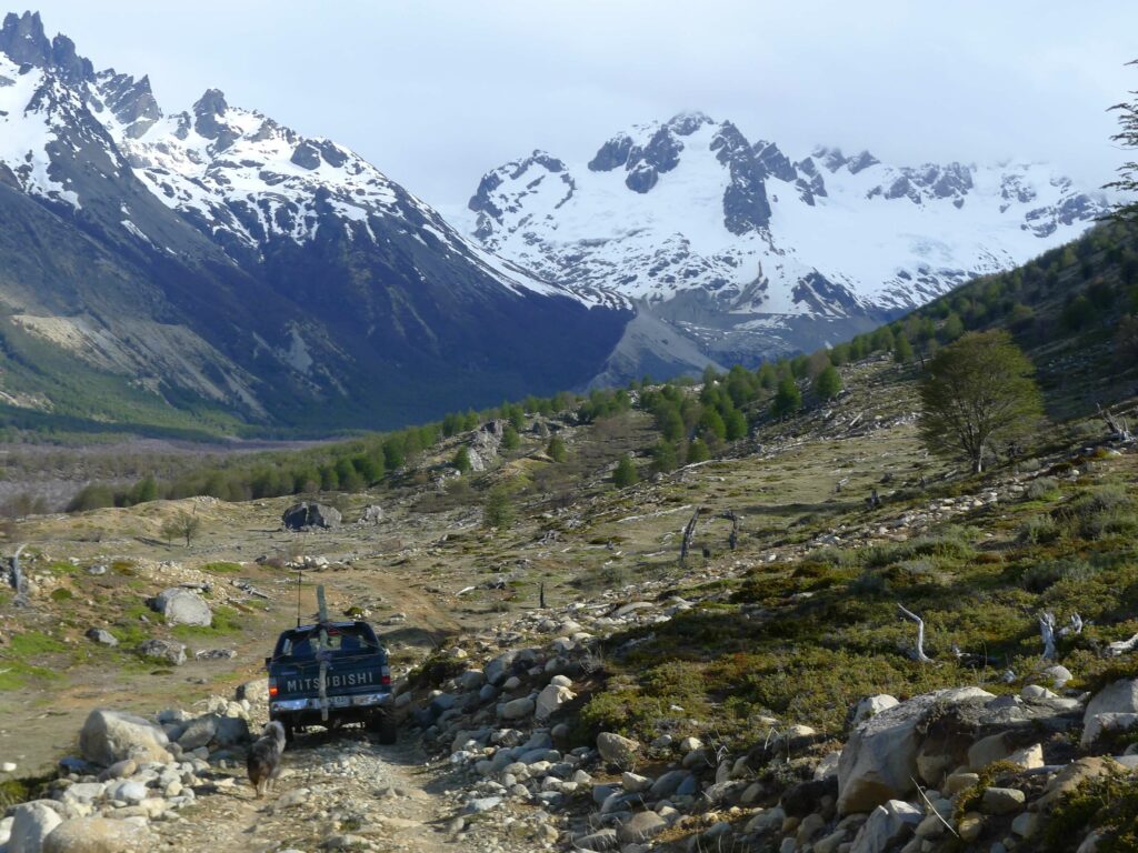
Fundo San Lorenzo

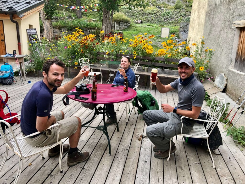
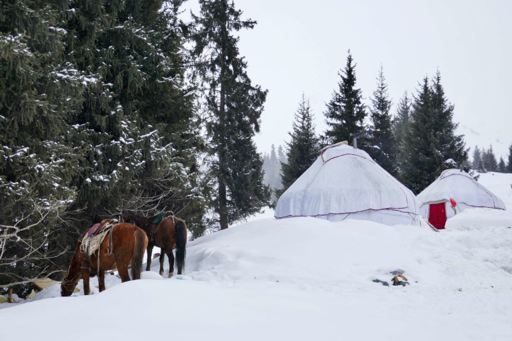
Towards the Fundo San Lorenzo the road is getting smaller and smaller and without 4×4 it is recommended to either continue walking or to contact Luis Soto from Fundo San Lorenzo. He was happy to pick us up and take us to his paradise the Fundo. A summer pasture where he lives with his family in summer and where his cows, horses and sheep graze. He has set up a wonderful campsite here even with hot showers.

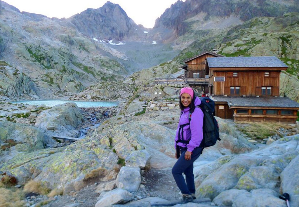
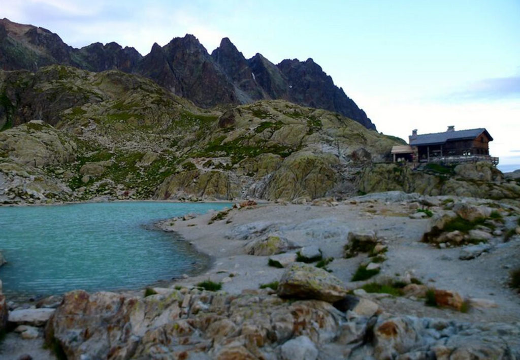
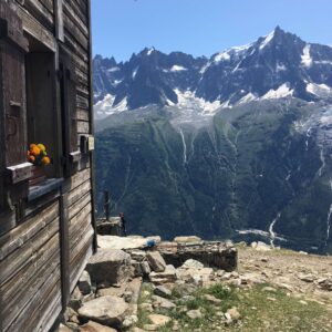
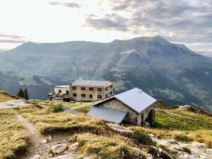
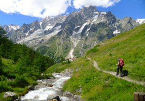
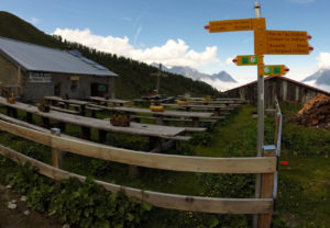
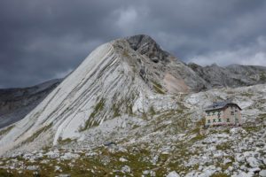
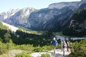
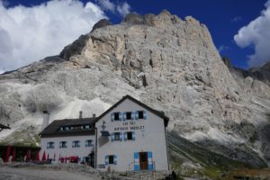
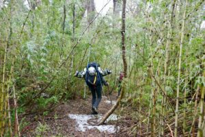
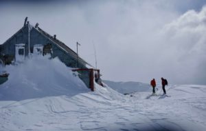
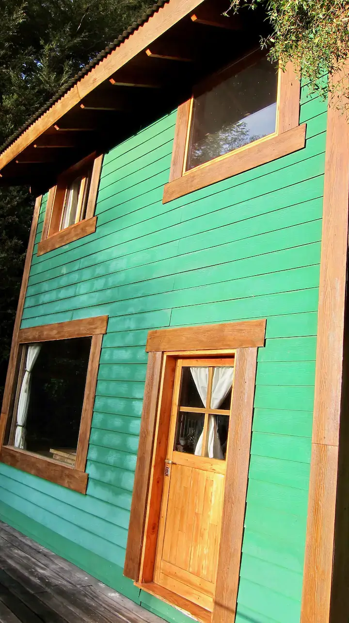
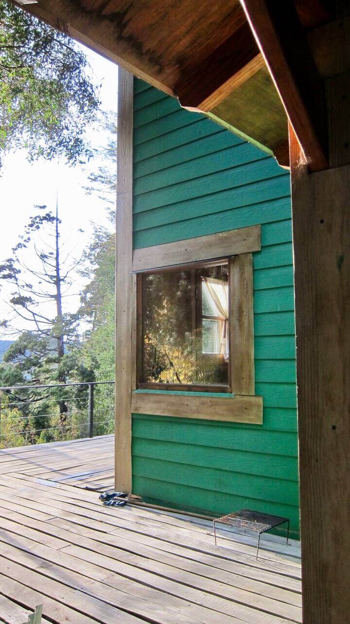
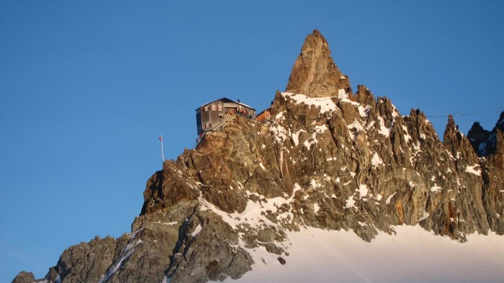
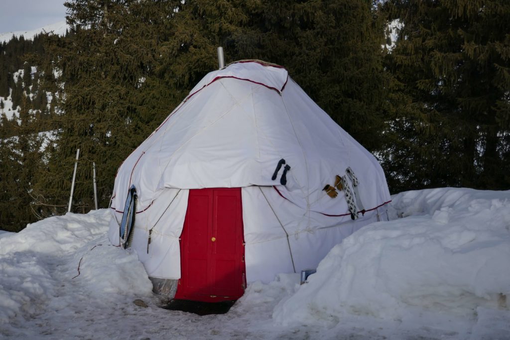
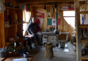
Refugio – home away from home

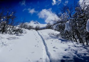
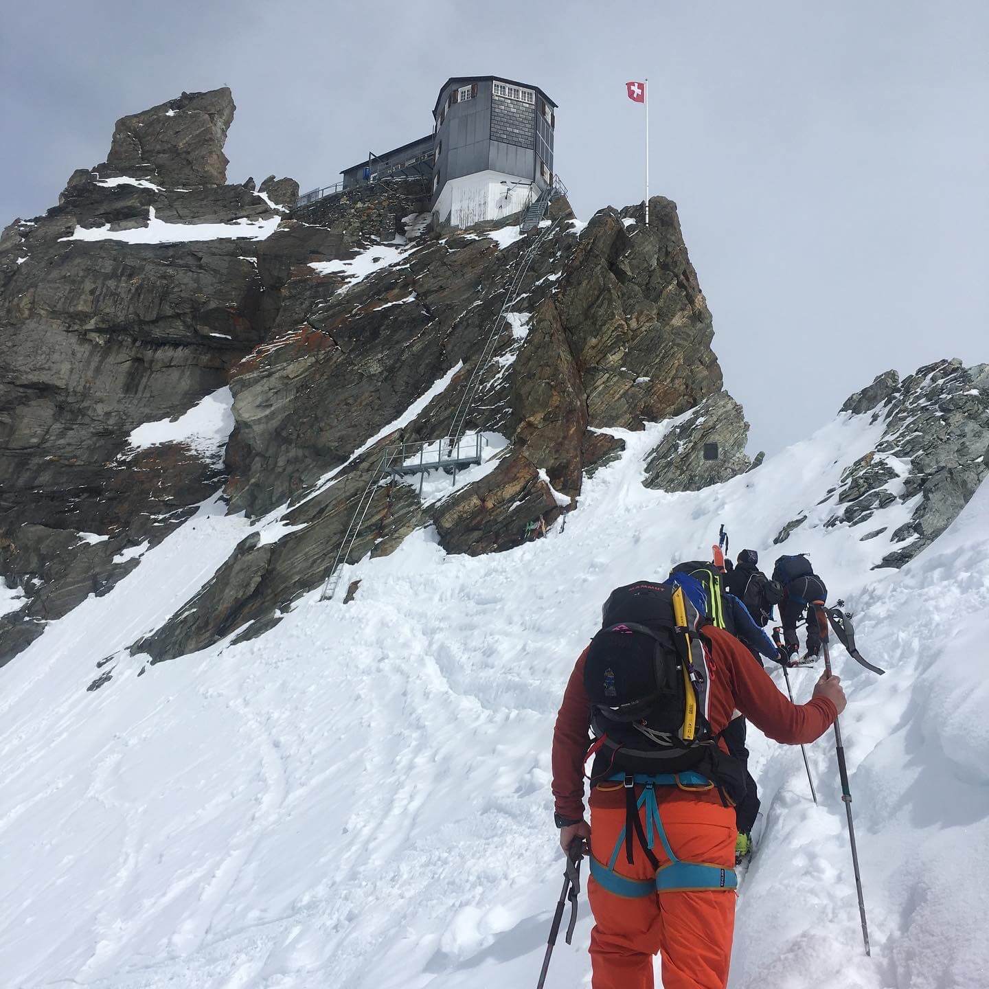
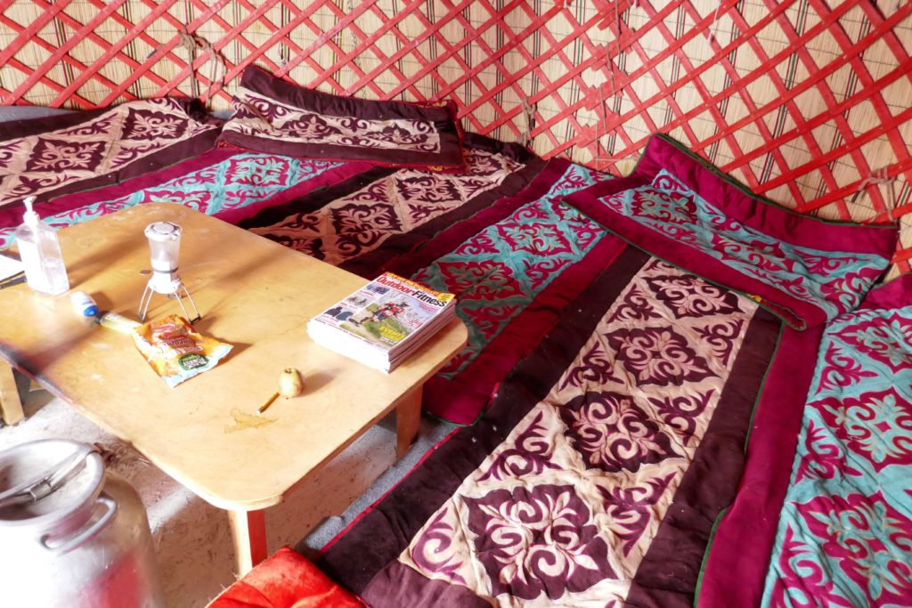
The next morning we walk up to the base camp of San Lorenzo in rainy weather along the almost 300m high Arroyo San Lorenzo. We do the almost 2.5 hour walk twice, as we have to carry our touring skis, tent, sleeping bags and food for about 10 days. The base camp is a beautifully made Refugio with a typical Chilean cypress shingle roof and wooden board walls. There is even an oven in which I bake four times wholemeal bread with raisins during our stay. This Refugio was lovingly created by the Soto family with financial support from Mrs. Rohrer. On a joint ascent of the Cerro San Lorenzo, her husband and Swiss mountain guide died in a tragic accident.

refugio San Lorenzo

The adventure can start

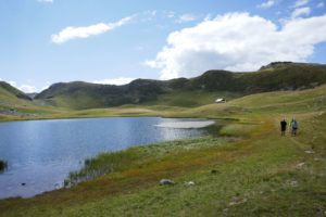
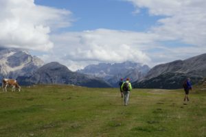
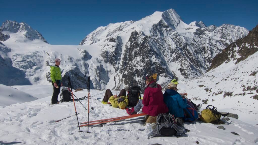
Now we are already here for a week, we want to enjoy this Patagonian expedition. At this time of year (at the beginning of October) you won’t find a soul here. Some birds and a red woodpecker have been seen so far. Yesterday we explored a parallel valley in Argentina. First by dense bushes and partly swampIn the evening we are back in Chile at the Refugio Toni Rohrer and enjoy a lentil stew with lots of chili over a fire.

Depositing material

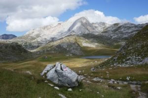
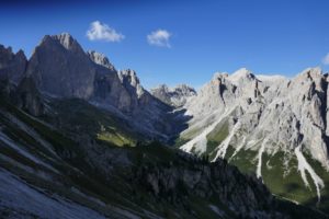
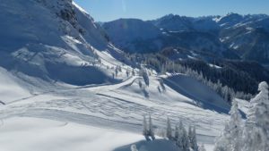
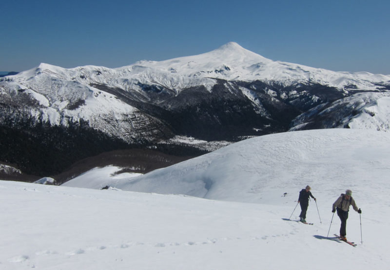
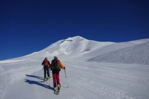
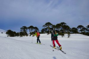
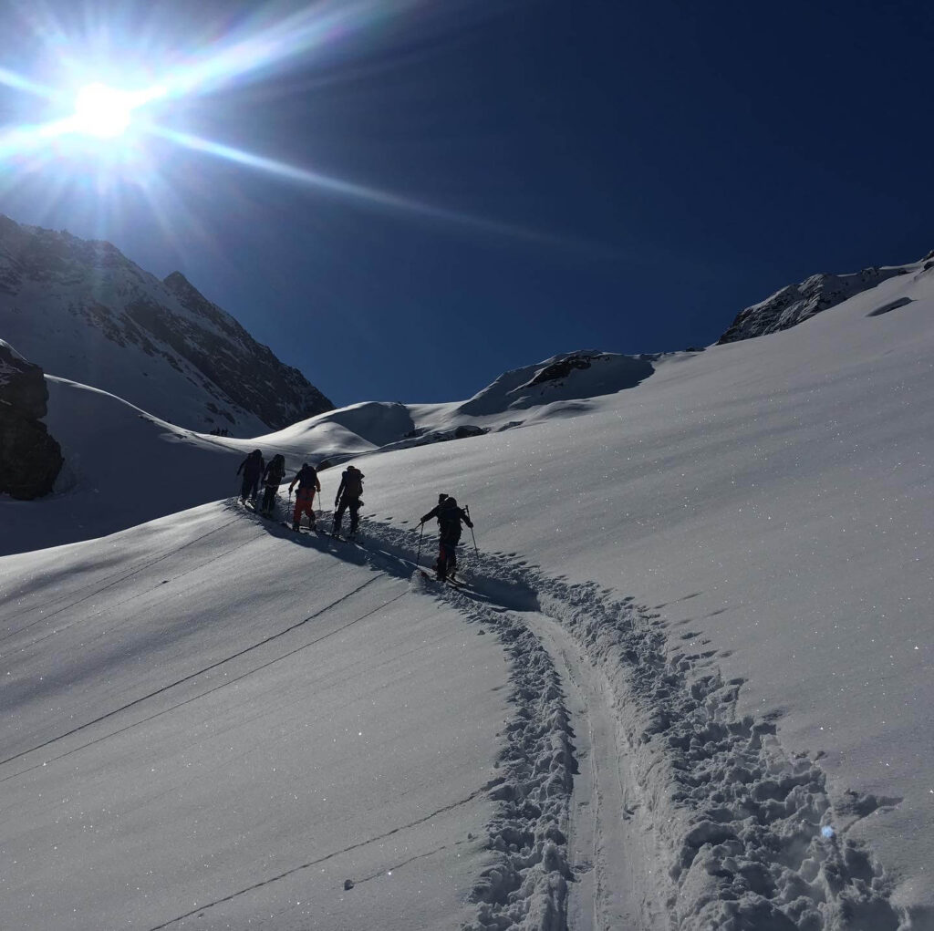
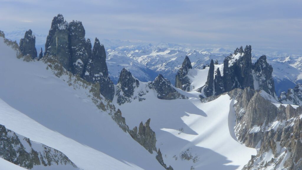
The days before we explored part of  the de Agostini route and deposited some of the items like tent and food. Our goal is to climb the summit on two beautiful days. But since it is about a 3000 meters ascent only a few kilos. These tours were beautiful, unbelievable this landscape. Granite towers, glaciers, valleys as far as the eye can see. Once we wanted to try a summit attack. But the typically strong Patagonian wind made it impossible to get further. Thus we came back to the hut in the evening at 19 o’clock. Today we make a comfortable hut day. Sawing wood, baking bread and getting the material in shape, tomorrow we should start.

An other try

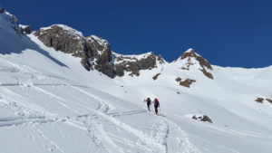
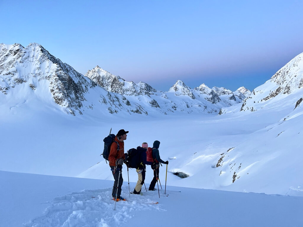
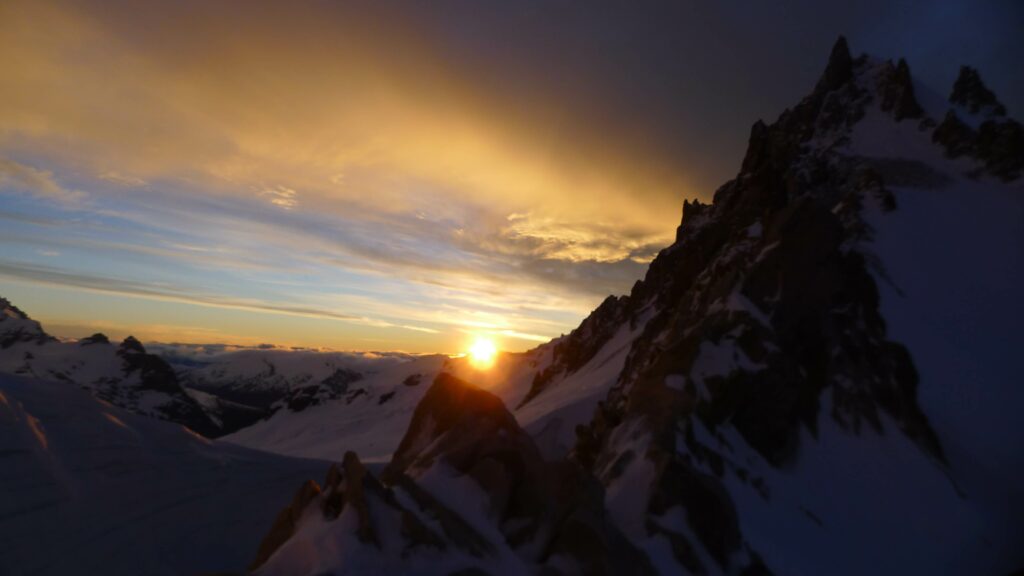
Thinking again about the luggage, have we taken everything we will need with us? The weather looks promising, still some clouds but it looks promising. We put the track to Paso Comedor in already some days ago. So it quickly goes uphill. After four hours we reach the brecha de la Cornisa, our camp for tonight. It storms, we have difficulties setting up the tent and the drops of sweat from the ascent freeze quite fast. In the tent we nest ourselves in warm down sleeping bags, cook ourselves a strengthening dinner and enjoy the enormous sunset.

Night before the adventure

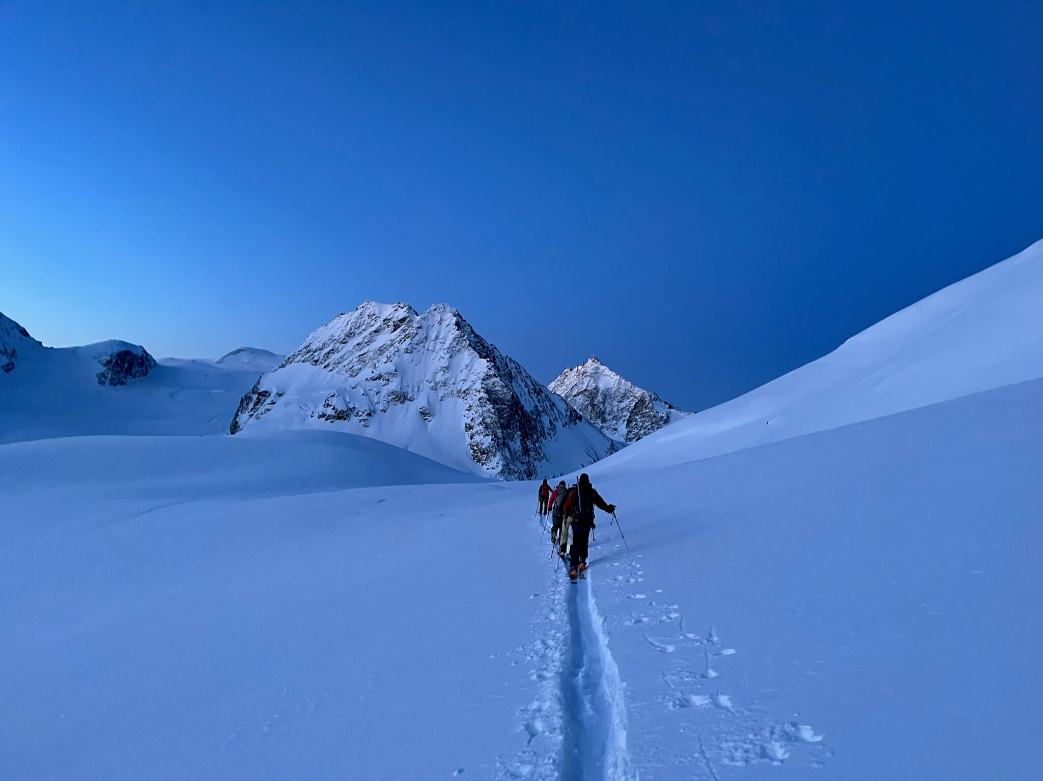
Between the rock towers and on the big glacier we try to sleep for a few hours. The continuous knocking of the tent wall changes after some hours into a silence, as it can probably only exist up here. Alarm at 4.00 am, the calming view from the tent shows only a starry sky. A few Mate teas and a Chilean breakfast, getting into the stiff shoes, putting on a climbing harness, everything is ready and off we go.
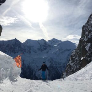
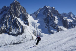
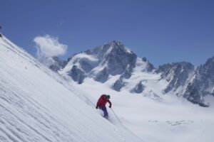
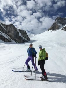
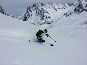
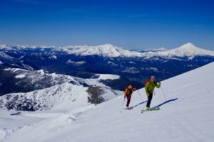
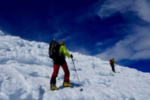
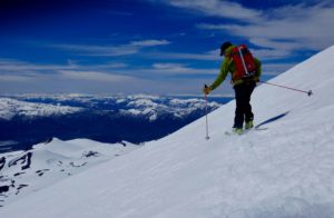
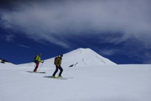
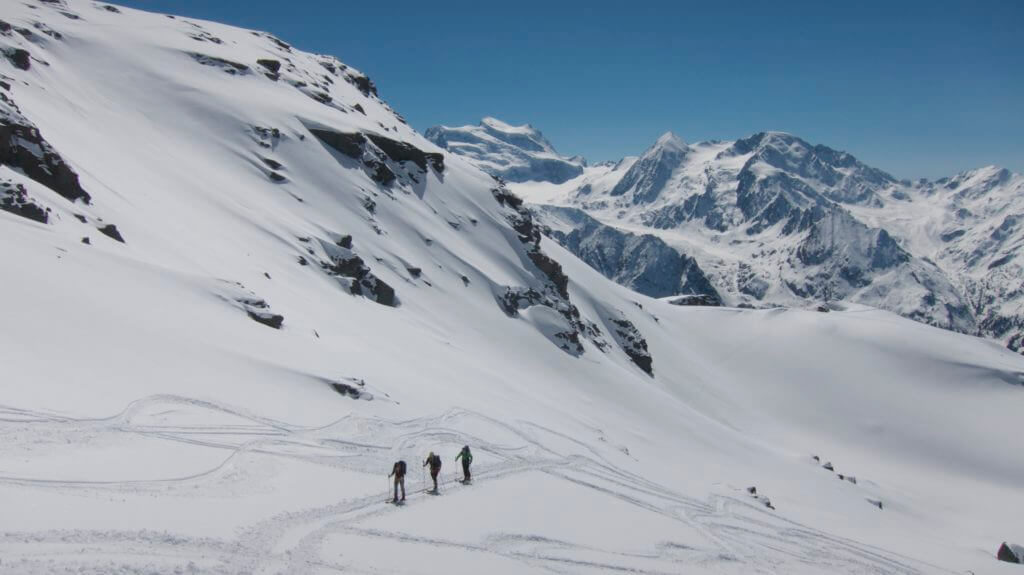
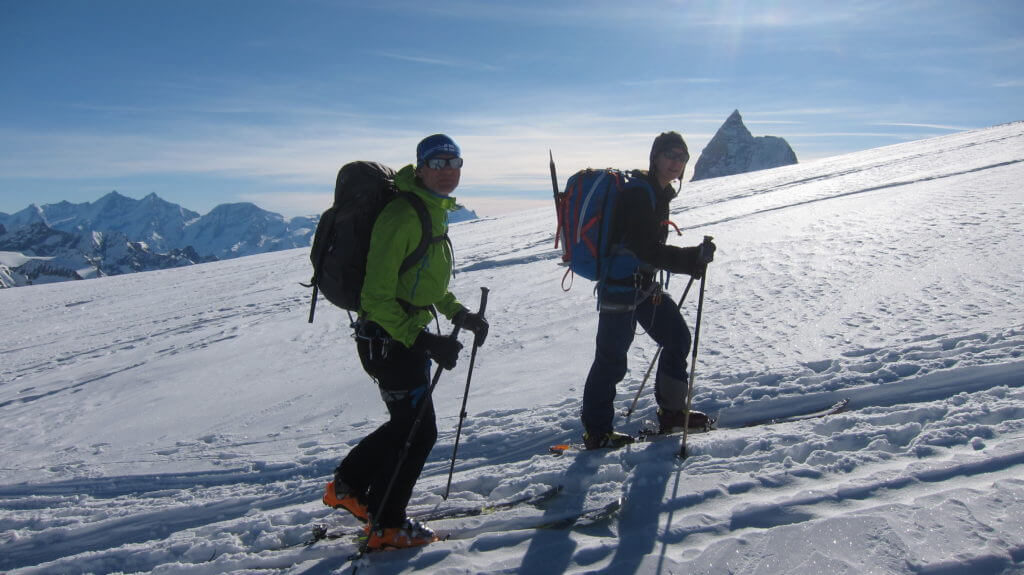
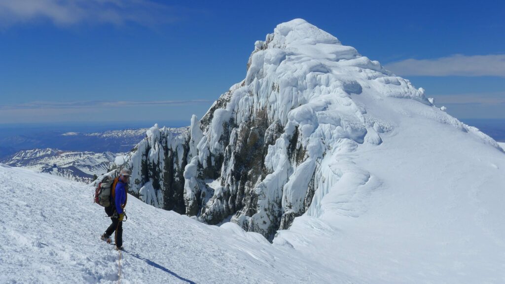
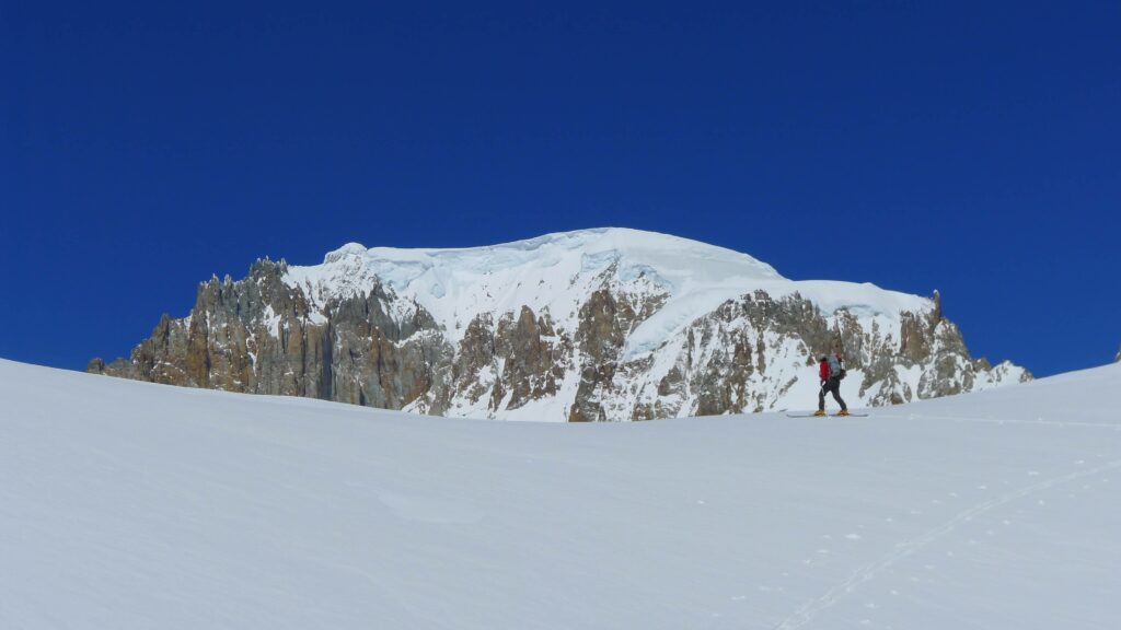
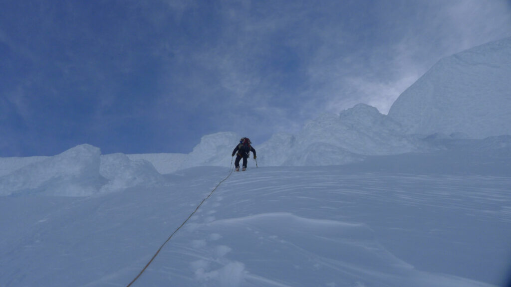
Sunset at the base camp

The climb 

Over a small couloir we climb on the huge Coshuenqo glacier. It’s freezing cold but the fact that we’ll finally  go to San Lorenzo today makes my blood boil. The descent from 100M and the 2Km long traversing of the glacier makes our bodies wake up. Finally we stand under the huge serac area.
Is there a way through the seracs? Will the weather hold?

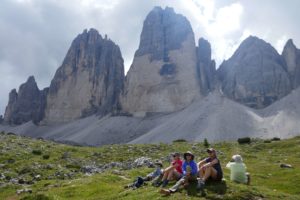
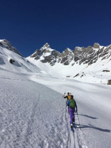
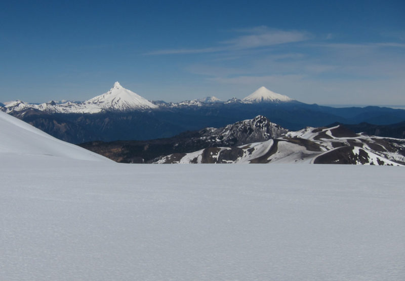
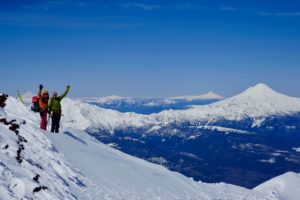
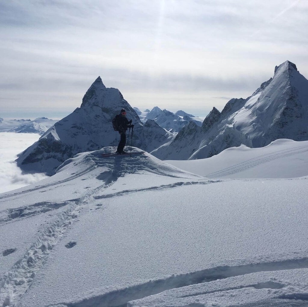
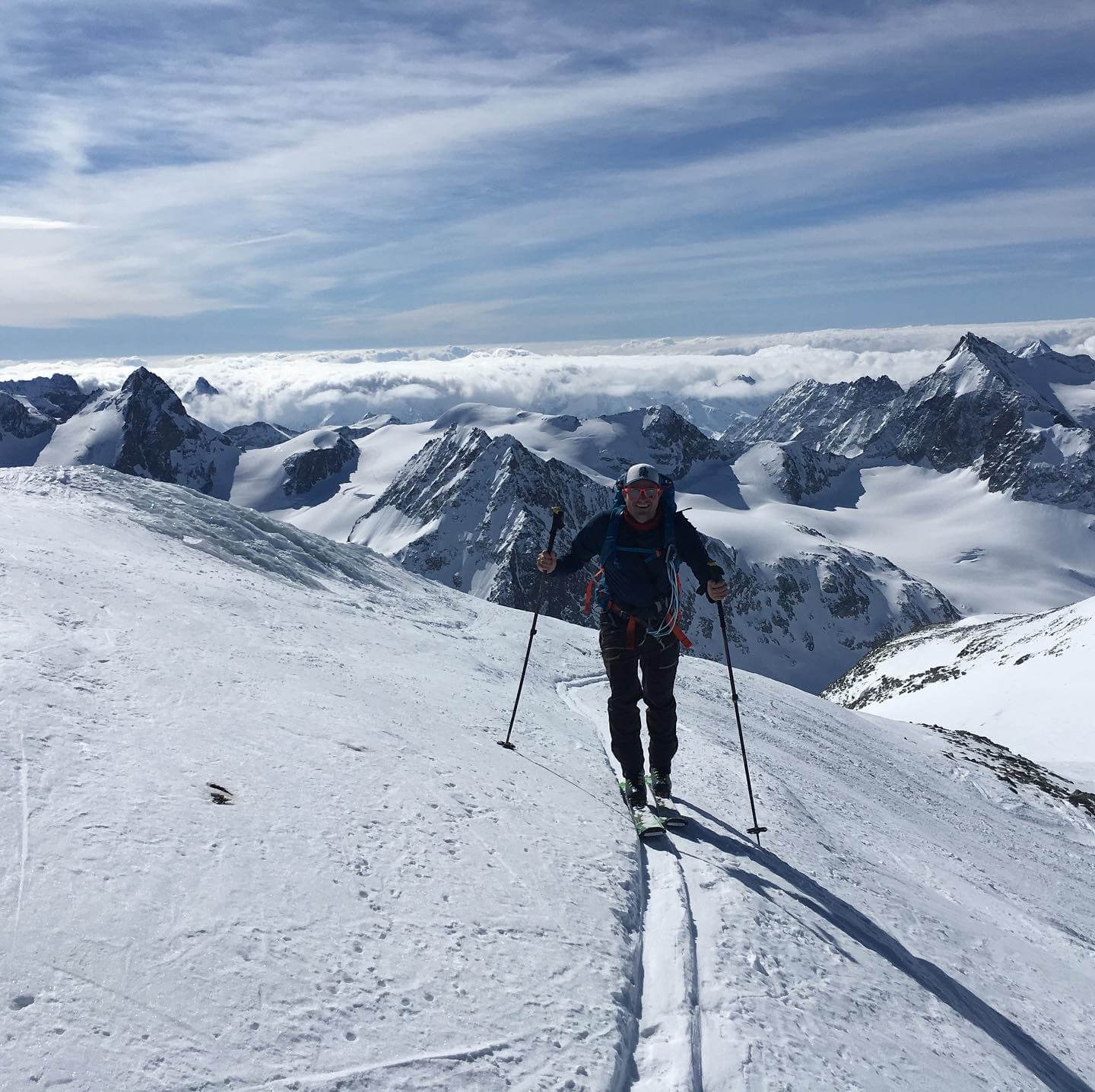
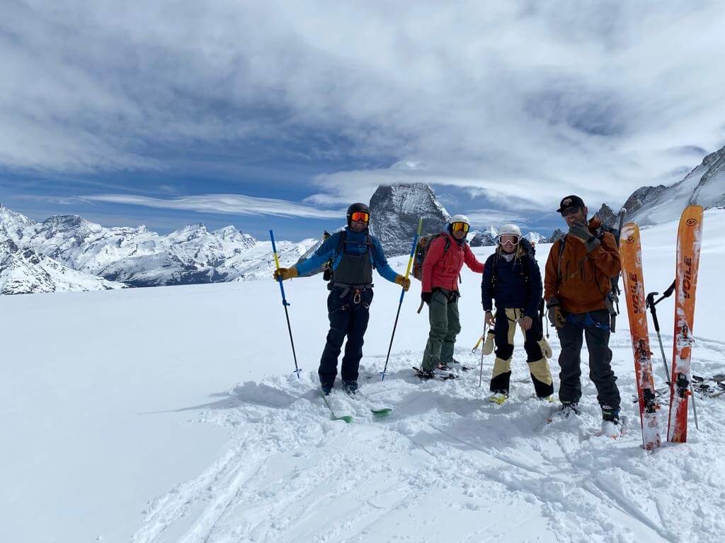
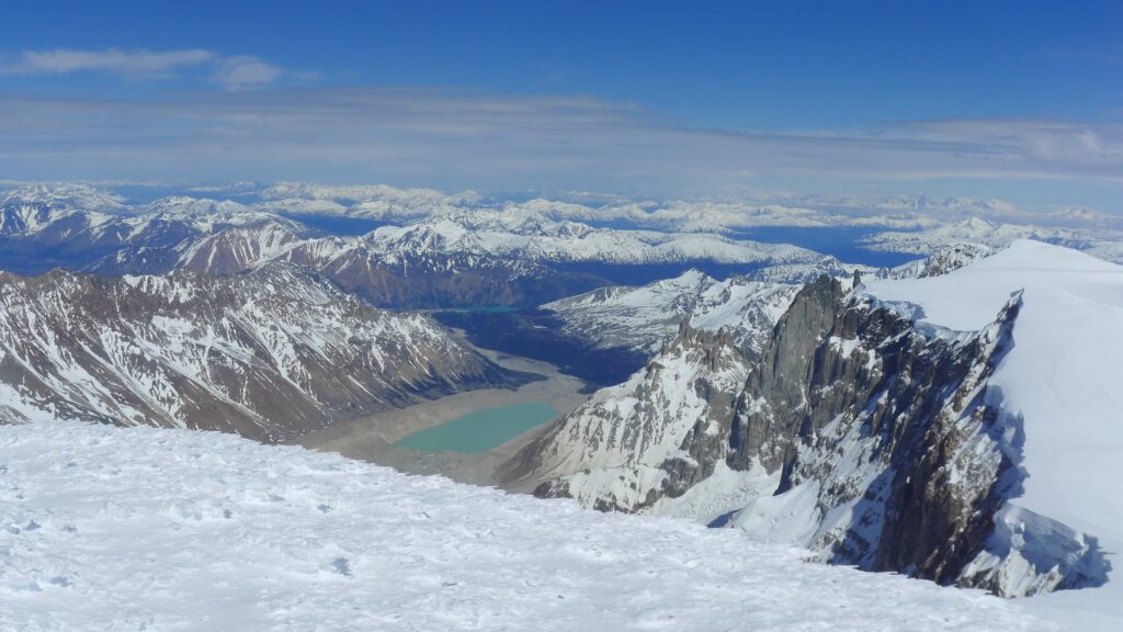
Step by step we work our way up between the crevasses. We master a few climbing passages well and after four hours we stand on top of the long ridge leading to the pre summit.  The view is simply stunning. No house and no road for miles, but countless Chilean and Argentinean peaks and turquoise, green, blue and grey lagoons. Glaciers and rivers as far as the eye can see. It is pleasantly warm today and amazingly no wind blows.
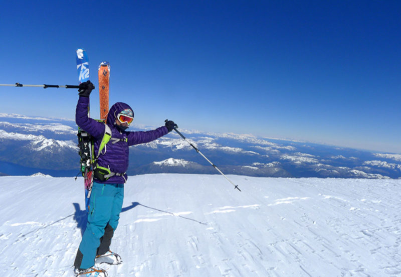
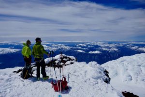
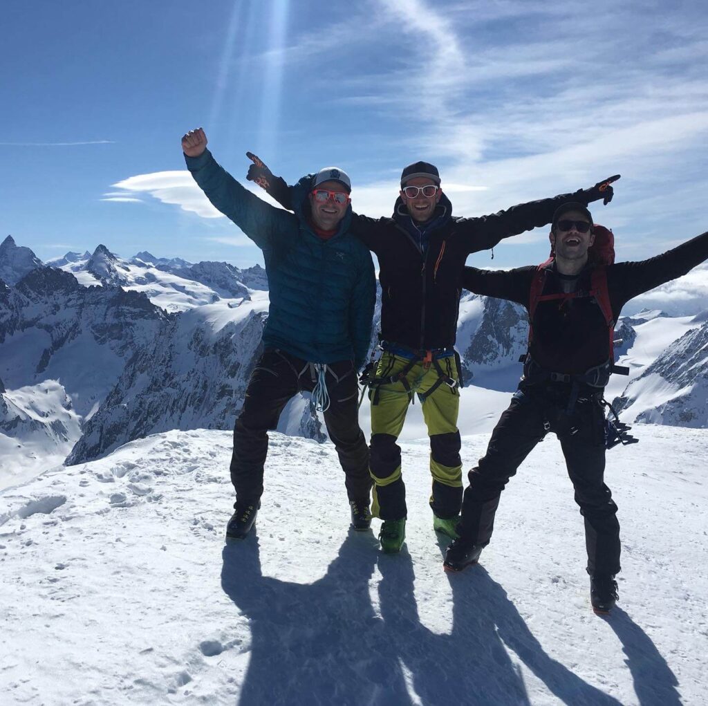
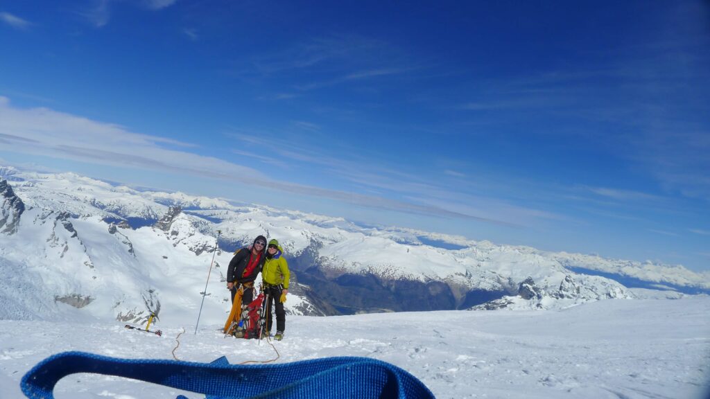
Summit

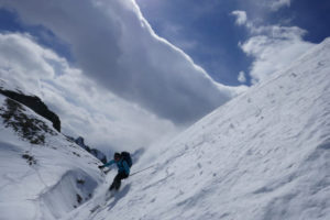
It has 20cm of fresh snow. The real summit shows up only after we have bypassed the pre summit west. The sight of the summit is beautiful! It is covered by the typical mushrooms formed by humidity and the strong winds. Now it is time to descend again and climb the summit with the newly gained strength. Unbelievable, we made it! After 8 hours the destination is reached, we are overjoyed. Unfortunately we can’t stay too long, we want to go back to the tent today.
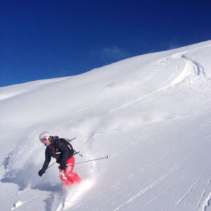
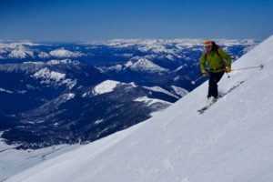
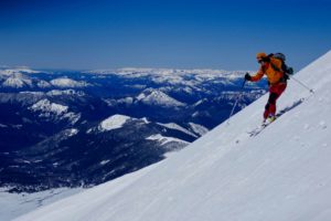
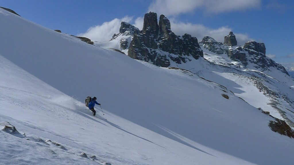
happy skiers in Argentina skitouring cerro San Lorenzo

The descent

The descent and the downhill  without any problems. We’re safely and overjoyed, but also tired, back to our camp. We have saved one last fine pasta dinner, which we enjoy to the full. We even find a trickle and don’t have to melt any water for today. How well it sleeps in our tent today, I would not change it with any 5 star hotel.
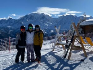
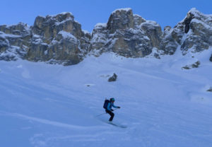
Already the last day of our expedition arrives, a long beautiful ski descent to the hut, packing everything into the backpack and another two hours marching to the Fundo San Lorenzo.
Louis has prepared the most beautiful surprise for us. He heated the oven for the hot shower water. We enjoy the most pleasant shower and body and mind relax slowly but surely. Our dream has come true.

skiing at cerro San Lorenzo

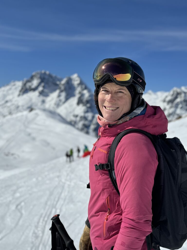
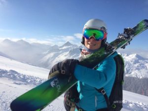
Autor ski touring Patagonia:

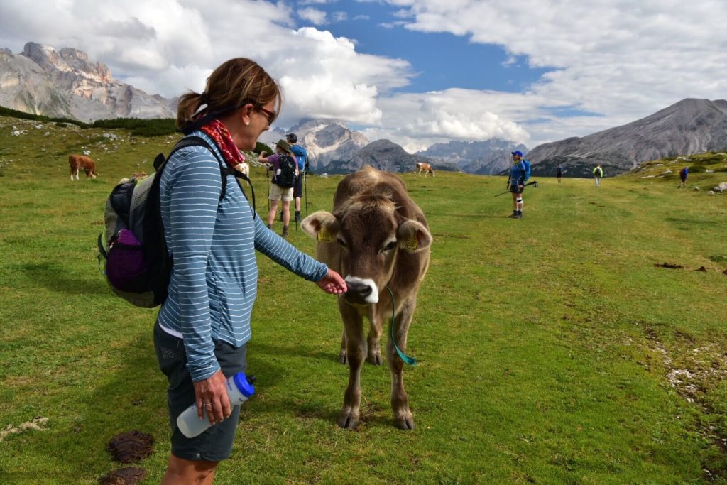
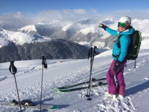
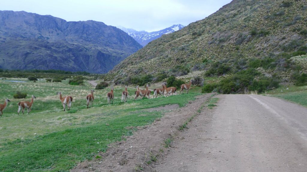
Ella Alpiger, owner of Patagoniatiptop and Patagonia lover. Her favorite animals are the Cuanacos, often to be seen in the Patagonian step land on the way to Cerro San Lorenzo base camp:

Wildlife along the road


Make a booking today with Patagoniatiptop


Pages:

Skitouring the Patagonian Volcanos

Dates: September/October

Ski Chile and Argentina with us!

7-14 days programs available. Tailor made for you.

When the days start to get shorter in the northern hemisphere, spring is slowly waking up in Patagonia. For the ski touring fans this means corn and sometimes powder snow skiing under the south american sun. Some experts speak about the best spring skiing in the world.

All our ski touring goals between Bariloche and Temuco are between 2000 and 3000 meters high and no long acclimatization is necessary.

Our skiing adventure starts in Bariloche Argentina or in Temuco Chile airport and ends in either of both, depending on the itinerary you choose. We can offer a round trip or also a point to point trip. Bariloche is situated in the northern part of Argentina’s Patagonia in the Nahuel Huapi National Park. There are great ski touring options around the so called “Switzerland of south America” in the Patagonian Lake District. The incredible views down to the huge lakes and rainforests are stunning.

After the amazing volcano-skiing in Chiles “small south” where we ski volcanos like Casablanca, Osorno and Villarica we cross the boarder into Argentinas lake basin.

We choose those volcanos and mountains with the best conditions at the moment we are there. (There are about 10 volcanos to choose from).

Relax included

To relax between the tours, we take you to some of the worlds best hot springs in hidden valleys and eat great seafood as well as Argentine beef. Come join us on this exotic skiing adventure!

At a glance:
  • 14 days / 13 nights in Chile & Argentina
  • 8 volcanos
  • 3 hot springs


Day to day itinerary, a program option that we like:

Day 1: Meet at Temuco airport – drive to Malalcahuello
Your mountain guide picks you up at the airport and drives you to the foot of the volcano Lonquimay.

  • Night in Hotel Malalcahuello

Day 2: Skitour volcano Lonquimay 2865m
Our first volcano, Lonquimay is surrounded by very old Araucaria trees and is perfect for a start into the Volcano-tour.

  • + 1365m
  • Night in Hotel in Malalcahuello

Day 3: Skitour volcano Llaima 3125m
Llaima is one of the biggest volcanos in this area and stands in the Conguillio National park. It’s name means “the reawakened” in Mapuche language, the language of the local people.

  • +1325m
  • Night in Hotel Malalcahuello
Relaxing day

Day 4: Travel to Pucon and hot springs „Los Pozones“
We use this day to relax and reload our batteries. The Pozones hot springs is the perfect spot to relax and enjoy nature. Pucon is one of Chiles favorite outdoor destination, a small vibrant town on the foot of Villarica vulcano. We spend the evening and night here.

  • Night in Hotel in Pucon
  • Drive: 160km

Day 5: Skitour volcano Villarica 2847m
A short drive up into the Villarica national park. Today we will climb the 2847m high volcano Villarica.
The long ascend is very much worth it: a view in to the bubbling Magma in the crater and a great downhill run on the slopes up to 35° back down to the car.

  • +1450m
  • Night in Hotel Pucon

Hidden hot springs and more volcanos 

Day 6: Hidden Hot Springs in the woods – Huilo Huilo Natural Reserve
A magical relax day! This natural hot springs  have an idyllic setting between the mountains. There are several pools with varying temperature for personal selection. The setting is very natural and quiet. After soaking our muscles we continue the drive into the Huilo Huilo natural reserve where we can discover the Valdivian rainforest.

  • Night in Hotel in the Huilo Huilo Nature Reserve

Day 7: Skitour volcano Choshuenco 2300m, travel south to Llanquihue lake
The Mocho-Choshuenco volcano lies directly behind our Hotel, we cross the Huilo Huilo river with it’s clear blue water and skin up trough the rain forest to the top of this twin volcano.
After the tour we drive down south into Chiles Lake District and to the beautiful Llanquihue.

  • +1000m
  • Night in Hotel in Puerto Varas

Day 8: Skitour volcano Osorno 2650m – Antillanca hot springs
Maybe the most perfect conical shaped volcano on the tour. We reach it after a short drive around Llanquihue lake, Chiles biggest sweet water lake. From the top we will be able to overlook the whole lake basin and all the way to the Fjords near Puerto Montt. A short drive brings us to Antillanca and it’s hot springs near the Argentine boarder.

  • +1300m
  • Night in Hotel in Antillanca
Volcanos Casablanca and Puyehue

Day 9: Volcano Casablanca 2050m
Casablanca or the whit house is our last volcano in Chile. Easy to reach from the Antillanca ski area.
In the afternoon we drive over the Samore pass and the boarder line into Argentina down to the Nahuel Heap National Park

  • +900m
  • Night in Hotel in  Puyehue

Day 10: Refugio Puyehue, 1450m
We walk up to Refugio Puyehue trough thick Valdivian rainforest.

  • +1000m
  • Night at Refugio Puyehue

Day 11: Volcano Puyehue, 2240m
Skitour up to Volcano Puyehue where we’ll be able to overlook the huge crater. Ski back down.

  • Night in  Hotel in Puyehue

Day 12: Travel day to Bariloche, Argentina
We drive over the boarder into Argentina today and enjoy a relaxing afternoon in Bariloche.

  • Night in Bariloche
Cerro Tronador

Day 13: Skitour Refugio Meiling, 2000m
We hike up to Refugio Meiling from the hamlet of Pampa Linda. It takes a 1.5hr drive from Bariloche trough the Nahuel Huapi National Park and along the pale blue Gutierrez and Mascardi lakes.
We first hike trough a forest and skin up reaching the hut at the foot of the glacier.

  • +1000m 
  • Night at Refugio Meiling, 2000m

Day 14: Skitour Cerro Tronador 3200m, Back to Bariloche
We start early this morning after a breakfast at the hut. We skin up over big, wide glaciers to the Blanco Pass. The last part to the summit gets a bit steeper, but no climbing techniques are required.
Ready for an unforgettable ski run down?

  • +1200m
  • Night and farewell dinner in Bariloche

(Itinerary will be adapted to weather and snow conditions if needed.)


Price per skier in Swiss Francs:
  • With 2 skiers: 5690.- CHF 
  • With 3 skiers: 5184.- CHF
  • With 4 skiers: 4161.- CHF

Included in the price:

  • Organisation, UIAGM – IFMGA mountain guide, private ground transportation, 11 accommodations in hotels in double rooms, 2 nights at mountain huts, breakfasts, dinners, lunches

Not included in the price:

  • Personal insurances (accident, cancelation, travel etc.), thermal bath entries, drinks, flights, personal equipment
  • Please contact us for programs and prices tailored to your wishes!

How to get to to Bariloche, Argentina
  • Take a 2 hours flight from Buenos Aires, the capital of Argentina.
How to get to Temuco, Chile
  • Take a 2 hours flight from Santiago de Chile, the capital of Chile.

Map with all the volcanos and our route
Map of all the volcanos we ski in Patagonia

Wonderful private house in Bariloche

Are you looking for the perfect place to relax a couple of days after your tour? We offer this wonderful, quiet house in the forest. You can book trough Airbnb or directly with us:


Geography and History of Patagonia

Patagonia is the scene of the world’s great adventures. Even if you know little of the place, the name itself inhabits our subconscious, whispering of an unknown finger of the earth, el fin del mundo. You picture large silent spaces and windblown solitude.

The first Europeans to lay eyes on this landscape were led by Ferdinand Magellan, who pioneered passage trough the treacherous strait that now bears his name. His expedition named the mainland “Tierra de los Patagones” unwittingly spawning the myth of a race of Patagonian giants.

The Pampa

To the east of the Patagonian Andes, the pampa is an immense desert, by some accounts among the five largest deserts in the world. West of the Andes is another world. Here both the Central Valley and the Coast Range have sunk into the Pacific; what were once glacial valleys are now fjords, and what were once mountaintops ar now islands. Hotsprings lay revealed by coastal erosion while great glaciers further fragment the landscape, necessitating maritime or air travel. Great forests cloak the Andes from the Pacific shoreline to the continental divide, bisected by surging emerald rivers carrying glacial silt to the sea and providing habitat for fearless trout and salmon.


Patagoniatiptop video


Travel Blog

A ski trip to the Lake District of Chile & Argentina
“Snow-white perfect volcanoes… strung together like a string of pearls.”


volcano llaima with green fields and cows

The firehouses of the Mapuche Indians – The ring of fire

Volcanoes have always fascinated me. If they are also suitable for skiing and produce hot thermal water, they offer a perfect experience. In the Chilean-Argentine Lake District there are about twenty volcanoes that form part of the Pacific Ring of Fire. The snow-white volcanoes, perfectly conical in shape, are a string of pearls. They tower high above the green meadows, primeval forests and crystal-clear rivers.

The lolak Mapuche Indians called them Pillan or “firehouses”. Pillan is the name for a powerful, extraordinary, powerful and sinister appearance. Even today they still try to conjure up the spirits in the volcanoes with the help of ancient rituals.

Mapuche people

The Mapuche are considered to be the worst-humoured, proudest Indians in South America.
In December 1553, at the Battle of Tucapel, they brought a first terrible defeat to the conquistadors who were accustomed to victory. The greedy Spanish governor of Chile, Pedro de Valdivia, is said to have been
in battle. Rumour has it that the Mapuche poured glowing liquid gold into his throat. Also in the following time the Indians successfully prevented a further colonization of Chile. The ongoing resistance of the indigenous people was so successful that in 1641 the Spanish had to recognise the Mapuche nation as an independent territory in a treaty, a unique process in the history of South America. So the persistently bad mood for the Mapuche paid off. Unlike most Indian peoples, they survived colonization.

Temuco

In Temuco, where volcanic forces have created fascinating lunar landscapes over thousands of years, where remote mountain lakes glow and thermal springs gush, where thousand-year-old primeval forests with araucaria and southern beeches have been preserved – this is where our ski tours begin.

Volcano Lonquimay, 2865M

At the foot of the Lonquimay volcano we spend the night in a quiet lodge. The next morning we drive to the ski resort of Corralco, and put the skins on our skis. The Lonquimay with its 2865m is the perfect entry mountain into our ski adventure.
After an ascent of 1362m we stand on its ridge and enjoy the wonderful view of the surrounding volcanoes. We can already have a look at the volcano Llaima, our summit destination tomorrow. In the afternoon we enjoy the warm spring sun in the garden of our lodge. The neighbours invite us for a typical dinner. We can try the yellow Llao Llao mushrooms, which grow on the native Andean beeches, pasta from the nuts of the Araucaria and fresh trout from the river.

Volcano Llaima, 3125M

The next morning we drive into the Conguigilo National Park on a bumpy natural road, freshly strengthened. The snow line is exactly at our starting point and so we can start with the skins from the car. Through the lively araucaria trees we go up to the steeper slopes of the Llaimas. It is one of the highest and most active volcanoes in the area. We deposit the skis 300m below the summit and climb the last meters with crampons. Again and again it steams from holes filled with avalanche stones. A bizarre contrast to the frozen snow through which we find our way to the summit. Also on the summit there is a mixture of ice and warm, steaming avalanche stones in all colours.
A great descent brings us back down to our pick-up. A cold beer which we put in the lagoon tastes very good.

Drive to Pucon

We drive around the Llaima and after a three-hour drive in the south through forests, small villages and green meadows we reach the big Villarica lake. On its southern shore lies the volcano Villarica which proudly watches over the area.
We spend the night in the small town of Pucon, the Chilean outdoor Mecca par excellence. A paradise for hiking, rafting, biking. There is a lot going on in the main street with all the restaurants and cafes. We enjoy a nice dinner with Sopa y Pilla, the typical salty pastry as Appetizer and Carmenére wine from a winery near Santiago de Chile.

Hot springs

If in Pucon then you have to treat yourself to a day in one of the surrounding thermal baths. We drive on the east side of the Villarica to the Geometricas baths. These are beautifully located, hidden in a small valley. Red wooden walkways lead to the numerous pools with water temperatures between freezing cold and 39C. Large, green Nalcabättern, a kind of wild rhubarb decorate the slopes and slowly but surely the tired muscles recover.

Villarica Volcano, 2847M

A layer of fog covers the valley floor around Pucon. All the more we are drawn up into the sky. Also the Bandurria birds (Ibis) with their loud screeching help us to exchange the bed for the ski touring skis. As hoped, we quickly get out of the fog. A huge sea of fog lies below us. Pucon also has a small ski area from which the tour to the volcano can be started.
The Villarica offers a very special spectacle. Already on its steep summit flank a wave of stinking eggs rises from time to time in the nose. We’ll soon find out where these smells come from. A huge crater opens and we can even observe the red, bubbling Lawa in its throat. The descent from 1400m offers some ice above, then hard powder and beautiful spring snow below.

A Legend

A legend explains why volcano Lanin is extinct: The god of the volcanoes Pillan, sign of the evil has become angry, because the boys Huaiquimil Indians Huemules, Andes stags would have hunted. He made the volcano Lawa spit ashes and stones over the landscape. The volcano could only be reassured when Huilefun, the prisoner’s pretty daughter, was sacrificed to it. So they brought the Indians to a sacrificial stone where they were immediately recited by a large condor and thrown into the crater. From this moment on the volcano has calmed down, its fires are extinguished and Huemules may not be hunted any more…

Argentina, Volcano Tronador 3187m

When rain is announced in Chile, it is often worthwhile to change to the Argentinean sides of the Andes. So also this time. Through dry steppe landscape we drive into the so-called Switzerland of Argentina, to Bariloche. The little town is situated at the big Nahuel Huapi Lake and is very popular with tourists and athletes from all over the world thanks to its beautiful landscape.
To really dive into the Gaucho world we test ourselves the next day on horseback on a ride on an estancia. We are invited by the Estancieros to a fine Asado with delicious beef, Empanadas and Malbec wine. An extensive siesta and we are ready for tomorrow’s ascent to Refugio Meiling at Cerro Tronador.

Ascent to Pampa Linda 

In the Pampa Linda, the beautiful Pampa, our ascent begins through an impressive forest with huge Coihues trees. In about 4 hours we arrive at the Refugio. Lorena has already heated up and brewed coffee. She cooks a delicious lentil stew while it blows and snows outside. The strong winds shake the hut all night long. It only remains to hope that tomorrow it will be calmer. We almost overslept, no sound can be heard and the sun slowly rises in the distance. A splendid day without clouds and wind!

To the top

Federico, our local IVBV mountain guide from Patagoniatiptop, will take you up to the pass between the Pico Argentino and the Pico Internacional. The extinct volcano has 3 peaks. Our destination is Argentina, the Pico Chilene in Chile and the International, as the name suggests, right on the border.
From the pass it goes steeply up with a short, easy climbing tour in the second degree at the very end. It’s great to be up here. If our guests had more time, we could add some more volcanoes to the program. We see the volcanoes Osorno, Puntiagudo, Puyehue which erupted in 2011 and Casablanca. All are great ski touring mountains.

After the descent and a short descent we drive through the Nahuel Huapi National Park back to Bariloche. Our guests from Switzerland fly back home in the morning.

Arrival:

The tour can be made as a round trip from/to Bariloche or as an Andes traverse from Temuco, Chile to Bariloche, Argentina or vice versa. The airport of Temuco can be reached with a domestic flight from Santiago de Chile, that of Bariloche with a two-hour flight from Buenos Aires.

Best time to go ski touring:

Early September to mid October are ideal for ski tours on the volcanoes. The days are longer and the climate is comparable to March/April in the northern hemisphere. Down in the valleys it is already pleasantly warm and often the slopes of the volcanoes offer perfect firn conditions. As in the Alps, it can snow in spring. The volcanoes often surprise you with powder snow.

Program suggestions:

Flexibility is the magic word for a good ski tour program in this area. Depending on the weather, it can be very valuable to switch quickly from one side of the Andes to the other. Weather and conditions can vary greatly. We like to keep our programs flexible so that our guests can enjoy the best descents. 

Personal requirements:

Daily ascents from 1200-1800m should be mastered. On some volcanoes you have to climb the top with crampons. Experience is required. Downhill runs in all kinds of snow with up to 40 degrees should not be a problem.

Author:

Ella Alpiger, Swiss hiking guide and snow sports teacher, owner Patagoniatiptop GmbH. For over 10 years I have been travelling back and forth between Patagonia and the Alps and have been able to turn my dream into my profession.


Book Haute Route Chamonix to Zermatt


Patagoniatiptop

Pages:

Ski touring Haute Route Chamonix – Zermatt

Dates:
March – April, please choose your date for privat tours

From the French to the Swiss historical alpine capital

This seven day Ski tour on glaciers for the most part, offers exceptional beauty of the landscapes. It traverses the crest of the Western Alps and passes through some of the most stunning mountain scenery in Europe. We start in Chamonix, at the foot of Mont Blanc and ski across the Wallis glaciers of Switzerland. The tour ends with a unique ski descent on the foot of the Matterhorn down to Zermatt.

  • 7 skitouring days
  • 6 nights in typical mountain huts


Daily itinerary

Day 1: Chamonix – Refuge d’Argentière
Chamonix – Refuge d’Argentière
Elevation gain: 700m
Vertical loss: 700m

Day 2: Refuge de Trient
Ref Argentière  – Refuge Trient
Elevation gain: 1100m
Vertical loss: 300m

Day 3: Refuge Prafleuri
Refuge Trient – Refuge Prafleuri
Elevation gain: 900m
Vertical loss: 2700m

Day 4: Cabane de Dix
Refuge Prafleuri  – Cabane de Dix
Elevation gain: 800m
Vertical loss: 660m

Day 5: Cabane des Vignettes
Cabane de Dix – Pigne d’Arolla – Cabane des Vignettes
Elevation gain: 894m
Vertical loss: 728m

Day 6: Cabane Bertol
Cabane des Vignettes – Cabane Bertol
Elevation gain: 1098m
Vertical loss: 853m

Day 7: Cabane Bertol – Zermatt
Cabane Bertol – Zermatt
Elevation gain: 610m
Vertical loss: 2270m

Options:

This spectacular tour can be done in many different ways. Adding more peaks or changing tour route with other huts. Please contact us for more informations.


Map:

map of the haute route Skitour from chamonix to zermatt


Price:
  • 2 Skiers: 3’596.00€ per Skier
  • 4 Skiers: 2’189.00€ per Skier
  • 6 Skiers: 1’720.00€ per Skier 

Included in the price: Organisation, 7 days IFMGA mountain guiding, Private Transport Champex – Verbier on Day 2,  6 nights at huts with half board, 6 pack lunches, tea for the tour
Not included in the price: Drinks, Lift tickets, personal insurance*, personal equipment

*We strongly recommend the purchase of a cancellation, accident, travel insurance.


Level requirements

This trip is for experienced ski tourers who have already done at least one hut-to-hut tour or a multi-day ski tour. You should be able to skin up to 5 hours with up to 1100m vertical gain per day, at a good steady pace.
Efficiency in your skinning technique and confident moving over a steep and exposed terrain should be no problem. You are expected to be comfortable and safe doing kick turns on slopes of over 35 degrees.
Are you an excellent off piste skier, confident and efficient in skiing in all snow conditions without losing control over your skis?  Skiing on slopes of 40 degrees is not a problem of you?
You should be physically fit, ready to hike and ski for up to 8 hours per day without being too tired the next day. You have to be able to move reasonably fast (climb 400m/h).


Haute Route Mont Blanc Extension 

Why not benefit from your fitness and acclimatization and climb Mont Blanc with skis following your completion of the Haute Route? Take a look at our program!


Pages:

Kyrgyzstan ski touring adventure

Best time for this tour is February, please contact us.
What to expect:

Imagine waking up in a traditional Yurt, in the middle of the snow caped Tien Shan mountains.  You are ready for a day of ski touring with your friends…! Your dream can come true.

We would like to introduce you to a fascinating country. Kyrgyzstan, a country of nomads, in the heart of Central Asia. Largely unexplored mountains offer a wonderful playground.

We take you to yurt camps in snowy summer pastures. That offers us immediate access to endless skiing terrain with mountains up to 3,400-3,600m.

Traditional, cosy yurts will be ready for us swell as a traditional Russian Sauna next to a river with refreshing spring water. All yurts are heated by wood burning stoves.

10-day program / 7 skiing days:
Arrival day:

Arrive early in the morning at the airport in  Bishkek. Meet with the group and join the privat transfer to Karakol  (6hrs). We drive along the north shore of Issyk Kul lake, the second biggest alpine lake in the world. 

  • Night near Karakol in a privat home, dinner cooked by the family
Day 2: Yurt arrival

We skin up to the yurt today, do some avalanche training and get installed for the next 5 days.

Day 3 – 7: 5 complete days of skiing

Yurt based skiing days in Jyrgalan and Aksuuvalley

Day 8: Ski and back down to Karakol

We ski in the morning and go back down to Karakol in the evening.

  • The night is spent in Karakol
Day 9: Travel to Bishkek:

You will have some time to explore Karakol in the morning before we travel to Bishkek. Hot spring visit.

  • Last night and farewell dinner in Bishkek
Day 10: Back home

Flight back home


Prices per skier: 
  •  2495€  (minimum 4 skiers)

Included in the price:
Guiding with IFMGA mountain guide Federico Arletti, organization, all accommodations as mentioned in the program (Hotel, guest house Yurts), all meals, all transportations from/to Bishkek

Not included in the price:
Flights, personal insurances, alcoholic drinks, personal equipment


Check out our video:


Kyrgyzstan… a fascinating country in central Asia:

A welcoming landlocked oasis located at the heart of Central Asia. It’s surrounded by Tajikistan, Uzbekistan, Kazakhstan and China. Kyrgyzstan is a  in a remote, always fascinating, sometimes volatile, and oftentimes misunderstood part of the world. With an average elevation of 3,000m (9,840ft) and 30% of its landmass buried under permanent ice and snow. The country’s landscape and people are defined by a ruggedness utterly unique to the highlands of Central Asia. The republic is a little smaller in area than the UK minus Northern Ireland.


Home sweet yurt

Yurts are the archetypal shepherd shelters. Circular homes made of multilayered felt stretched around a collapsable wooden frame. The outer felt layer is coated in waterproof sheep fat, the inner most lined with woven grass matting to block the wind. Long woolen strips secure the walls and poles. The interior is richly decorated with textiles, wall coverings, quilts, cushions, and ornately worked chests. Floors are lined with thicket felt and covered with bright carpets and sometimes yak skin. Look up: the central wheel-like tuneup that supports the roof is none other than the design depicted in the middle of Kyrgyzstan’s national flag.


Kyrgyz People

Native Kyrgyz make up around 70% of the country’s population. The remaining percentage made up mostly of Uzbeks and Russians. Kyrgyzstan gained its independence from the former Soviet Union in 1991. Many Kyrgyz today follow the nomadic traditions of their ancestors, erecting hand-crafted yurts in the high mountain pastures above their villages. There they graze their animals and live for the summer.

The central Tien Shan mountains

This region offers many superlatives of Central Asia. The highest mountains, the coldest temperatures, the longest glaciers and the strangest natural phenomena. It’s a region of ice, snow and unexplored peaks. The world’s fourth longest glacier and an amazing disappearing lake can be found here. You will be discovering the valleys close to Karakol where the temperatures are more pleasant. The Chinese were the first to explore this foreboding mountain zone, but it was not until the middle of the 19th century that European explorers penetrated the region. The snow that falls on this former Soviet state is particularly light and fluffy. This, combined with the country’s mountainous geography, makes it something of a paradise for powder-loving backcountry skiers.


Food

All food is prepared by local chefs. Our breakfast menu is Western-inspired, featuring omelets, frittatas, burritos, pancakes and french toast, and always the option of muesli or porridge. The dinner menu highlights traditional Kyrgyz cuisine.


Getting to Kyrgyzstan by airplane

Bishkek’s Manas airport is the main hub with relatively inexpensive international connections on Turkish and Pegasus (via Istanbul), Flydubai (via Dubai), Ukrainian International (via Kiev) and Aeroflot (via Moscow).


Visa

Around 60 nationalities can stay for 60 days or longer without a visa. Citizens of most major Western and former Soviet countries are included in those.


Language

Kyrgyz is a Turkish language that has the usual characteristics of that language group. Most notably vowel harmony, which is strictly adhered to. As part of the Kyrgyz-Altay group of Turkic languages, it is most closely related to the Altai language and fairly similar to Kazakh. Russian is also an official language and Uzbek is widely spoken in the south.


Book Haute Route Chamonix to Zermatt

Patagoniatiptop

Pages:
× This is Ella from Patagoniatiptop. How can I help you?