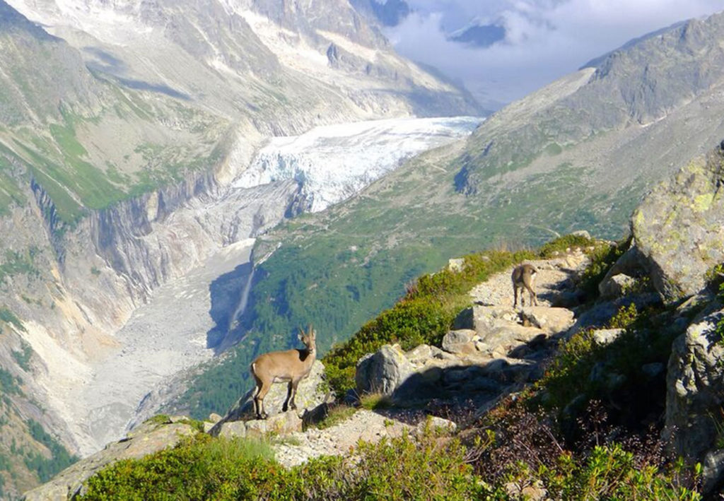
This two short trips are perfect for hikers that like to enjoy stunning views over the Mont Blanc mountain chain, sleep in two mountain huts and spot some ibex and wildflowers along the way. Your local guide makes sure that you will get to the huts just in time to enjoy a delicious mountain dish and that you don’t have to worry about anything but taking the nicest pictures of the famous mountain scenery.
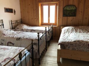
On the first option you will sleep in dormitories, and on the second option you’ll enjoy the comfort of a double room if available.
1. Aiguille Rouge mountain range
Arrival day : Meet in Chamonix
18.00: Information and meeting with the guide in Chamonix.
Day 1: Refuge Bellachat, 2152m
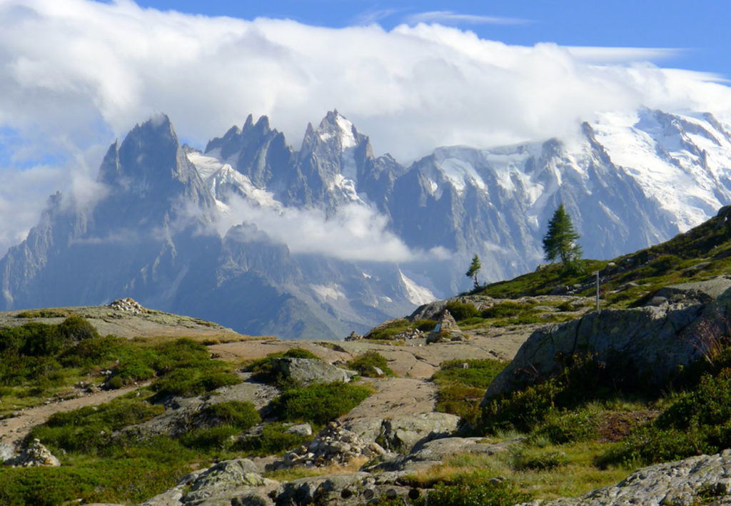
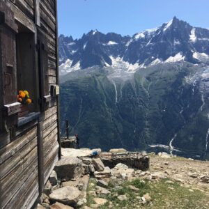
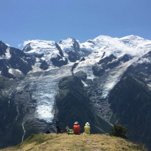
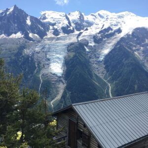
We hike from Chamonix up to the Refuge Bellachat (2152m). The Refuge offers one of the nicest views over the Mont Blanc mountain chain. You might want to enjoy a drink on the terrace that overlooks the whole Mont Blanc valley and wait until the sunset puts the mountains in a pink coat. The family style dinners will soon be served in the cosy mountain hut.
5-6 hrs, 7km, +1100m, (can be less altitude gain with a transfer to a higher start in the morning, overnight at the Refuge Bellachat
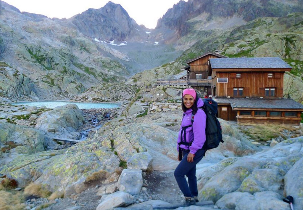
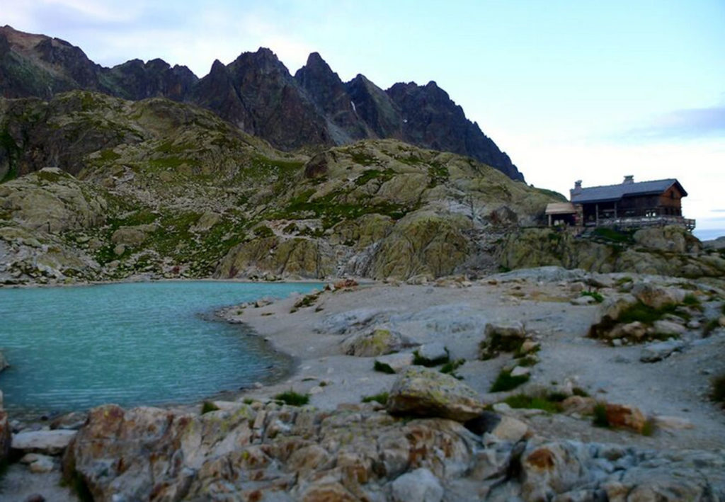
Day 2: Lac Blanc – Refuge Lac Blanc, 2352m
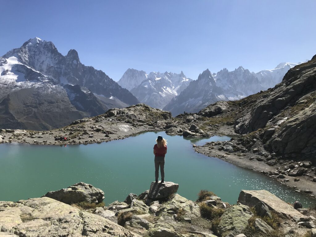
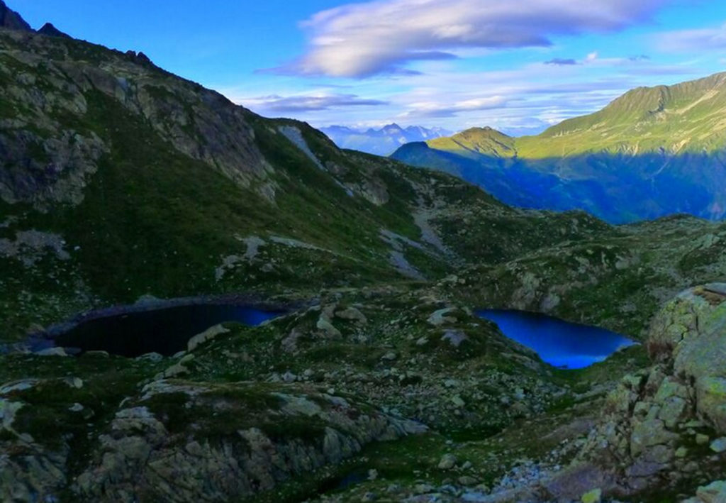
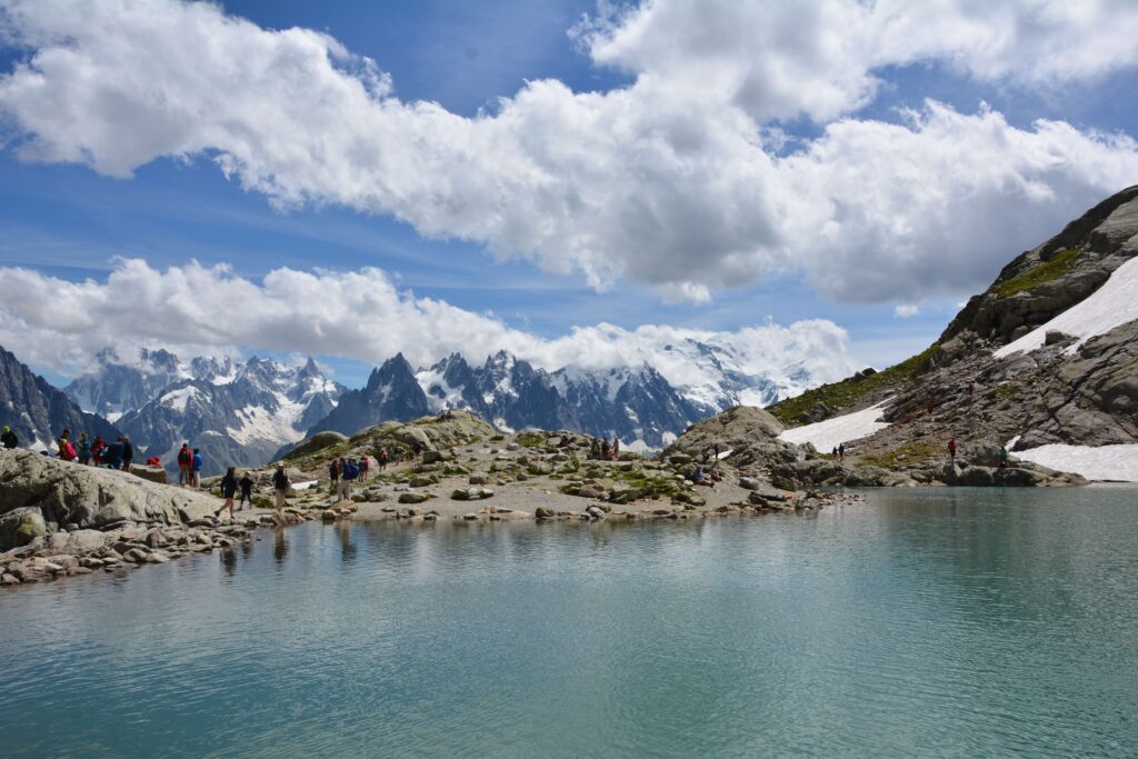
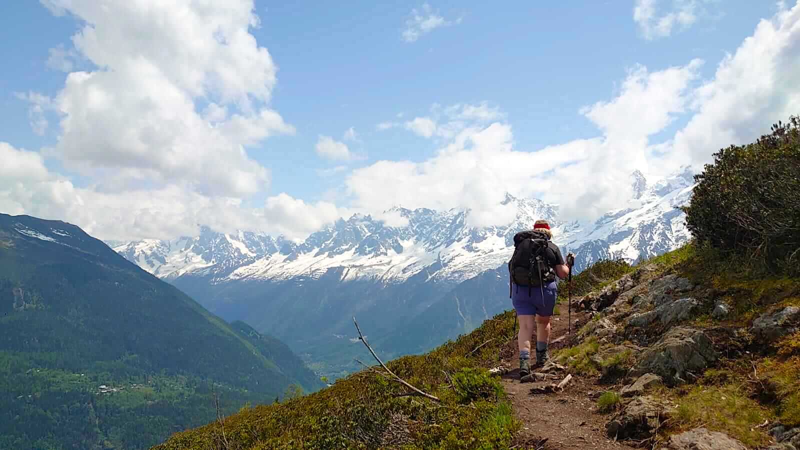
An early breakfast at the mountain hut with the fantastic views towards Mont Blanc. Our trail brings us up to Brevent summit for an even more breathtaking view. We reach Col du Cornu via the Col du Brévent where we walk down to Planpraz. After a picknick lunch we continue along the northern Balcony trail to Flégere. A chair takes us high above tree line. From here, our Refuge for the night is only 1hr away. Lac Blanc mountain lake is the perfect location to take some stunning pictures of a perfect mountain scenery with the Mont Blanc in the back.
We eat a good breakfast overlooking the Aguilles Rouges mountain before leaving this beautiful spot. Our way down to Argentière will take us to the Lac Cheserys and either Argentière or the Col du Montets. Those that want to hike a bit longer can join the guide on the Petit Balcon Sud all the way back to Chamonix. Lunch will be served at local restaurant in a typical mountain restaurant.
3-5 hrs, 10km, – 100m
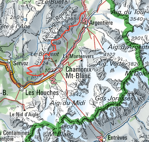
Map with the Chamonix hiking route in red:
Costs per Hiker
1254.00€ with 2 hikers
795.00€ with 4 hikers
642.00€ with 6 hikers
Included in the price: Organisation, privat UIMLA-mountainleader for 3 days, 2 nights in dorms at mountain refuges with half board, 2 pack lunches, one lunch at Restaurant, hiking map copy Not included: personal insurance, drinks
2. Miage Mountain range
Day 1: Refuge de Miage, 1559m
Meet your guide at 9.00 in the morning in Chamonix and take the local bus to Les Houches. Prarion cable car brings you to a starting location with an exceptional view, right across the Mont-Blanc mountain range. You will walk down to Col de Voza (1653m), cross an impressive suspension bridge over a glacial stream and hike up to your next pass, Col de Tricot (2120m). You will eat picknick along the way and have time to enjoy the wild flowers and views over glaciers and peaks.
A steep trail down brings you to your beautiful final location of the day, the Refuge de Miage.
Day 2: Refuge de Miage – Refuge Tré – la Tête (1970m)
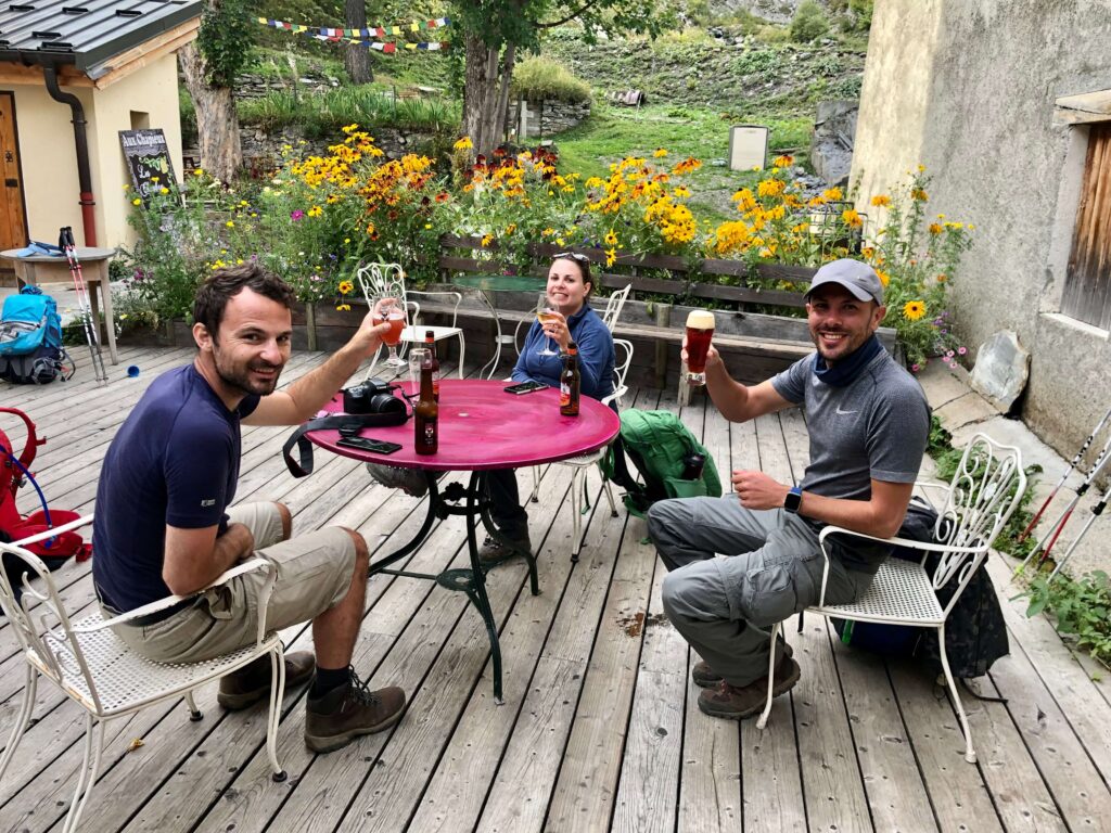
You will walk up to Chalet du Truc (1800m), a lookout where local farmers produce their cheese and sausages and start walking down trough a lush forest to the Valley of Les Contamines. Now your way starts climbing up little by little to finally arrive at the Tré – la – Tête Refuge at the foot of the Domes du Miage on the West side of Mont Blanc. You might want to enjoy the homemade Blueberry pie on the sunny terrace overlooking the mountains and valleys.
You stroll down to the Gorge Bon-Nant and can decide if you want to take a longer hike to Jovet Lake or just a loop in the Gorge and back down to Les Conatmines.
Take the local bus back down to St.Gervais les Bains and continue back to Chamonix by train.
You will be back in Chamonix around 5-6pm.
(14km, -1400m, + 800m included Lac Jovet, can be much less up and down)
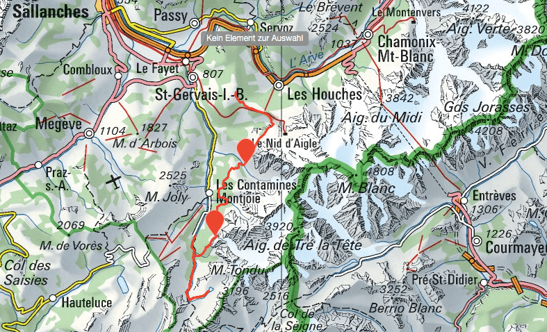
Map with the Chamonix hiking route and the huts in red:
Costs per Person
2 hikers: 1290.- € / hiker
4 hikers: 828.- € / hiker
8 hikers: 597.- € / hiker
Included in the price: Organisation, privat UIMLA mountain leader guide for 3 days, guides expenses, 2 huts in privat rooms with half board, 3 picknick lunches, Prarion cable car, Bus Chamonix – Les Houches, Bus Les Contamines – St.Gervais les Bains, Train St.Gervais les Bains – Chamonix, hiking map copy
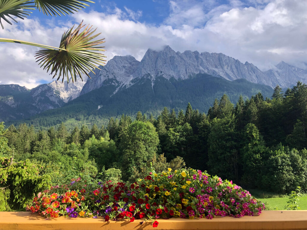
Our Tirol and Bavaria hiking trail crosses from Germany to Austria through two beautiful mountain ranges, the Bavarian Alps and the Tyrol. It links the mountain trails of the Wetterstein and Karwendel Mountain Ranges passing through alpine valleys.
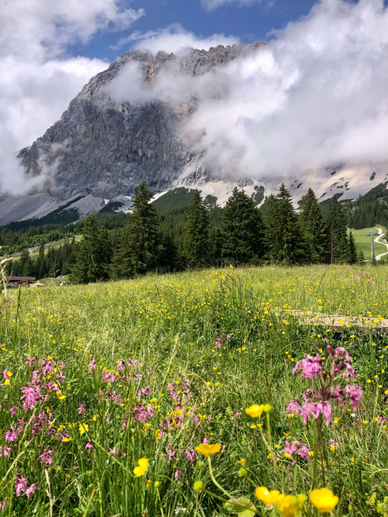
Enjoy the refined culture, stemming from over 2000 years of heritage, of today’s Garmisch- Partenkirchen. Directly behind town sits the massive Zugspitze mountain, the highest peak in Germany. As part of the Wettersteingebirge (Wetterstein mountain range), the Zugspitze is the highest of the peaks that define the border between Germany and Austria. As we hike, we will make a traverse from Garmisch Partenkirchen in Germany all the way to Innsbruck in Austria. We pass two stunning mountain ranges and alpine parks.
As part of the Northern Limestone Alps, the Wetterstein and adjacent ranges are known for rugged mountains, deep blue lakes, and picture-perfect scenes.
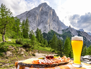
Breathe in the alpine atmosphere during our hikes and sample some of the best local food.
You’ll find yourself mesmerized with spire-shaped limestone peaks like the Sonnenspitze, and the southern wall of the Wetterstein Mountains will leave you awestruck as you parallel the German/ Austrian border.
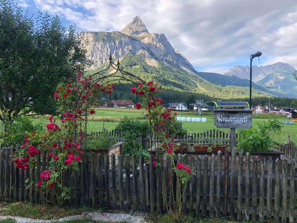
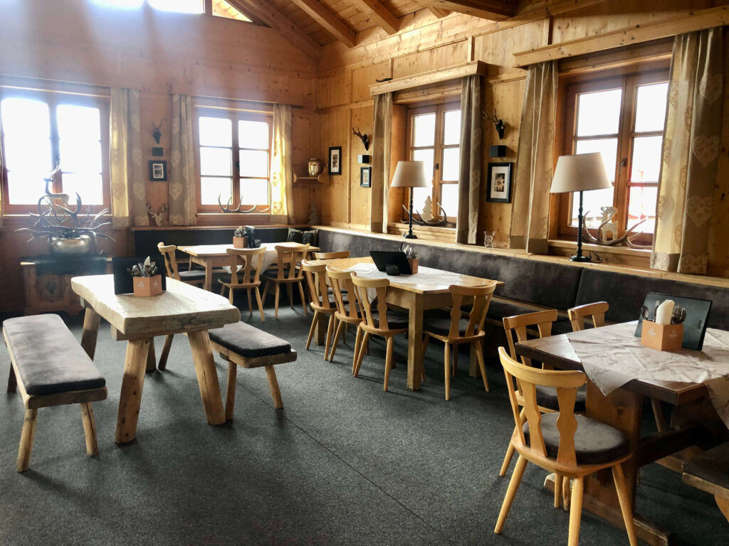
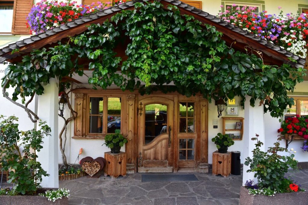
There is a very nice collection of mountain huts (for lunch) and hotels (for sleeping) on this trip. Two nights are spent high up in the mountains in beautiful, rustic mountain guesthouses . The villages of Ehrwald and Mittenwald boast some of the prettiest mountain chalets in the area.
Decorative artwork adorns some of the chalets, and a delightful mix of wood and stone architecture, with hanging flower boxes on every window, makes the whole place feel like a fairy tale.
TRIP ITINERARYTIROL AND BAVARIA HIKING
7 Hiking days, 8 nights
Day 1, Arrival in Garmisch-Partenkirchen
We meet in Garmisch – Partenkirchen at the train station at 5 pm and check in at the Hotel in the old part of the town.
Night and dinner at Hotel in Garmisch-Partenkirchen
Day 2: Wankberg hiking and top of Zugspitze
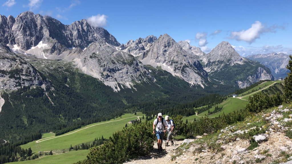
Mount Wank offers one of the greatest panoramic views in the Garmisch-Partenkirchen region. In spite of its popularity, however, you will be able to enjoy peace and quiet throughout the tour.
After our hike we take a train and cable car up to the highest mountain of Germany, the Zugspitze. It offers some of the best views of the Alps.
The 90-year-old cogwheel traintakes us from Garmisch-Partenkirchen via Grainau to Lake Eibsee and through the 4.5-kilometre Zugspitz tunnel to the Zugspitze plateau at 2,600 m. We continue up to the summit with a cable car to enjoy the views. From top of Bavaria (Germany) we step over the boarder into Tirol (Austria) and take the cable car down into Ehrwald, Austria.
Hike: 11km, +550m, – 710m
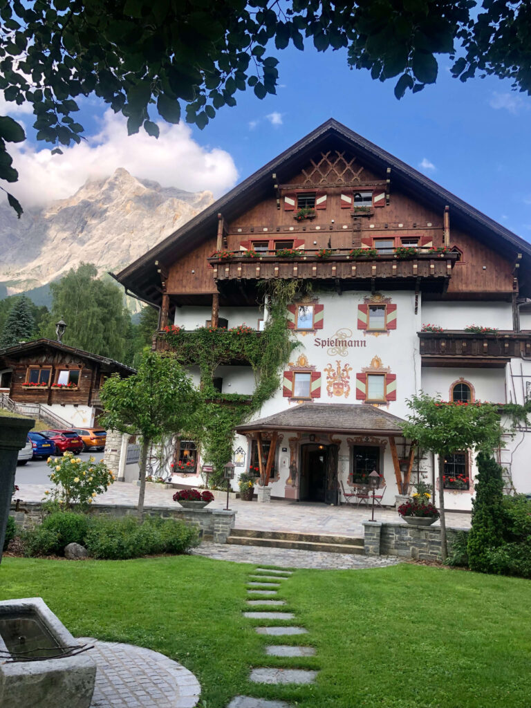
Night at Spa Hotel in Ehrwald
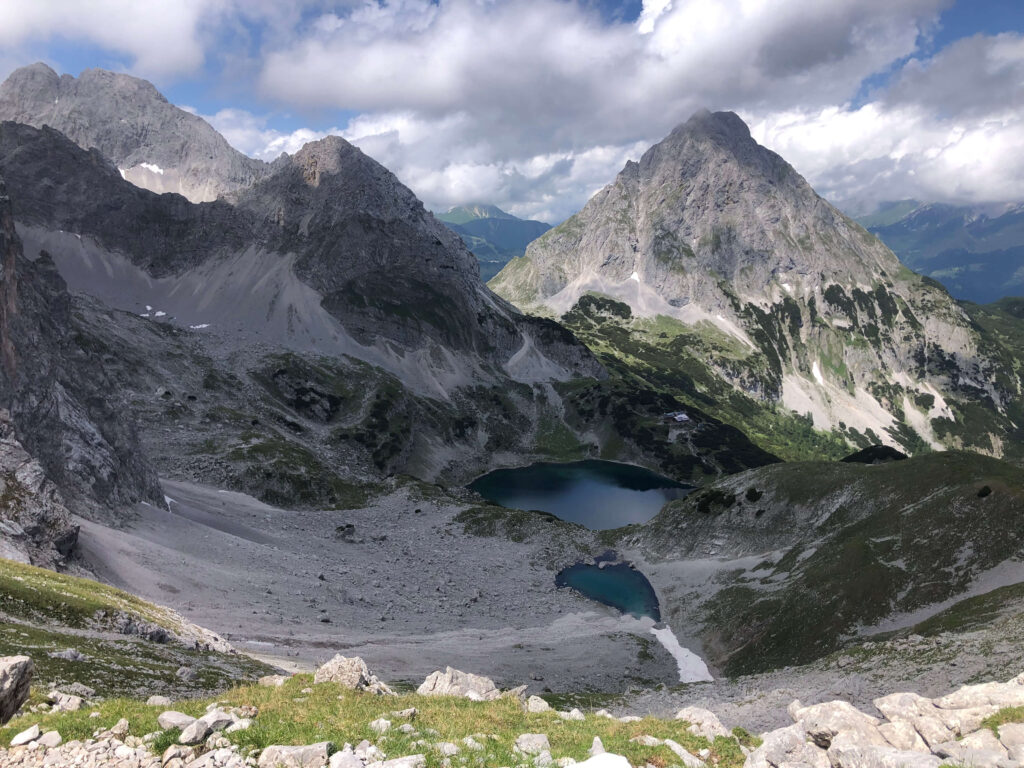
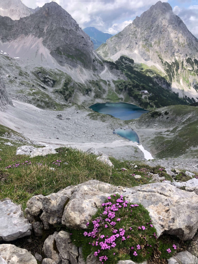
Day 3: Coburger Hütte and mountain lakes hiking loop
Today features a dramatic trek into the Mieminger Kette, the mountain range high above the Inn
River Valley. Hiking start is at Ehrwalder Alm above town, before ascending the Ganghofersteig
trail around Taja Peak. We enjoy a delicious picnic at the mountain lakes and will stop for a coffee and Apfelstrudel at the Coburger Hut on the shores of the Drachensee before returning to Ehrwald. This mountain range features the spire-like limestone peaks such as the iconic Sonnenspitze.
Hike: 14.9km, +/-750m
Night and dinner at Spa Hotel in Ehrwald
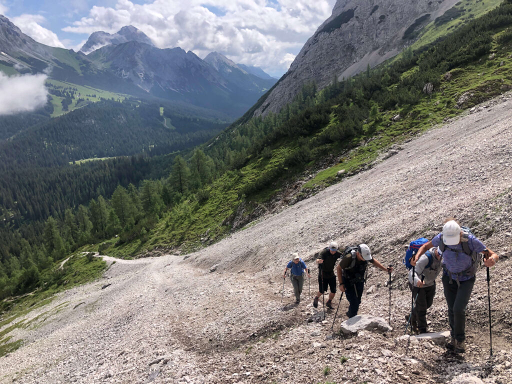
Day 4: High above Gais valley
Leaving Ehrwald with the Ehrwald Alm gondola and our belongings for 2 adventurous days in the mountains. We ascend to a high traversing trail along the southern side of the Wetterstein range, with amazing views over the Leutasch Valley far below. This trail winds along the rocky southern wall of the Wetterstein Range, paralleling the German/Austrian border along the ridge. After a delightful lunch at the Steinernes Hut, we follow the Südsteig trail along the steep Wetterstein range. Our wonderful Alm for the night is reached after a steady descent down to our Alm for the night.
Day 5: Leutasch trough the Geisterklamm gorge to Mittenwald
We explore the marvels of Leutasch Gorge today. A morning walk along the valley floor brings us to the entrance of the Gorge.
Nestled between the majestic Wettersteingebirge and the Mieminger Kette in Tyrol, Austria, lies a hidden gem of natural beauty – the Leutasch Gorge. Carved over
centuries by the Leutascher Ache river, this breathtaking gorge offers a captivating blend of rugged landscapes, cascading waterfalls, and awe-inspiring rock formations. At the other end of the gorge we’re back in Germany and beautiful Mittenwald for the next 2 days.
Hike: 14.9km, – 400m
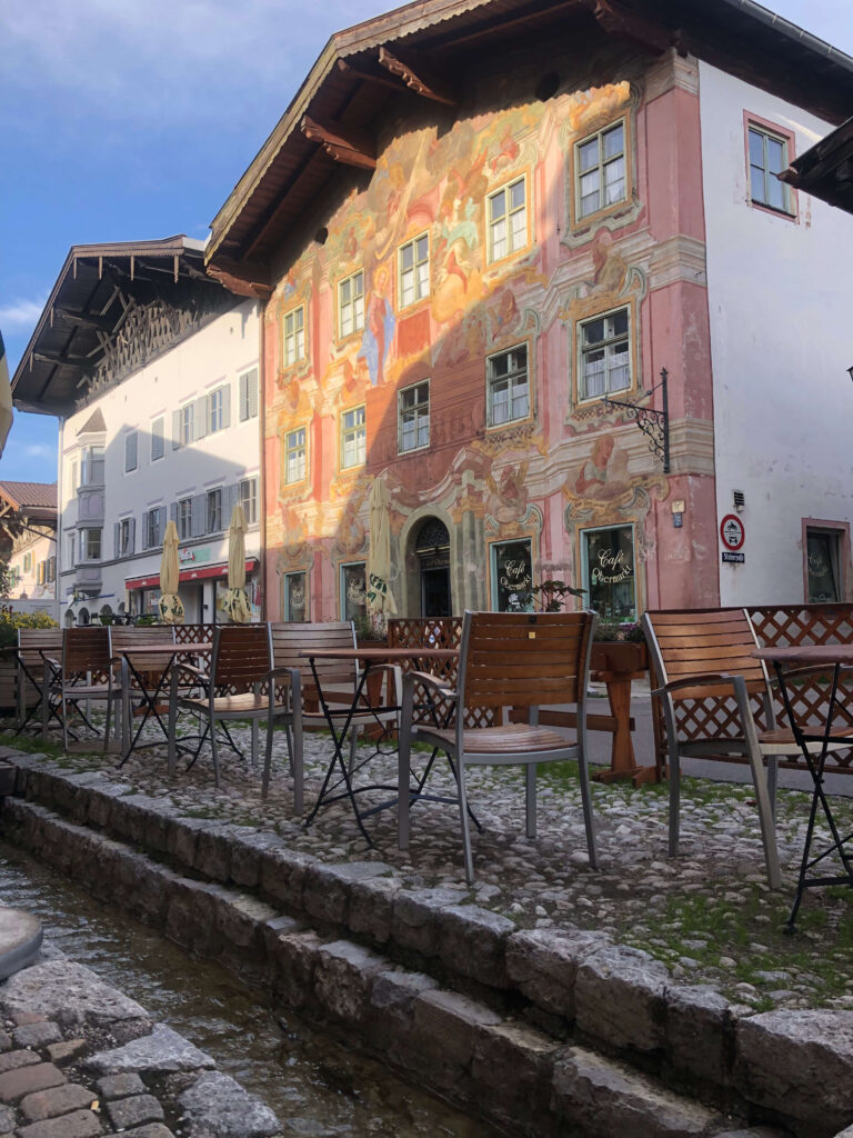
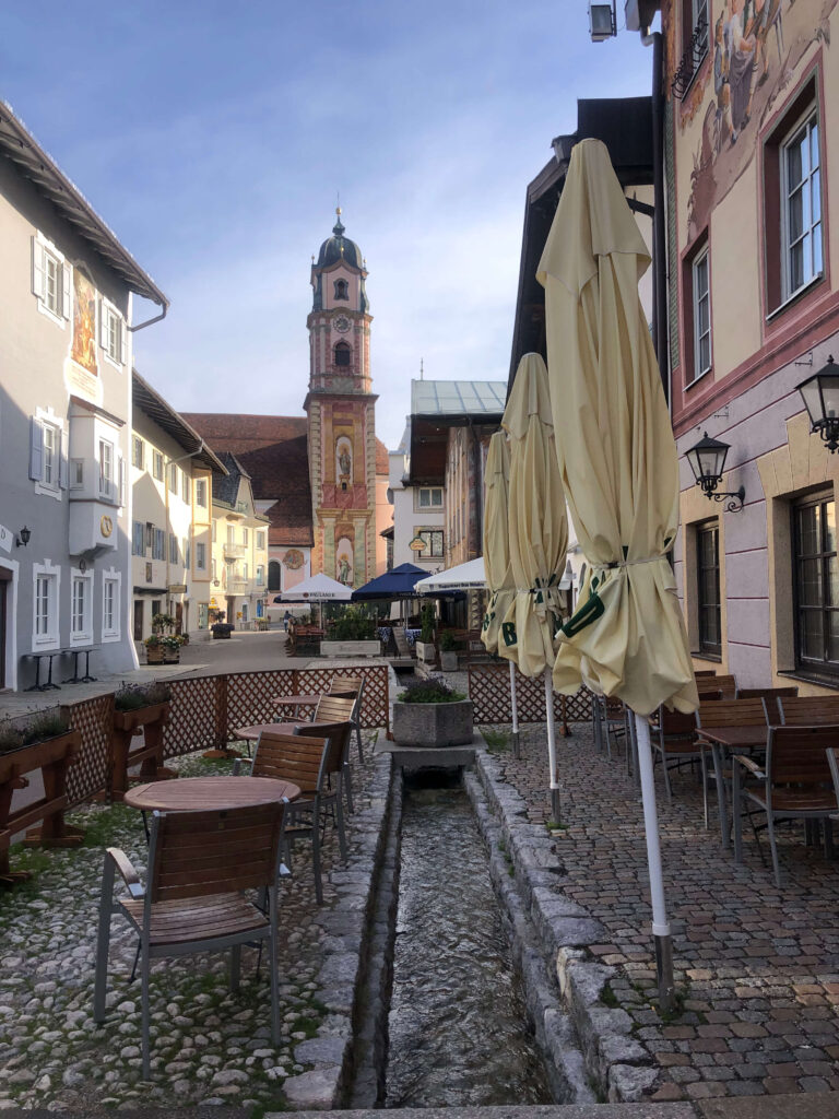
Night and dinner at historic Spa Hotel in Mittenwald
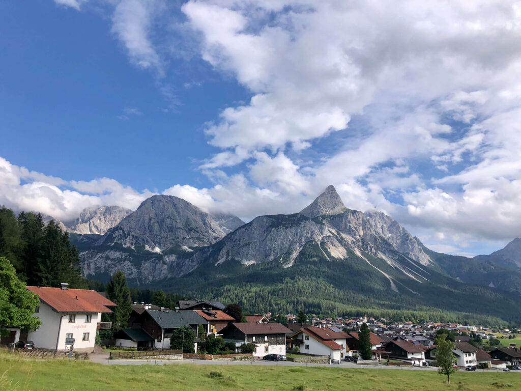
EHRWALD, TIROL
Day 6: Mountain Hut hiking loop
Today we ascending the north side of the dramatic Karwendelspitze massif high above the idyllic town of Mittenwald.After a morning filled with stunning views, pause for a delicious snack at the Hochland Hut, perched on the north flank of the massif. Following lunch, we continue the “Rundweg” back into the valley and to our Spa Hotel in Mittenwald.
Hike: 12km, + 689m, – 866m (this can also be a possible day off to relax)
Night and dinner at historic Spa Hotel in Mittenwald
Day 7: Mittenwald to Hall (Austria)
We take a shuttle to bring us to our hiking start at Kastenalp. From here we start hiking up to Hallerangerhaus for a mountain lunch. After lunch we climb up to the boarder with Austria at the Lafatscher Joch. A long descend brings us back down into the wild valley of Hall and the 14th century monestery St.Magdalena. The foundation of St.Magdalena is closely connected with sal mining in the Middle Ages. Several legends can be traced back to the discovery of the salt deposits in the Hall Valley in the 13th century.
A shuttle will bring us down to Hall for our last night. Hall in Tirol is one of Austria’s most beautiful towns. Tradition and modernity, urban chic and scenic natural beauty build enthralling contrasts and unexpected harmonies. Salt mining in the Middle Ages transformed Hall into the north Tyrol’s main commercial centre
We enjoy a celebration dinner in town tonight.
Hike: 12km, +1090m, – 1030m
Night at Hotel in Hall
Day 8: Departure day
This trip finishes after a delicious breakfast in Hall.
HISTORIC MITTENWALD
CHANGES OF PROGRAM FOR TIROL AND BAVARIA HIKING:
Our aim is to complete the proposed itinerary outlined above, however, it may be necessary for our mountain leaders to adjust the daily itinerary based on the weather conditions, group safety and enjoyment.
COSTS FOR TIROL AND BAVARIA HIKING:
Please contact us for the costs of this tour.
ACCOMMODATIONS/ MEALS
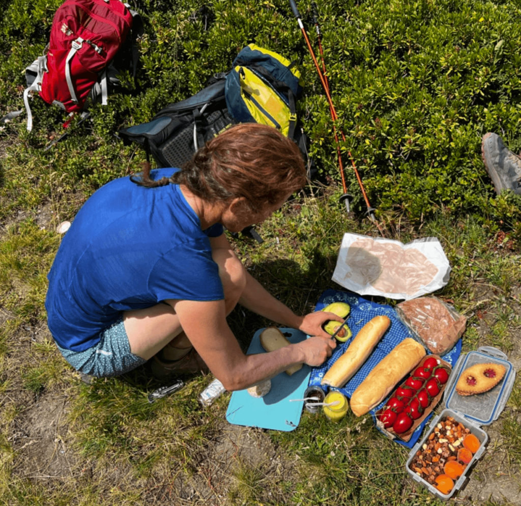
7 nights in charming Spa Hotels and local boutique hotels in private double rooms with ensuite bathrooms. Breakfast and dinners are included. Lunches and snacks are not included but your guide will lead you to the best mountain huts or can organise picnic lunches.
LUGGAGE TRANSFER
Luggage transfer is provided to all Hotels but the night at the Alm guest house on day 4 and the night at the mountain hut on day 7. We will put our necessary belongings into our backpack for those 2 nights. Each person is allowed to transfer 1 piece of luggage weighing no more than 50 lbs.
TRANSPORTATION
All lifts and transfers incidental to itinerary beginning in Garmisch-Partenkirchen and ending in Hall, near Innsbruck are included.
ARRIVAL AND DEPARTURE
This tour travels north to south trough the Alps starting in Garmisch-Partenkirchen in Germany and ending in Innsbruck in Austria. Both destinations are easily reached from other European and worldwide destinations by road, rail, bus or plane.
Innsbruck and Munich are the closest international airports to the starting point making shared transfers, buses or trains easy to arrange. At the end of the tour Innsbruck airport is 20 minutes away and Munich 2 hours 15 minutes by road.
DIFFICULTY
Hikers should be prepared for distances up to 10 miles and ascents up to 3050 ft.
WEATHER AND CLIMATE
The Alpine summer lasts from mid June to early October and is predominantly warm and sunny, but variable. This mountain range in southern Germany is a little lower and affected by the warmth of the plains to the north so it is hike-able from mid-May through mid-October. Temperatures usually hover in the 55-75 degree F range, with the occasional heat wave or cold snap.
ARRIVAL
Munich – Garmisch-Partenkirchen: approximately 1.15 hours by train from the main station. Multiple flights daily arrive in Munich’s International Airport. Connections are easily made at the airport terminal via Deutsche Bahn (DB) regional rail to Munich Hauptbahnhof (Main Railway Station), to connect to the DB Train to Garmisch-Partenkirchen. Information and booking may be made at the Deutsche Bahn.
We’ll meet at the train station in Garmisch at 5pm on the first day to take a short shuttle to our Hotel.
When packing for a trip in the mountains it is important to have appropriate equipment and clothing. This kit list features items we believe are necessary for the weather you might encounter and accommodation you will be staying in. If you have any questions with regards to what to bring, do not hesitate to get in touch with us.
Equipment
Walking boots – comfortable & waterproof, with a good tread. Low cut mountain walking shoes are ok’ if they have a stiff sole for rough terrain. Be aware that early season snow can remain on the high passes and boots may be necessary!
Walking Poles – optional, but highly recommended
Backpack– 30-35 litres, ideally with a chest and waist strap and a waterproof cover
Water container – 1 to 1.5 litres, or hydration system
Short gaiters – useful for tours in the early season, but not essential
Clothing
WATERPROOF jacket and over trousers
Waterproof over pants
Walking Pants
Shorts/skort
Sun hat
Warm hat
Thin gloves
Base layer e.g. t-shirt, thermal tops
Fleece jacket/shirt
Socks – technical walking socks 2/3 pairs
Duvet jacket/second warm jacket
Thermal leggings – optional
Comfort
Sunscreen
Lip salve
Sunglasses – eye protection is essential
Tissues
Supplementary snack bars/chocolate/trail mix
Book/Kindle/Music
Documentation
Passport, plus a paper copy
Travel Insurance
Credit Card
Cash – Euros
Waterproof bag for documents
Personal First Aid (All guides are first aid trained and will carry their own first aid kit)
Personal medication – if required
Antiseptic cream/spray
Painkillers/anti-inflammatories
Blister plasters
Items for the nights in mountain huts
Ear plugs – optional, but advised
Head torch – plus batteries
Lightweight towel
Additional Items
Slippers for use in accommodation
Clothing for use in accommodation and towns
Toiletries – including shampoo/shower gel as not all accommodations provide this
Swimwear for pools and spas
Camera
1 Medium sized – kitbag/holdall/suitcase
Your luggage will be moved most days by a taxi driver. Please restrict yourself to one bag of approximately 15kg (33lbs) per person.
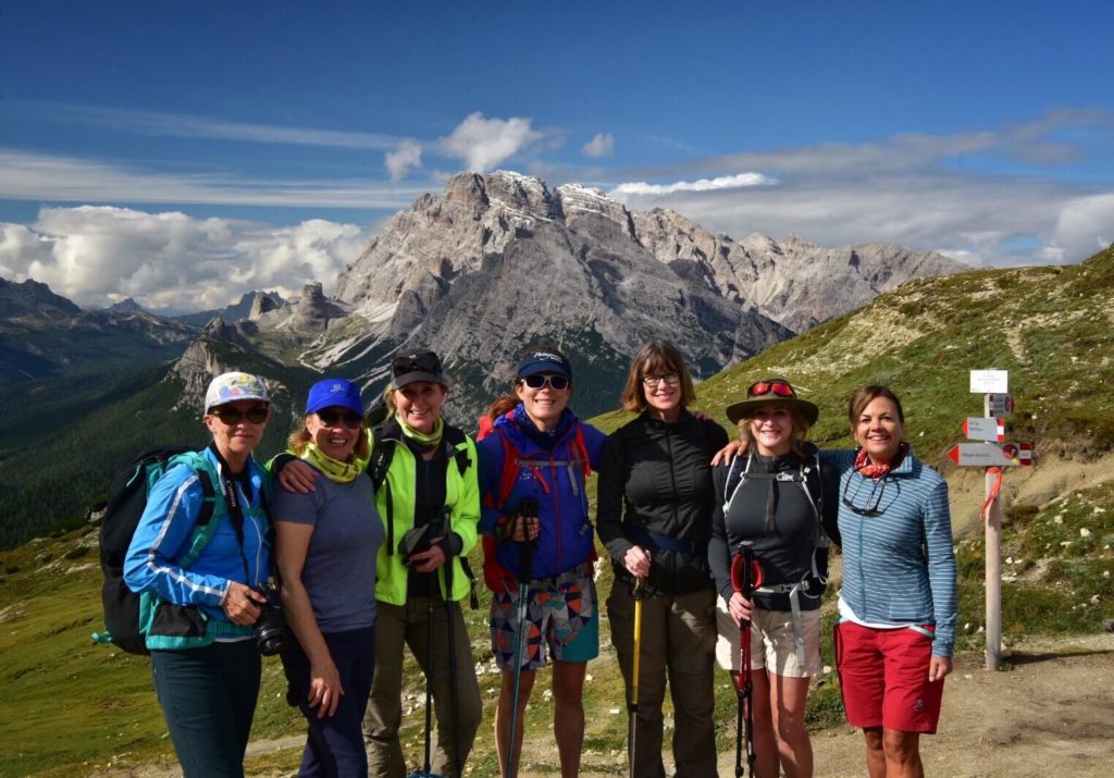
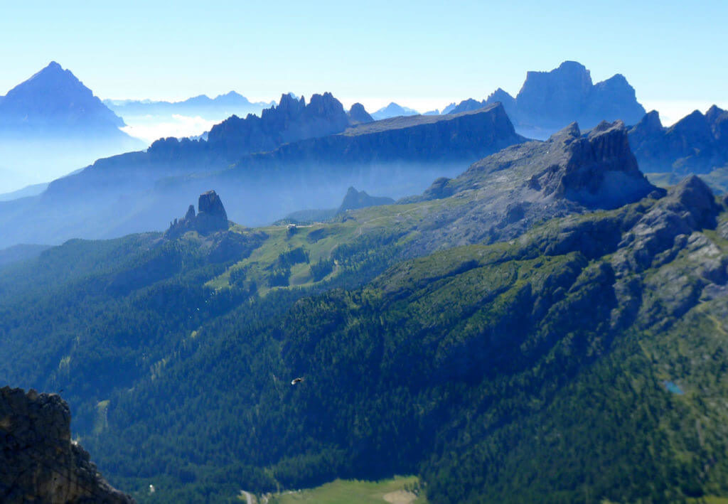
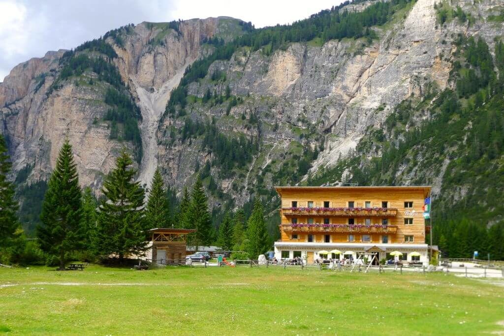
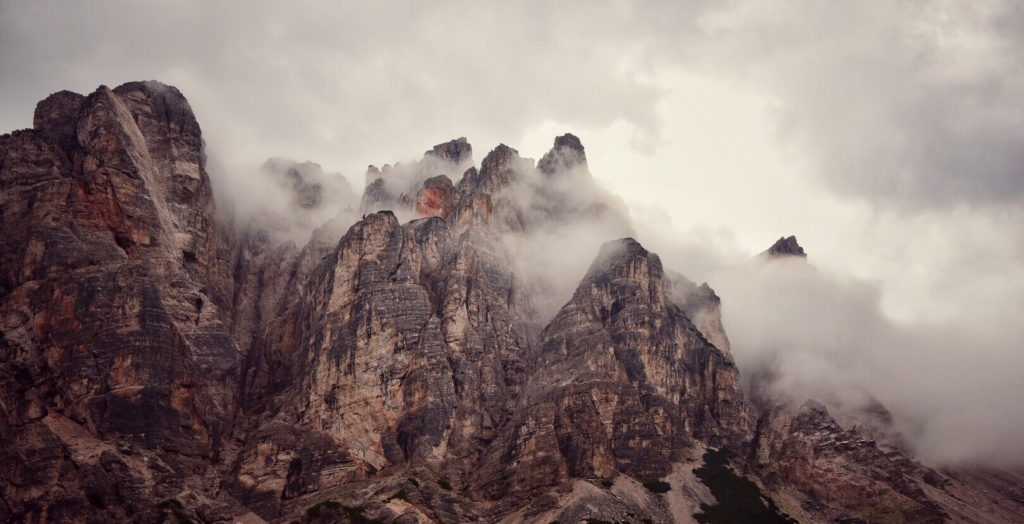
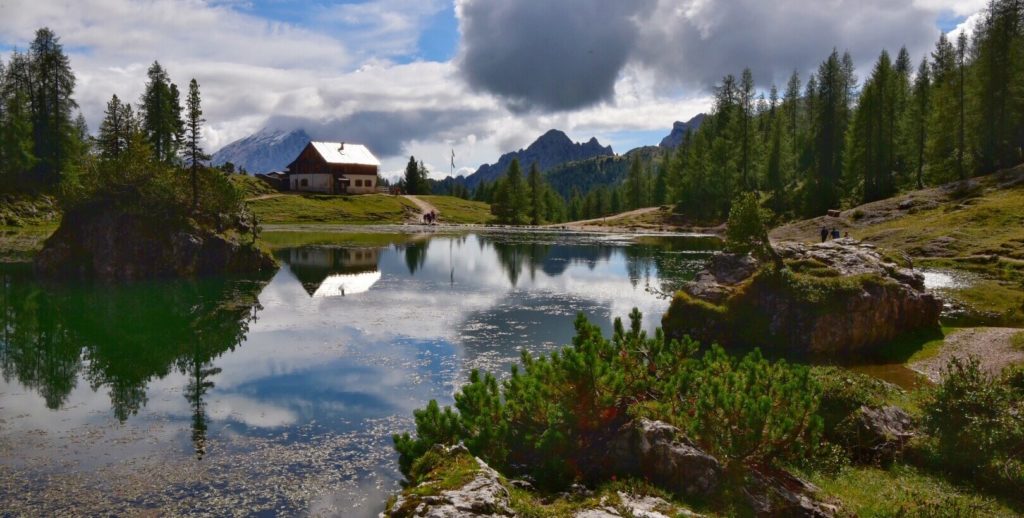
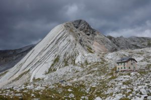
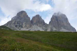
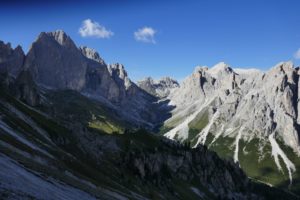
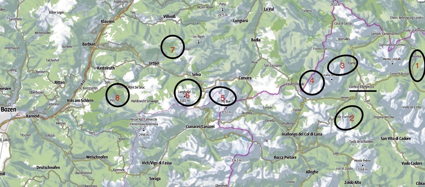
The Dolomites might just be the world’s most beautiful construction, on this both architect Le Corbusier and alpinist Reinhold Messner can agree. See and experience true South Tyroleanbeauty whilst pondering the towers of Three Peaks (Drei Zinnen) or basking in the last rays of evening light that redden the mountains around Pederü mountain guest house. Hike along the Dolomites High Mountain trail and enjoy the very tasty, local food in this UNESCO World Heritage site. Our hiking traverse brings us from Cortina d’Ampezzo to Val Gardena and the impressive Sella mountain range and ends at the foot of the impressive Rosengarten towers at Karer pass.
There are great differences between the Himalayas, the Rocky Mountains and the Alps. It is yet not easy to tell them apart, by just giving a quick glance at a picture of the ranges. Generally speaking, mountains have common features, such as rocky summits, trees growing on hillsides, snow remaining in shady couloirs…
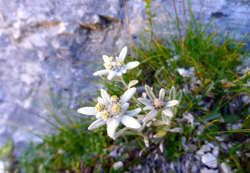
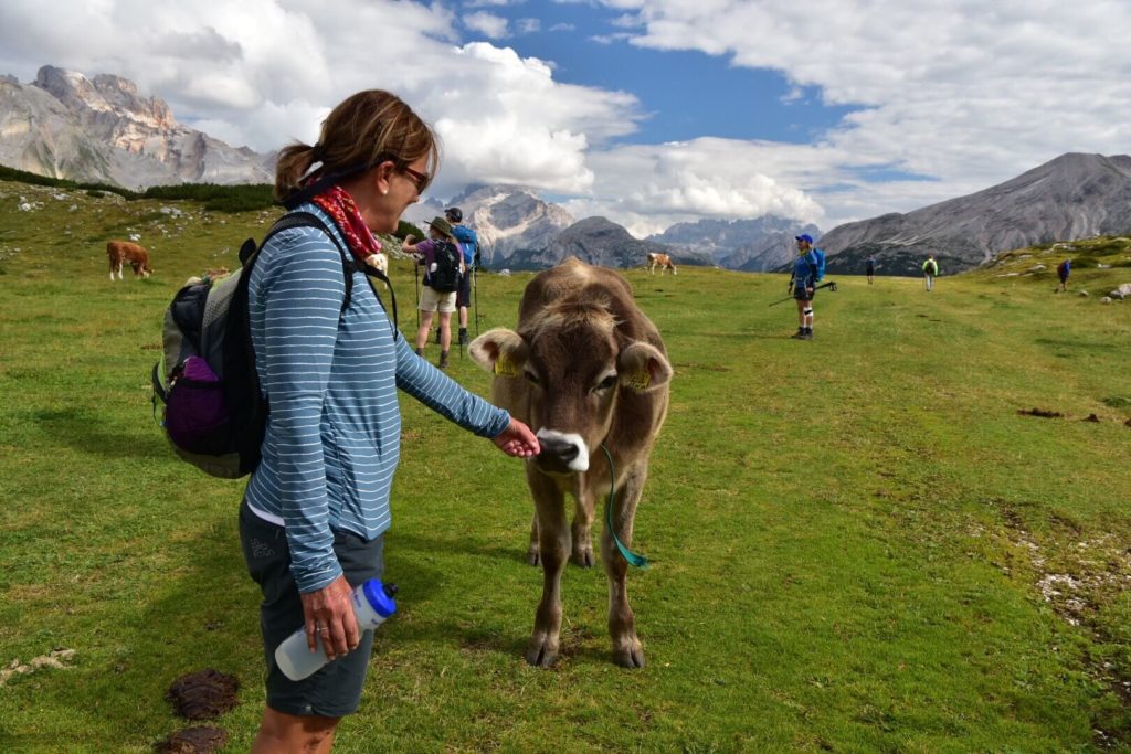
The Dolomites however show very specific characteristics and are impossible to mistake for othermassifs. Not only were they made from coral, but their history, flora and fauna make them truly unique. Mountain lovers find the views offered by these spectacular landscapes striking.
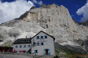
We will discover the pretty mountain villages, 3 different natural parks and 5 mountain Dolomite mountain ranges. We will stay in beautiful Hotels with one night in a traditional mountain Guesthouse.
Picture credit: Keith Wagner, Canada
The Dolomites:
“Born as coral reefs 250 million years ago, today they soar skywards proud and confident as white towers of rock.”
Dolomites hiking Itinerary
Day 1: Cortina d’Ampezzo
We all meet at the Hotel in Cortina at 7pm to get to know your hiking guide, and talk about theitinerary for the week. We enjoy a delicious dinner together. Night and dinner at Hotel in Cortina
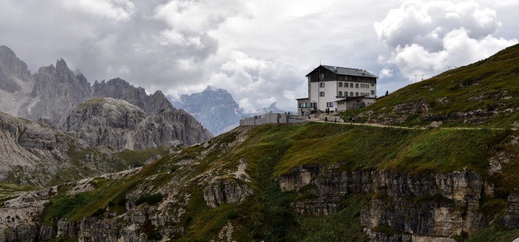
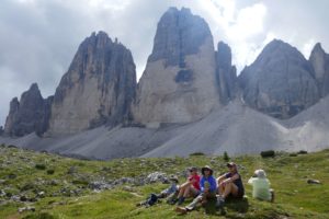
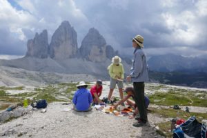
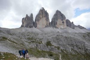
Day 2: Tre Cime di Lavaredo
10.5km, 4 – 5hrs, + 378m – 378m // 6.5 miles, 1240ft elevation gain, 1240ft loss After a short drive past beautiful Misurina lake we start with a gentle hike at the foot of the famous vertical rock needles Tre Cime di Lavaredo. Night at Hotel in Cortina, no organized dinner (many options in Cortina)
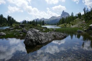
Day 3: Around Croda di Lago
13,4km, 6hrs,+ 864m – 327m // 8.3 miles, 2834ft gain, 1073ft loss A short drive brings us to the south side of the Cortina valley from where we hike to the beautiful mountain lake Mondeva located at the foot of the imposing Croda da Lago. Here we stop for a drink at the mountain hut and can later admire the Mondeval alpine pastures from the Forcella Ambrizola Pass. We continue to Forcella Giau and meet our minivan at Passo Giau. Night at Hotel in Cortina, organized dinner
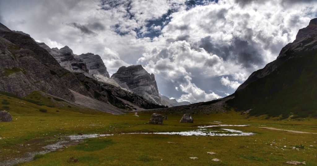
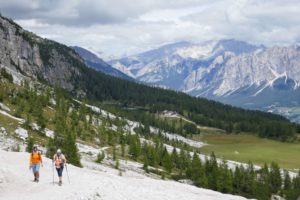
Into the mountains we go…
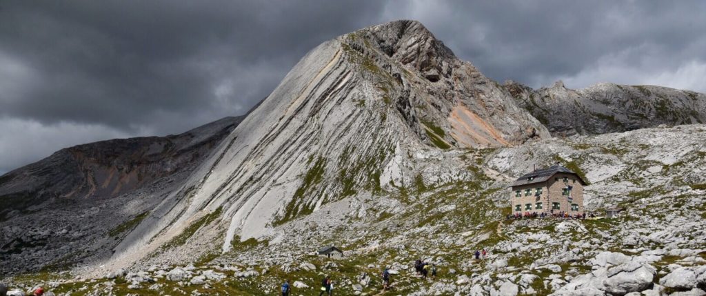
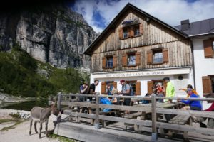
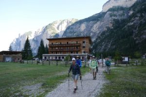
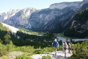
Day 4: Malga Ra Stua – Rifugio Seekofel – Pederü
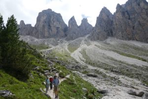
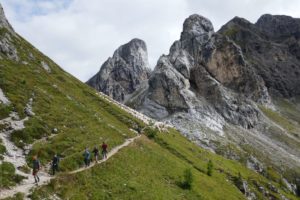
15 km, 5hrs, + 730m, – 840m // 9.3 miles, 2395ft gain, 2756ft loss We hike through the Fannes-Sennes nature park today on the Alta Via, a high trail that crosses the Dolomites, and visit the Seekofel hut, one of the oldest mountain huts in the Dolomites. Over green pastures we reach Fodara Vedla to test the best Apfelstrudel in the area. Down a steep military road and we are in Pederü. Night and dinner at Mountain Guesthouse Pederü
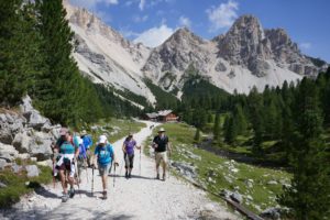
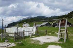
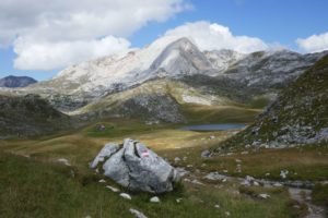
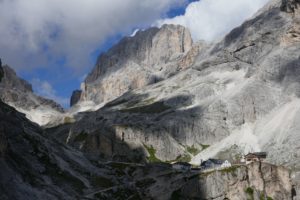
Day 5: Pederü, Lavarella hut, Fanes Alm, Capana Alpina
14,3km, 5hrs, + 635m, – 575m // 8.8 miles, 2083ft gain, 1886 loss A trail through beautiful alpine pastures in the heart of the Fannes – Sennes Nature park and a sea of rocky limestone formations decorate our way up to Fanes Alm. A short way down a steep valley and we’re in the Alta Badia valley. Night and dinner at our Mountain Explorers Hotel in the beautiful small town of San Cassiano, Spa
Day 6: San Cassiano – Kolfschung – Crespeina alta via – Wolkenstein (Val Gardena)
7.4km, 5hrs, + 545m, – 339m // 4.6 miles, 1788ft gain, 1112ft loss From Kolfschung we take a small cable car up to our hiking start. We hike a panoramic high trail today and finish the hike in the beautiful small town of Wolkenstein in the famous Val Gardena. Night and dinner at Hotel in Wolkenstein, Spa
13km, 5hrs, + / – 540m // 8.1 miles, 1300 gain, 1772ft loss This hike leads us around one of the mightiest of the Dolomite mountains. Thanks to this loop path, you can circumnavigate the whole Langkofel / Sassolungo mountain range and enjoy continuously different sceneries and panoramas, alwaysspectacular, while you proceed. We start and finish our hike with cable cars. Night and dinner at Chalet Hotel in Fassa valley, Spa
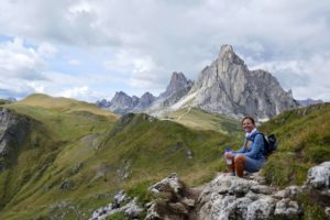
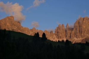
Day 8: Rosengarten explorer – Refugio Vajolon
11km, 6hrs, + 538m, – 290m // 6.8 miles, 1765ft gain, 951ft loss The Rosengarten towers are very unique and our loop brings us to the Vajolon mountain cabin which is situated right underneath the steep rocky faces of the Rosengarten towers. We might spot some rock climbers on our way back towards the cable car. Night at Hotel in Fassa valley, organized dinner
Day 9: Panoramic high trail Campiedi – Paolina hut – Fronza hut
10km, 4hrs, + 615m, – 200m // 6.2 miles 2018ft gain, 656ft loss This relaxing walk is perfect to enjoy the views over the Fassa valley and up to the beautiful Rosengarten towers. A great hike up to a relaxed meal at Paolina hut with lots of time to enjoy the beauty that surrounds us. A chair lift brings us back down to our beautiful Hotel at Karer pass. Night and farewell dinner at our beautiful Hotel at Karer pass, Spa
Day 10: Departure day
Bye – Bye hikers Breakfast at the Hotel before your onward journey or your travel back home. From Karer pass it’s only about a 1.5hr drive to Bolzano.
Map for the Dolomites hiking traverse:
Fees Dolomites hiking traverse:
4982.00 USD per person with 6 guests, single supplement $270.00
Minimum of 4 persons needed to conduct the tour (ask for prices); tour will be cancelled if less than 4
Ask for discounts for bigger groups.
Included in the price: Accommodation and meal reservations and organization of the trip, UIMLA hiking guide, 9 nights in nice Hotels in private double rooms, 1 night in a cozy mountain guesthouse in private double rooms, private transportation to the hikes and back to the hotels, luggage transfer to all hotels, 8 dinners (as noted), park entries, cable car fees.
Not included in the price: 1 dinner, lunches and snacks, beverages, personal insurances (accident, travel, cancelation etc.), transport to Cortina and back from Karer pass.
Changes to the itinerary:
Note: All itineraries are subject to change due to circumstances beyond our control including, weather, road or trail conditions and flight schedules.
Hiking Level for Dolomites hiking traverse:
This is a moderate trek 8 hiking days with 4 to 7 hours of hiking daily, with 1900ft of average vertical gain each day. Hiking will generally be on well-maintained mountain trails, sometimes including easy off-trail sections. This trip is for active people who don’t mind training to prepare for the hike, or a great multi- day hike for people with trekking experience.
Accommodation:
3 nights at Hotel in Cortina d’Ampezzo 1 night at the mountain guest house in Fanes Natural Park 1 night at Hotel in San Cassiano 1 night at Hotel in Wolkenstein 2 nights in Fassa valley 1 Nights at Karer pass
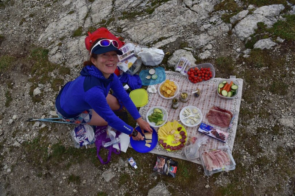
Lunches:
We didn’t include the lunches because we have had big differences in eating preferences in the past. Some people only want to eat an energy bar, others like more a buffet style picnic or to stop at one of the many great mountain restaurants. Once in Cortina you can let me know your preferences and I can organize a picnic style buffet each day or box lunches for you. Also often there are many great mountain restaurants along the way where we can stop for lunch.
Dinners:
1 dinner in Cortina d’Ampezzo is not included. The guide will help you find the perfect dinner place for you.
Insurances:
Travel insurance is not included in your tour. We strongly recommend that you purchase insurance to cover cancellation, medicalexpenses, personal accident, personal baggage, money and public liability.
Climate:
Alpine weather can change suddenly, involving wide temperature variations. Temperatures also drop with altitude, and snow falls in summer are not rare. You should be prepared for cold andhot weather, while minimising items you need to pack.
How to get to Cortina d’Ampezzo:
Venice has the closest airport and is a great location to start the tour. We recommend spending a day or two in this beautiful town prior or after the trip.
Private transportation from Venice airport: If you like I can organize a private shuttle from the Venice airport to Cortina and back for those who would like to go back to Venice on the last day.
By train:
If you prefer traveling by train, the main railway line is Venezia S.Lucia – Calalzo di Cadore, then transfer to Cortina by a connected bus service. The next railway station is at Calalzo di Cadore, 21.7 miles away.
By bus:
There is a 2-hours direct bus service from Venice to Cortina called the Cortina Express. It operates daily: http://www.cortinaexpress.it/en/index.htm
How far is Cortina from … / miles:
100 from Venice 268 from Milan 430 from Rome 102 from Innsbruck 820 from Calais 27 from the Austrian border 45 from A27-Belluno motorway
How to get back from Karer Pass at the end of the tour
I’m happy to arrange a Taxi for you or you can take the public bus to Bozen/Bolzano and than a train to Venice or where ever you like. From Bozen there are trains in all different directions.
Packing list for this Dolomites hiking tour:
Recommended clothing:
(We’re fans of Merino wool clothing for hiking, they dry fast and don’t smell)
1 pair of hiking boots or shoes (high or low is up to you, I always recommend higher ones but the trails are in very good shape)
functional underwear
hiking socks
1 long sleeve shirt
2-3 T-shirts
1 fleece or soft-shell jacket
1-2 pair synthetic hiking pants or shorts
1 pair long pants
2 – 3 pair hiking socks – wool or wool blend
1 pair shoes for wearing after the hiking in the towns
1 sun hat, 1 warm hat
thin Gloves
1 set Gore-tex rain gear
1 thin down jacket
Casual outfit for dinners
Gaters (for tours in early spring)
Optional clothing:
Swimsuit (many Hotels have a Spa)
Gear:
1 day backpack
1-2 water bottles, thermos bottle
Sunglasses
Personal toiletries
Wollte or similar for hand washing clothes at Hotels
1 pair trekking poles
Camera
Blister tape
Pocket knife
Personal medicaments
Read more about our last Dolomites hiking traverse from our friend and travel writer Laura Gosset
Please press on the “make a booking” button to send us an e-mail with your questions!
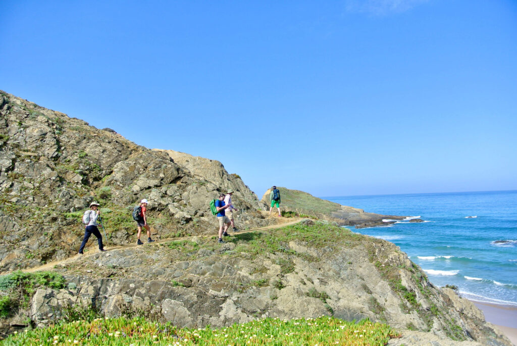
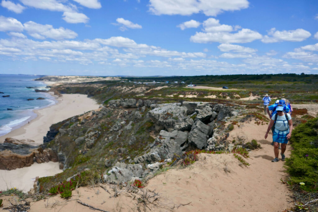
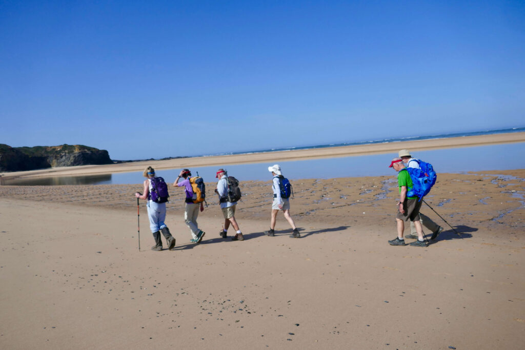
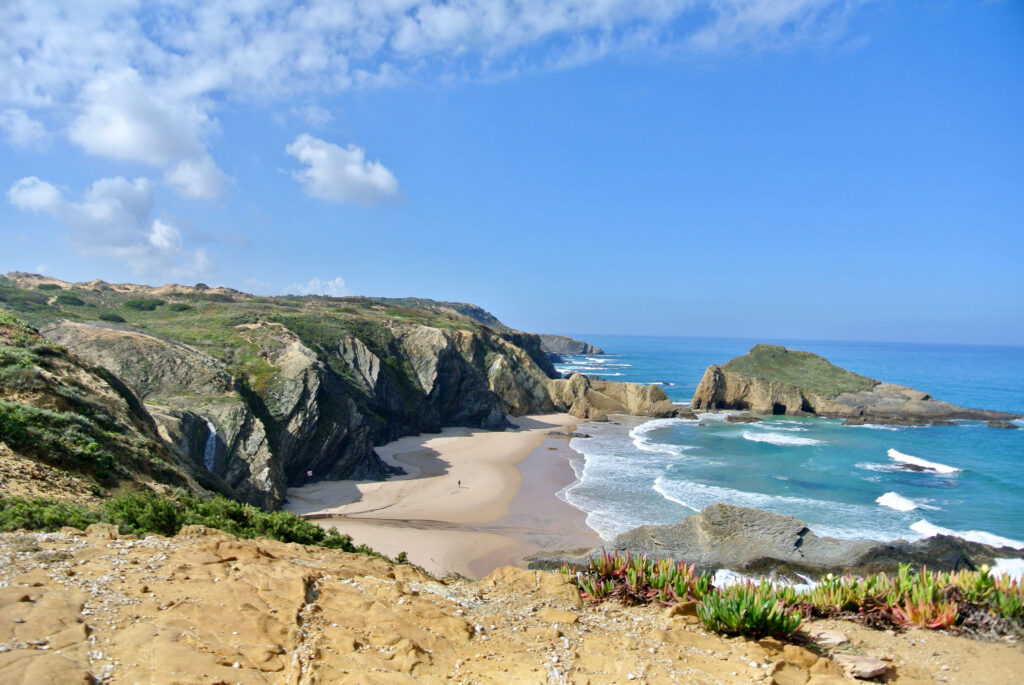
Follow the footsteps of Portugueses fishermen along the Alentejo coastline to wild and rugged beaches
Nights in beautiful and authentic guesthouses and hotels
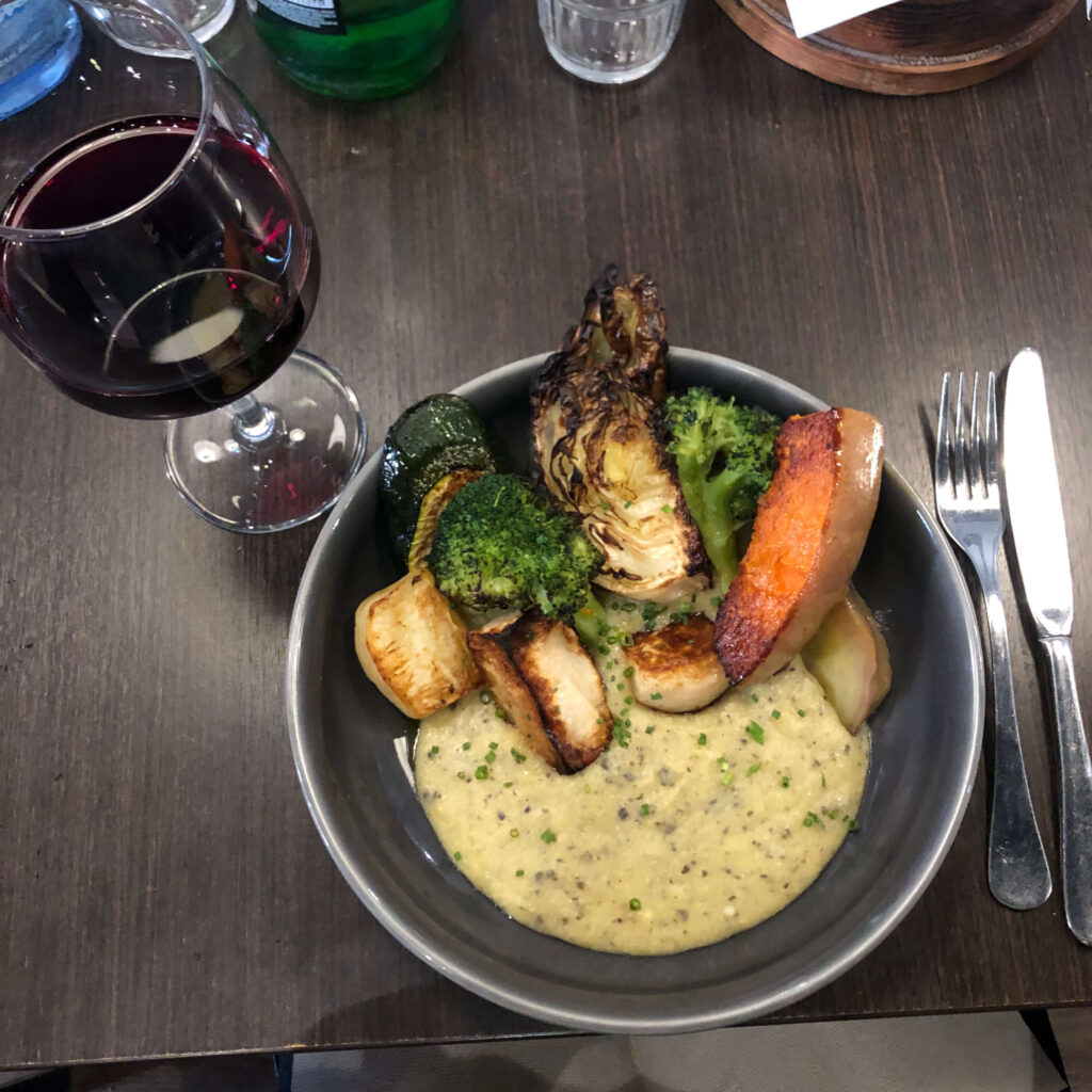
Relax with a glass of “vino” and some tasty seafood after hiking
Daypack hiking with luggage transfer
The Rota Vicentina is a network of hiking trails in the south of Portugal, it passes trough two provinces Alentejo and Algarve.
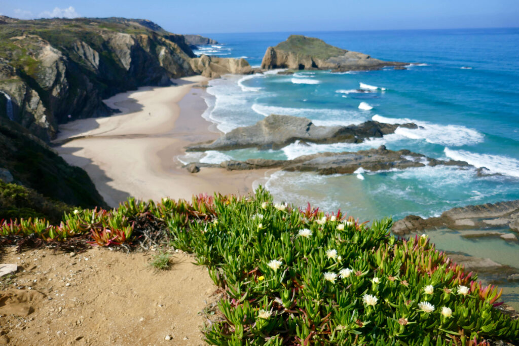
Beautiful trails take us along honey-coloured cliffs, down to small beaches and hidden sandy coves. This allows you to discover the “real* Portugal as you visit places only accessible by foot along the Alentejo coastline. We discover some of the best preserved coastline in Southwestern Europe.
Charming Portuguese fishing villages welcome us for the nights. Enjoy tasty local food and wine while watching the sunset and listening to the crashing waves of the Atlantic coast.
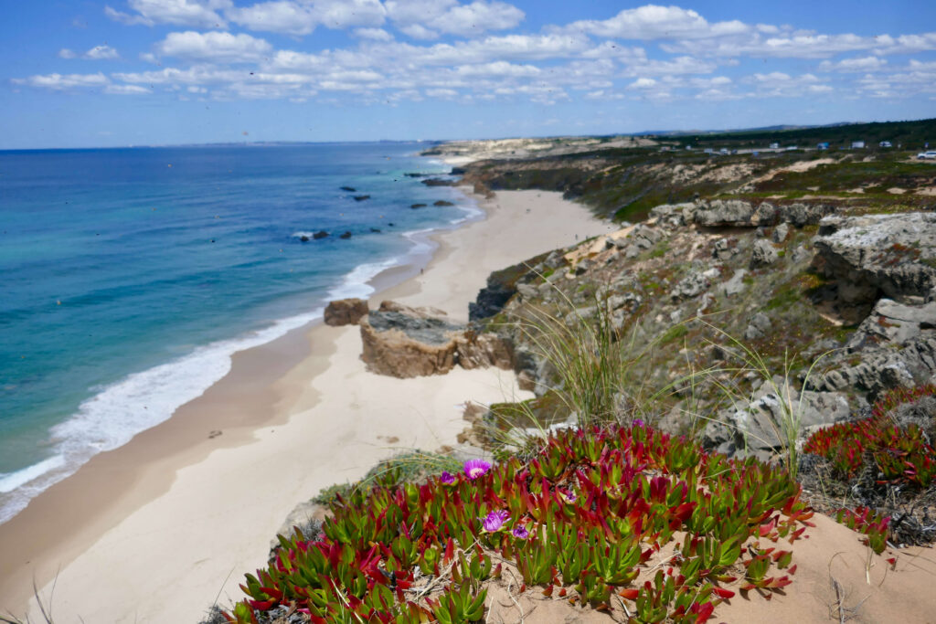
Rota Vicentina, coastline in Portugal
Walking Itinerary Portugal hiking, Rota Vicentina
7 nights
5 hiking days
Day 1: Arrival at Lisbon, Culinary & Wine Tour
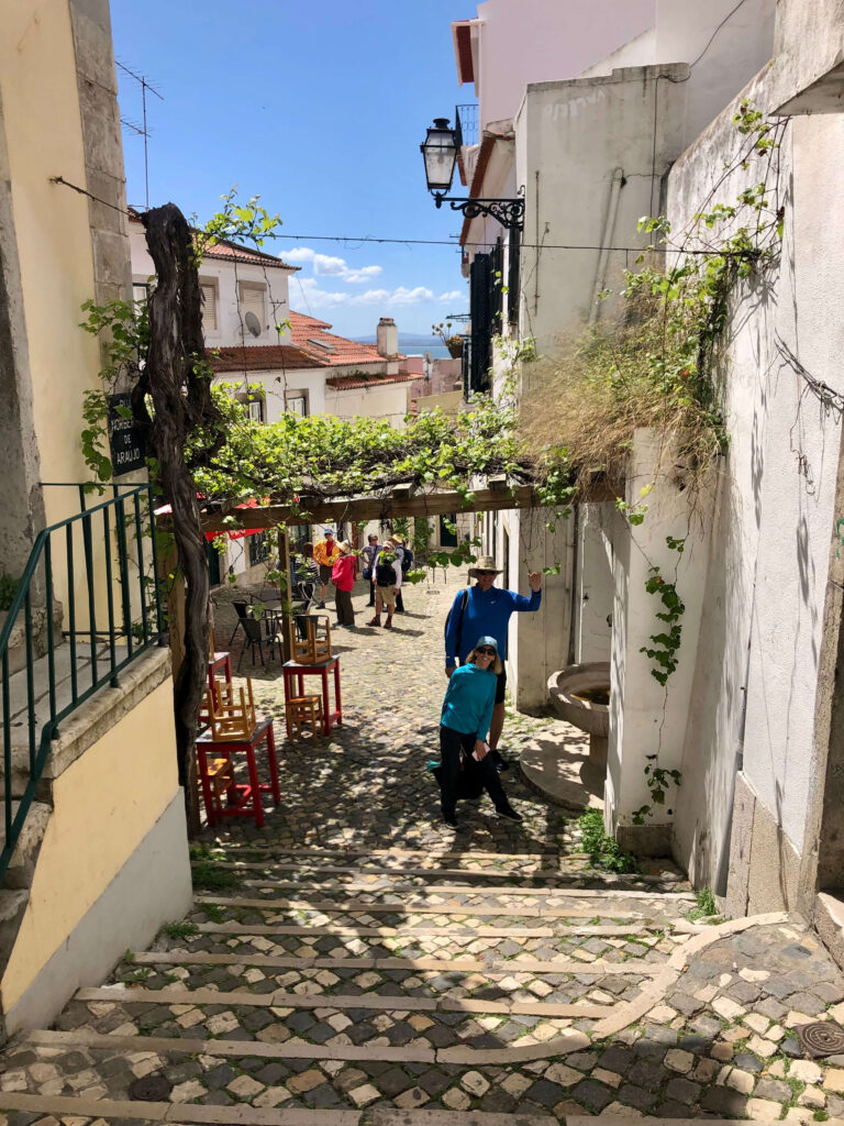
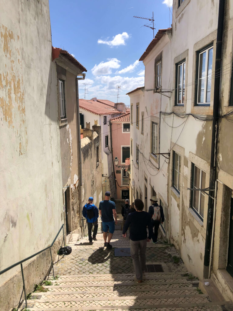
We meet at the Hotel in Lisbon at 4.30pm for a culinary tour. We’ll saver the flavours of Portuguese food on a 3-hour tour of Lisbon’s traditional eateries. In the company of a culinary guide, we get tips on wine, petiscos, food and fado in the historical center, home to some of Lisbon’s most famous restaurants.
Night in a wonderful historic Hotel in Lisbon
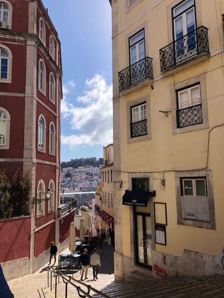
Day 2: Walking tour Lisbon – Road to Porto Covo
We discover this charming city and cultural cradle. The Belém district with a concentration of history and an immense architectural memory. Among other things, we visit th eHieronymite monastery, in Manueline style, which recalls the epic of Vasco da Gama and the discovery of the Route of India. This complex, true architectural masterpiece, bears witness to the county’s power for centuries. We stroll through the city’s vibrant neighbourhoods and enjoy a nice lunch.
In the afternoon, transfer by privat shuttle to Porto Covo (1.45hrs). With it’s white-washed cottages and beautiful beaches backed by high cliffs, Porto Covo is a charming location for our second night in south-west Portugal.
Walk: City walk 3hrs
Overnight: Guesthouse in Porto Covo
Day 3: Porto Covo to Vila Nova de Milfontes
Today’w walking is all about beaches, sand dunes and deserted coves. From the rough beaches at Aivados to the golden sand dunes of Farol. Discover the diversity of coastal landscapes and plant life on this section,. Some tougher walking along the sand dunes is rewarded by fantastic coastal views. The small town of Vila Nova de Milfontes is the most popular resort on the Alentejo coast. Positioned on the sheltered waters of the Rio Mira estuary the town is only a stone’s throw from the Atlantic coast and any number of outstanding beaches. Although the town has expanded over the years too cater for the increasing number of visitors, the old center still retains much of its charm.
Walk: 20km / 12 miles, +167m, – 149m, 7 hrs
Overnight: Beach Hotel
Day 4: Vila Nova de Milfontes to Almograve
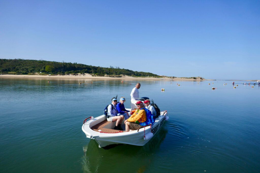
We take the small ferry to do the river crossing first and then start walking. The trail will lead us into an easy day of walking, crossing fields, and passing by small cliffs, with access to several beaches while heading to Almograve. Almograve is a nice place to have lunch and enjoy the local gastronomy. After lunch it’s time to explore the Almograve beach or to finish the route, heading to the village of Longueira, located inland.
Walk: 11km / 6.8 miles, + 88m, . 116m, 3-4 hours
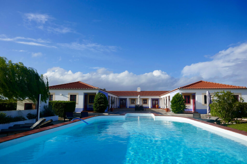
Overnight. Beautiful rural Casa in a very quiet area, pool
Day 5: Almograve to Entrada da Barca
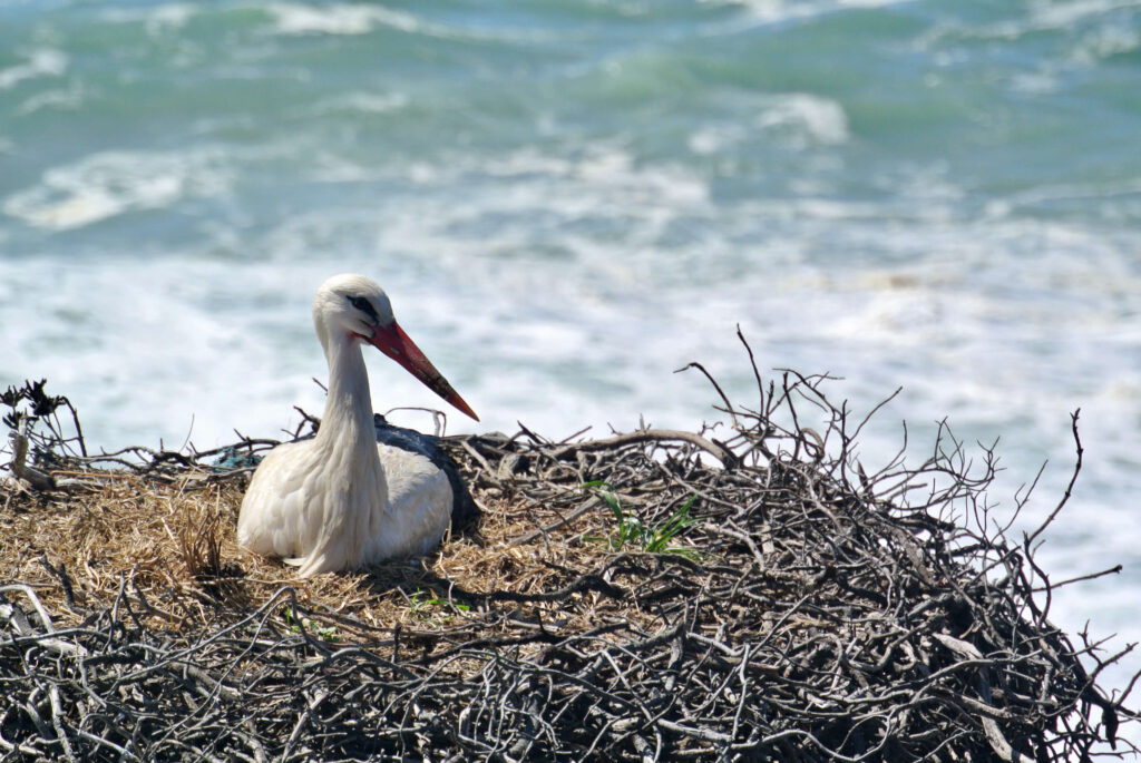
We walk past ochre sand dunes and high cliffs, home to over twenty species of birds, followed by a section trough some fragrant pine forests. A highlight is sure to be capturing sight of the nesting white storks – this coastline is the only place in the world, where they nest! We can make a stop at the small village of Cavaleiro, buy some supplies and enjoy a fresh orange juice. After a short walk in the afternoon we arrive at Entrada da Barca where a Taxi will bring us to our Hotel near Zambujeira do Mar.
Walk: 18.4km / 11.4miles, + 203m, – 193m, 7 hours
Overnight: Hotel Casa de Campo in Zambujeira do Mar
Day 6: Hiking or relaxing: Entrada de Barca to Zambujeira do Mar
Today you can either enjoy the beautiful Hotel and relax at the pool ore take 2 miles walk to laidback Zambujeira do Mar and some nice beaches and bays.
Hotel: Same Hotel as day 5
Day 7: Hiking Zambujeira do Mar to Odeceixe
The trail today offers some of the best waves on the whole of the Fisherman’s Trail. We walk up and down to the sea on narrow cliff side paths. We walk along many beaches, a natural fishing harbour and the spectacular Ponta em Branco. This is one of the most popular hiking routes used by the fishermen going South, heading to Odeceixe, the first village in the Algarve region. We’ll fin plenty to explore passing by Carvalhal Beach, the residence of the famous fado sinter Amalia Rodrigues and the locally famous harbour of Anenha do Mar, and there are just some of the highlights. After recharging our batteries at Azenha do Mar’s seafood restaurant, wee will have the energy to continue your journey to Odeceixe, where the bridge over the river Seths the border between Alentejo and Algarve regions.
We enjoy some spectacular mountain views before following the river into Odeceixe.
walk: 17.7km / 10.6 miles, + 263m, 283m, 6-7hours
Overnight: Typical fishermen houses transformed into a modern boutique Hotel with a Pool
Day 8: Odeceixe to Lisbon airport
After breakfast, we travel to Lisbon airport (2,5hrs)
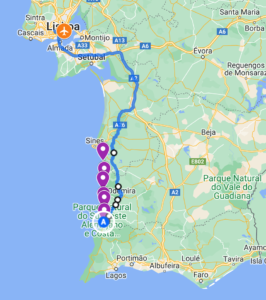
Map:
Costs Portugal hiking, Rota Vicentina :
With 8 hiker: 2’289.00€ /hiker
With 6 hikers: 2’656.00€ / hiker
Single room supplement: 420.00€
Included in the price:
Organisation, privat hiking guide, all accommodations with half board as mentioned in the programme, gourmet walk day 1 with a private guide, city walking tour in Lisbon with a privat guide, all ground transfers from Lisbon airport to Faro airport in a privat van (iff group arrives at the same time, if not that transfer is not included but I can organise it), luggage transfer ( 1 piece of max. 20kg)
Not included in the price:
Personal insurances, flights to Lisbon and back from Faro, Taxis for separate arrivals at Lisbon airport, lunches and snacks, drinks, tipps
Who is this hiking tour for?
The walking is moderat with some more difficult sections of walking on sand, and a few steep assents to cliff-top-paths! Perfect for those who would like to explore the wild and unspoiled Portugal.
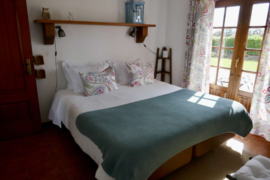
Accommodation
We stay in a mix of nice, traditional guesthouses, rural Casas, and small beach Hotels with a focus on a personal service and welcome. Enjoy the warm Portuguese hospitality!
Meals
Breakfast in the Guesthouses and dinners in local Restaurants are included.
Packed lunch items are not included but can be bought locally from markets or cafes. Your guide will assist in finding good products and can arrange picnics.
Grade & Terrain
This trip is graded “moderate” overall with the average daily distance being 16km. You will be walking between 3 to 7 hours a day on undulating terrain with some short ascents and descents and often on sand which does make the walking tube tiring at times.
Baggage Transfer
Your bags will be transferred from your accommodation as per your itinerary and move on to your next overnight accommodation. We ask to limit your luggage to one bag of up to 20kg per person.
To travel from the airport to the Hotel in town a Taxi will be organised at a determinate time. If you arrive before or after please organise your own shuttle.
Travel insurance
It is a requirement of booking this tour with Patagontiptop GmbH that you have suitable travel insurance which covers you for the activity and emergency evacuation and hospital care.
Wonderful coastlines in the south of Portugal
Geography of Portugal
Portugal is situated in the extreme west of Europe, on a strip of land bordering on the Atlantic. It basically occupies a rectangle of land within the Iberian Peninsula. Almost its entire coastline faces west, endowing its beaches with a rare beauty at dusk. In the Algarve the beaches face south. The two other sides of this rectangle border on Spain.
The northern and central areas of Portugal are more mountainous than the south. Plains and gently undulating lands extend from the Tejo basin to the Algarve. The southern interior of the Alentejo is one of the areas with the least light pollution ion the whole of Europe and is therefore the perfect place for amateur astronomers. Even layer may catch sight of a shooting star streaking trough the sky from time to time. The Algarve is separated from the Alentejo by a chain of mountains.
Rivers
The country is traversed by rivers, usually perpendicularly. The Tejo, which is the largest river in the Peninsula, flows trough the centre of Portugal ad its banks are succeeded by very fertile alluvial plains and marshland. The rugged landscape of the north of Portugal is moulded by the River Douro which cuts its way trough hills and mountains. The River Guadiana marks the border with Spain in the south of Portugal and it is here that the largest dam in Europe, the Barragem do Alqueva, was constructed. Portugal has other smaller rivers which occasionally form rare wetland ecosystems at the point where they reach the sea, such as the Ria Formosa in Faro and the Ria in Aveiro at the mouth of the River Vouga.
The largest cities lie on the coast. The cities of Porto and Lisbon are situated at the mouths of the Douro and Tejo rivers respectively. Lisbon, the capital is the administrative, cultural and economic capital of the country.
Climate
Portugal has a Mediterranean climate with mild winters and glorious summers. However, the winters are harsher in the Tras-os-Montes region and the Sera de Estrela Mountains, where it is to unusual to find snow. Despite the hot summers, the sea almost always brings light breezes to make the temperatures more bearable for those less accustomed to the heat.
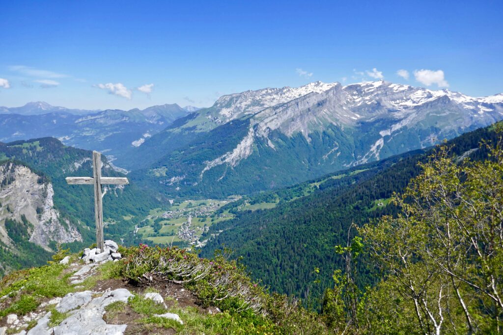
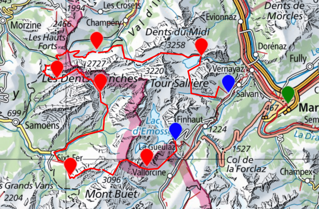
Tour around Dents Blanches, Mont Ruan and Dents du Midi between Mont Blanc and Lake Geneva
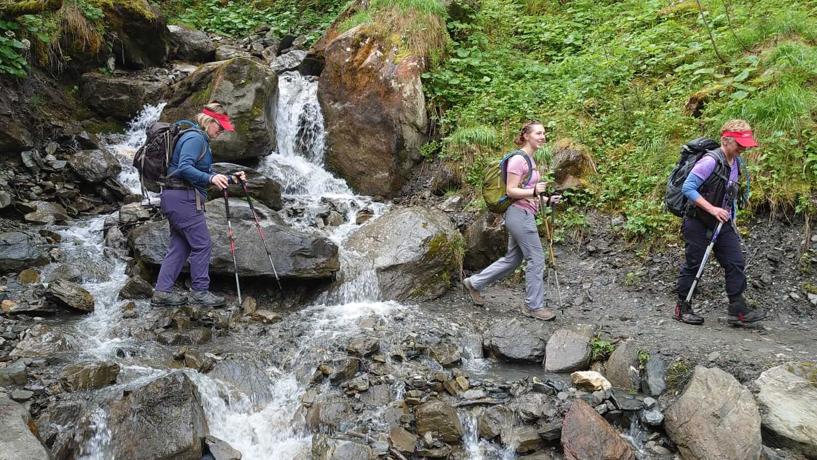
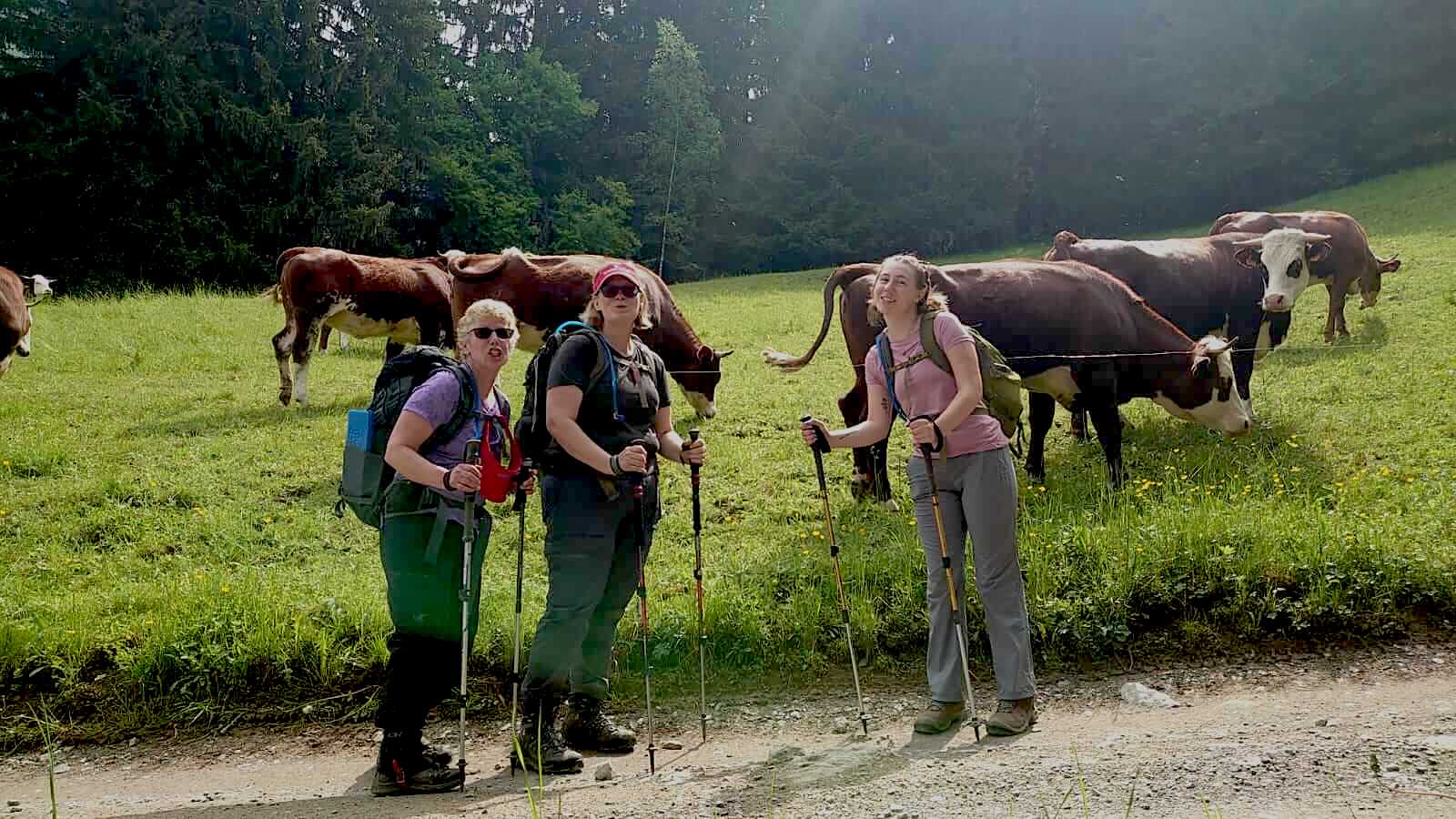
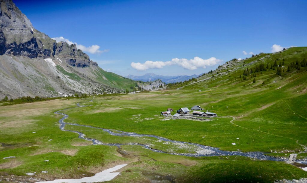
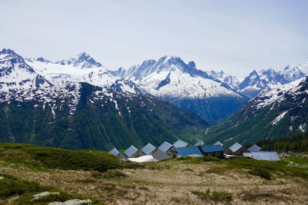
This magnificent 7 day tour hidden paradise hike for experienced hikers leads us out of the ordinary and into the wild, romantic mountains between Switzerland and France. This little paradise has not been discovered by many hikers yet. We’ll discover the haut Giffre mountains and the Val d’Illiez and stay in cozy mountain huts/guest houses. We walk over passes and trough mountain meadows and dip in some of the many crystal blue mountain lakes.
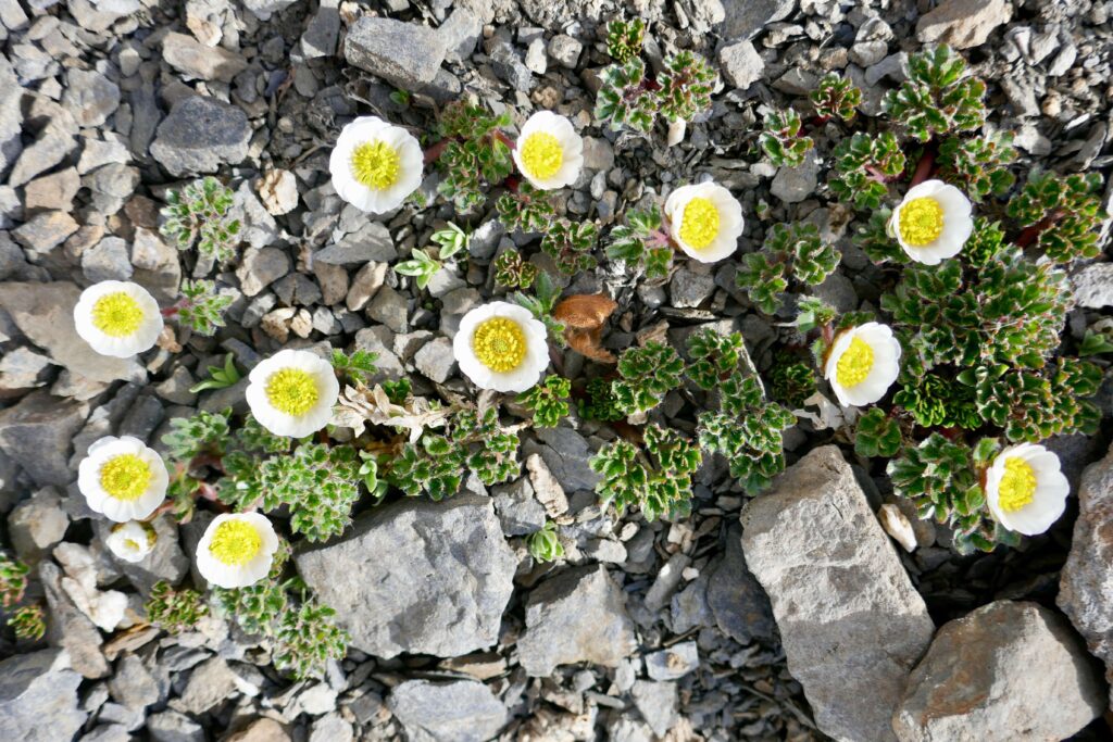
We sleep in typical mountain guest houses in beautiful spots surrounded by mountains and mountain lakes. Delicious dinners will be cooked for us and a hot shower each night awaits after the hike. Dips in mountain lakes, alpine flowers, great views and local fauna – there will be a lot to explore!
Come join us on this Tour of Dents Blanches & Dents du Midi hike!
7 hiking days
6 nights at mountain huts
Hiking Itinerary Tour of Dents Blanches & Dents du Midi
Day 1: Martigny – Les Marecottes – Salanfe
We meet at Martigny train station in the morning. From there we take the Mont Blanc Express train to the lovely montain town of Les Marecottes. A cable car brings us up to the mountains where we can enjoy great views. Now we start our walk toward a beautiful alpage where we stop for lunch. From there we hike up towards our first pass of the tour, Col d’Emaney. The big mountain we see now is the Luisin and also de Dents du Midi come in sight. From here we can overlook Salanfe lake and can already see our Auberge for the night.
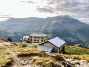
Night and dinner at Auberge de Salanfe at 1925m, double rooms or dorms, shower
+967m, -700m, 6hrs
Day 2: Salanfe – Barmaz
Our pass today is called Susanfe, squeezed in between Tour Salière and Dents du Midi. Our very charming guest house tonight is a beautifully located in the Alpages of Chambery at the Val d’Illiez.
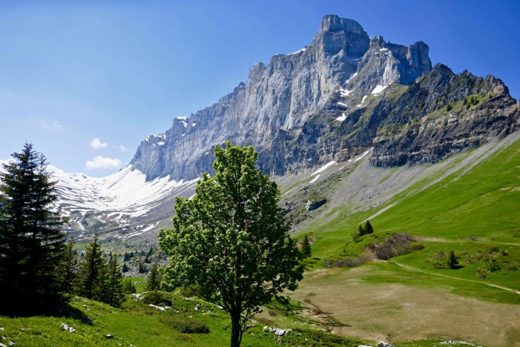
Here, no power lines that distort the landscape, we self-produce our energy, a real return to nature! You will find yourself in the middle of pastures strewn with hundreds of flowers, crossed by the torrents surrounded by a green forest.
The majestic “Dents Blanches” (2756m) massif dominates this enchanting setting. And you can see in the distance the high alpine peaks of the “Dents du Midi” (3257m) as well as the eternal snows of the Ruans glacier.
Night and dinner at Cantine des Barmaz, double rooms available, shower
+750m, – 1200m, 6hrs
Day 3: Barmaz – Refuge de Bostan
We enjoy a nice breakfast this morning before getting ready for our walk into France today. We follow an old smugglers trail over Col du Cou. From here we walk down toward Samoëns area and to the Alpage de Bostan where our Refuge for the night stands.
Night at Refuge de Bostan 1763m, double rooms available, shower
+ 750m, – 250m, 4hrs
Day 4: Refuge de Bostan – La Vogealle
We hike up to the small mountain lake Lac des Verdets for a snack stop. Trough the Natural Reserve of Sixt /Passy we reach Pas de Taurau. Now it’s nor far for our next lake, Lac de Vogealle and a refreshing swim. The refuge for tonight is just a short walk away.
Night at Refuge la Vogealle 1902m, in dorms, shower
+700m, -400m, 4hrs
Day 5: La Vogealle – Sixt Fer à Cheval – Refuge des Fonts
Trough the Pas du Boret with splendide views our trail winds down to the Chiffre valley and the impressive natural amphitheatre Cirque du Cheval. Now onward to the small town of Sixt For à Cheval. We enjoy a nice lunch here. Shortly after lunch we start our climb up to Refuge des Fonts situated in a natural Amphitheatre.
Night at refuge des Fonts 1380m, in dorms, shower
+600m, – 988m, 6hrs
Day 6: Refuge des Fonts – Refuge Moede Anterne 2000m
A magnificent day walking up towards the Fiz mountain range and the high plateau of refuge Wills. From here it’s not far to the beautiful Anterne lake. A jewel of a mountain lake where we’ll stop for picknick and maybe a swim. Onward over Anterne pass from where we’ll have an incredible view over the Mont Blanc mountain range. Short walk down to our Refuge.
Night at Refuge Moede Anterne 2000m, in dorms, no showers
+900m, – 250m, 5hrs
Day 7: Refuge Anterne – Brévent – Chamonix
Our last breakfast in the mountains. We start our walk with a gentle downhill to cross the Diosaz river on a bride before our last uphill to one of the best viewpoints in the Chamonix Valley. Brévent top station marks the end of our hiking tour. We can enjoy a lunch on the terrasse and take a cable car all the way down in to Chamonix in the afternoon.
+710m, -180m, 3hrs
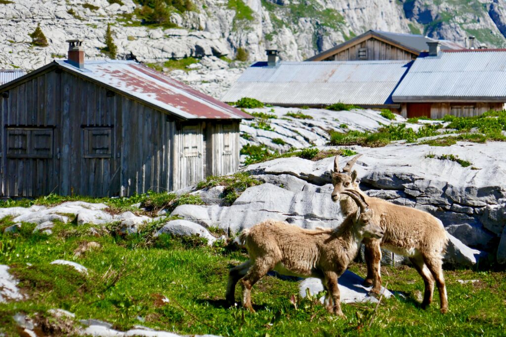
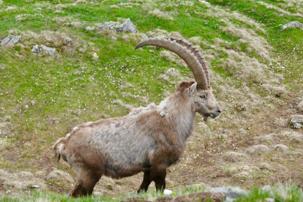
Ibex
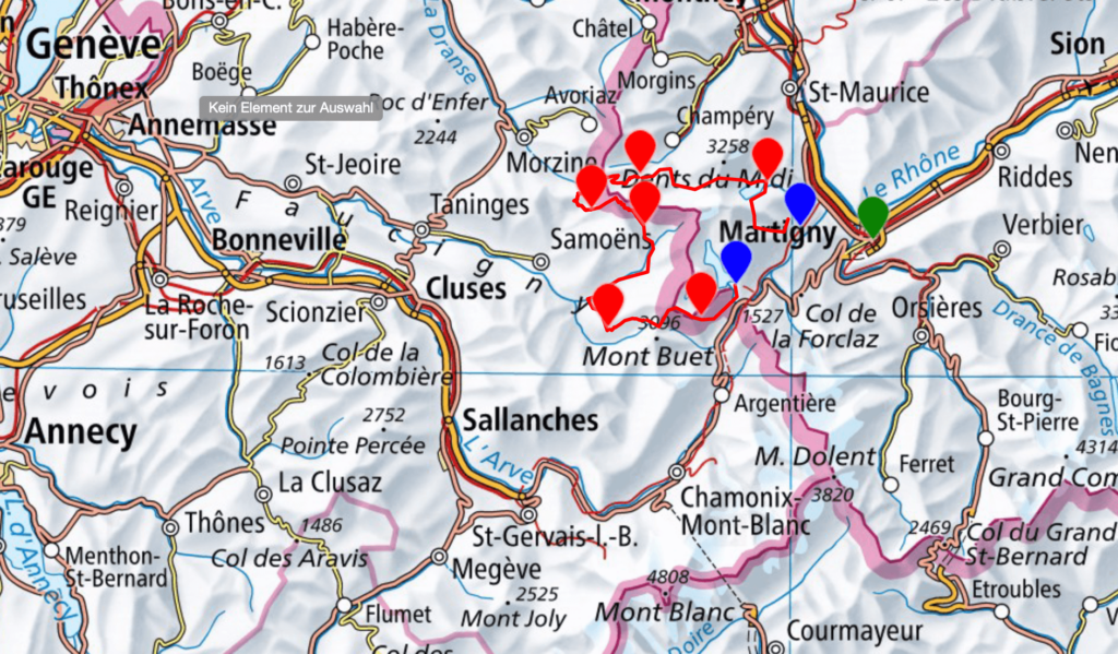
Maps for hidden paradise hike
Costs for Tour of Dents Blanches & Dents du Midi
1240.00€ with a group of 6 hikers
2435.00€ with a group of 4 hikers
2800.00€ with a group of 2 hikers
Included in the costs:
Organisation, 7 guided hiking days with a UIMLA mountain leader, all huts/guesthouses with half board (double room based where possible if not dorms), hot showers, 7 lunch packs, guides expenses
Not included in the costs:
Personal insurance, travel to Les Marecottes and back from Finhaut, Brévent cable car, personal equipment, drinks
Level requirement for hidden paradise hike
This tour is for fit and experienced hikers that are used to walk around 6hrs per day during 7 days. We climb about 1000m per day.
Accommodation and Food
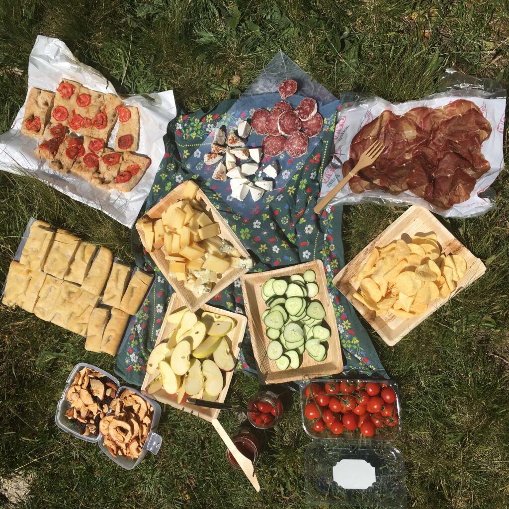
We stay in mountain guest houses and “Refuges” during our trekking. Some offer double rooms and other shared dorms. You’ll able to take a hot shower each night. Lunches will be picnics with local products on most days. Somedays we will be able to eat in mountain restaurants. Warm dinners will be cooked for us in the huts.
How to get to Martigny where the tour starts
Martigny, originally an important roman city with a castle and a roman amphitheatre that you still can visit today. It lies in the French speaking part of the Swiss Valais and can easily be reached by train from Geneva or Zürich airport. Please find the train schedule here.
Our tour ends in Chamonix, France. From there it’s a 1hr mini van shuttle to Geneva Airport or a 1hr train ride back to Martigny, Switzerland on the Mont Blanc Express train.